Broadway is a road in the U.S. state of New York. Broadway runs from the south at State Street at Bowling Green for 13 mi (20.9 km) through the borough of Manhattan, over the Broadway Bridge, and 2 mi (3.2 km) through the Bronx, exiting north from New York City to run an additional 18 mi (29.0 km) through the Westchester County municipalities of Yonkers, Hastings-On-Hudson, Dobbs Ferry, Irvington, Tarrytown, and Sleepy Hollow, after which the road continues, but is no longer called "Broadway". The latter portion of Broadway north of the George Washington Bridge/I-95 underpass comprises a portion of U.S. Route 9.
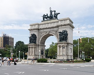
Grand Army Plaza, originally known as Prospect Park Plaza, is a public plaza that comprises the northern corner and the main entrance of Prospect Park in the New York City borough of Brooklyn. It consists of concentric oval rings arranged as streets, with the namesake Plaza Street comprising the outer ring. The inner ring is arranged as an ovoid roadway that carries the main street – Flatbush Avenue. Eight radial roads connect Vanderbilt Avenue; Butler Place; two separate sections of Saint John's Place; Lincoln Place; Eastern Parkway; Prospect Park West; Union Street; and Berkeley Place. The only streets that penetrate to the inner ring are Flatbush Avenue, Vanderbilt Avenue, Prospect Park West, Eastern Parkway, and Union Street.
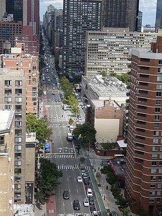
Second Avenue is located on the East Side of the New York City borough of Manhattan extending from Houston Street at its south end to the Harlem River Drive at 128th Street at its north end. A one-way street, vehicular traffic on Second Avenue runs southbound (downtown) only, except for a one-block segment of the avenue in Harlem. South of Houston Street, the roadway continues as Chrystie Street south to Canal Street.

The Cathedral Parkway–110th Street station is a local station on the IND Eighth Avenue Line of the New York City Subway. It is located in the Upper West Side and Morningside Heights, Manhattan, at West 110th Street and Frederick Douglass Boulevard at the northwest corner of Central Park. The station is served by the B on weekdays, the C train at all times except nights, and the A train during late nights only.
125th Street, co-named Martin Luther King Jr. Boulevard, is a two-way street that runs east–west in the New York City borough of Manhattan, from First Avenue on the east to Marginal Street, a service road for the Henry Hudson Parkway along the Hudson River in the west. It is often considered to be the "Main Street" of Harlem.
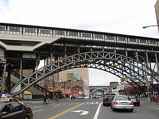
Eighth Avenue is a major north–south avenue on the west side of Manhattan in New York City, carrying northbound traffic below 59th Street. It is one of the original avenues of the Commissioners' Plan of 1811 to run the length of Manhattan, though today the name changes twice: At 59th Street/Columbus Circle, it becomes Central Park West, where it forms the western boundary of Central Park, and north of 110th Street/Frederick Douglass Circle, it is known as Frederick Douglass Boulevard before merging onto Harlem River Drive north of 155th Street.
Ninth Avenue, known as Columbus Avenue between West 59th and 110th Streets, is a thoroughfare on the West Side of Manhattan in New York City, United States. Traffic runs downtown (southbound) from the Upper West Side to Chelsea. Two short sections of Ninth Avenue also exist in the Inwood neighborhood, carrying two-way traffic.

Tenth Avenue, known as Amsterdam Avenue between 59th Street and 193rd Street, is a north-south thoroughfare on the West Side of Manhattan in New York City. It carries uptown (northbound) traffic as far as West 110th Street, after which it continues as a two-way street.

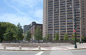
Harlem River Drive is a 4.20-mile (6.76 km) controlled-access parkway in the New York City borough of Manhattan. It runs along the west bank of the Harlem River from the Triborough Bridge in East Harlem to 10th Avenue in Inwood, where the parkway ends and the road continues northwest as Dyckman Street. South of the Triborough Bridge, the parkway continues toward lower Manhattan as FDR Drive. All of Harlem River Drive is designated New York State Route 907P (NY 907P), an unsigned reference route.
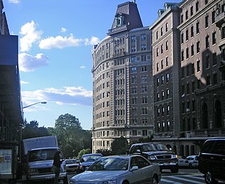
110th Street is a street in the New York City borough of Manhattan. It is commonly known as the boundary between Harlem and Central Park, along which it is known as Central Park North. In the west, between Central Park West/Frederick Douglass Boulevard and Riverside Drive, it is co-signed as Cathedral Parkway.

Ocean Parkway is a 4.86-mile-long (7.82 km) boulevard in the west-central portion of the New York City borough of Brooklyn. It is inventoried by the New York State Department of Transportation (NYSDOT) as New York State Route 908H (NY 908H), an unsigned reference route. The parkway is a New York City scenic landmark and is listed on the National Register of Historic Places.
Vanderbilt Avenue is the name of three thoroughfares in the New York City boroughs of Brooklyn, Manhattan, and Staten Island. They were named after Cornelius Vanderbilt (1794–1877), the builder of Grand Central Terminal in Midtown Manhattan.
116th Street runs from Riverside Drive, overlooking the Hudson River, to the East River, through the New York City borough of Manhattan. It traverses the neighborhoods of Morningside Heights, Harlem, and Spanish Harlem; the street is interrupted between Morningside Heights and Harlem by Morningside Park.

Eastern Parkway is a major east–west boulevard in the New York City borough of Brooklyn. Designed by Frederick Law Olmsted and Calvert Vaux, it was built between 1870 and 1874 and has been credited as the world's first parkway. At the time of its construction, Eastern Parkway went to the eastern edge of Brooklyn, hence its name.

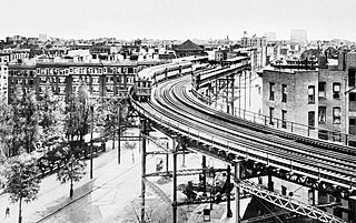
The Eighth Avenue Line is a public transit line in Manhattan, New York City, running mostly along Eighth Avenue from Lower Manhattan to Harlem. Originally a streetcar line, it is now the M10 bus route and the M20 bus route, operated by the New York City Transit Authority. The M10 bus now only runs north of 57th Street, and the M20 runs south of 66th Street. The whole line was a single route, the M10, until 2000 when the M20 was created.

The M1, M2, M3, and M4 are four local bus routes that operate the Fifth and Madison Avenues Lines – along the one-way pair of Madison and Fifth Avenues in the Manhattan borough of New York City. Though the routes also run along other major avenues, the majority of their route is along Madison and Fifth Avenues between Greenwich Village and Harlem.

145th Street is a major crosstown street in the Harlem neighborhood, in the New York City borough of Manhattan. It is one of the 15 crosstown streets mapped out in the Commissioner's Plan of 1811 that established the numbered street grid in Manhattan. It forms the southern border of the Sugar Hill neighborhood within Harlem.
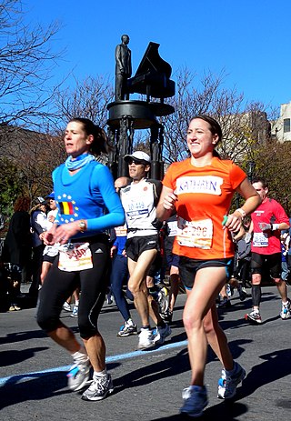
Duke Ellington Circle is a traffic circle located at the northeast corner of Central Park at the intersection of Fifth Avenue and 110th Street in Harlem, Manhattan, New York City. The traffic circle is named for the jazz musician Duke Ellington.