Tenth Avenue (Manhattan)

Last updated
Template:Attached KML/Tenth Avenue (Manhattan)
KML is from Wikidata
Tenth Avenue
Amsterdam Avenue (north of 59th Street)
NYC arterial road.jpg
Tenth Avenue at 17th Street, as seen from the High Line
Tenth Avenue (Manhattan)
Owner City of New York
Maintained by NYCDOT
Length10.5 mi (16.9 km) [1]
Location Manhattan, New York City, U.S.
South end West Street
North endFort George Avenue
East Ninth Avenue (below 59th St)
Columbus Avenue (above 59th St)
West Eleventh Avenue (below 59th St)
West End Avenue (above 59th St)
Construction
Commissioned March 1811
Amsterdam Avenue looking north from 119th Street toward Harlem Amsterdam Avenue looking north at Columbia University.jpg
Amsterdam Avenue looking north from 119th Street toward Harlem
New residential tower at 60th Street 10 WEA 2016 July jeh.jpg
New residential tower at 60th Street

Tenth Avenue, known as Amsterdam Avenue between 59th Street and 193rd Street, is a north-south thoroughfare on the West Side of Manhattan in New York City. It carries uptown (northbound) traffic as far as West 110th Street (also known as Cathedral Parkway), after which it continues as a two-way street.

Contents

Geography

Tenth Avenue begins a block below Gansevoort Street and Eleventh Avenue in the West Village / Meatpacking District. For the southernmost stretch (the four blocks below 14th Street), Tenth Avenue runs southbound. North of 14th Street, Tenth Avenue runs uptown (northbound) for 45 blocks as a one-way street. At its intersection with 59th Street, it becomes Amsterdam Avenue and continues as a one-way street northbound until 110th Street (Cathedral Parkway), where two-way traffic resumes. [2] [3]

As Amsterdam Avenue, the thoroughfare stretches 129 blocks north narrowing to one lane in each direction as it passes through Yeshiva University's Wilf Campus, between 184th and 186th Streets before connecting with Fort George Avenue south of Highbridge Park at West 193rd Street.

On the north side of Highbridge Park, unconnected to Amsterdam Avenue on the south side, Tenth Avenue then runs for slightly less than a mile from the northern terminus of the Harlem River Drive at Dyckman Street, to the intersection of West 218th Street where it merges into Broadway.

History

Tenth Avenue runs through the Chelsea and Hell's Kitchen neighborhoods on the west side of the borough, and then as Amsterdam Avenue, through the Upper West Side, Morningside Heights, Harlem, and Washington Heights. Much of these areas were working-class or poor for much of the 20th century. The street has long been noted for its commercial traffic. The street had grade-level railroad lines through the early 20th century. [4]

The Hudson River Railroad's West Side Line ran along Tenth Avenue from its intersection with West Street to the upper city station at 34th Street, after which it veered to Eleventh Avenue; the line was completed to Peekskill, New York in 1849. Over this part of the right-of-way, the rails were laid at grade along the streets, and since by the corporation regulations locomotives were not allowed, the cars were drawn by a dummy engine, which, according to an 1851 description, consumed its own smoke. While passing through the city the train of cars was preceded by a man on horseback known as a "West Side cowboy" or "Tenth Avenue cowboy" who gave notice of its approach by blowing a horn. [5] [6] [7] [8] However, so many accidents occurred between freight trains and other traffic that the nickname "Death Avenue" was given to both Tenth [8] [9] and Eleventh Avenues. [10]

Public debate about the hazard began during the early 1900s. [11] In 1929, the city, the state, and New York Central agreed on the West Side Improvement Project, [12] conceived by Robert Moses. [13] The 13-mile (21 km) project eliminated 105 street-level railroad crossings and added 32 acres (13 ha) to Riverside Park; it also included construction of the West Side Elevated Highway. It cost more than $150 million (about $2 billion in 2017 dollars). [14]

The part of Tenth Avenue north of West 59th Street was renamed "Amsterdam Avenue" in 1890 at the request of local merchants seeking to distance themselves from "Death Avenue" and to increase the value of their properties in an area that had yet to "catch on". [15] The name was intended to recall the Dutch roots of Manhattan's earliest colonization in the 17th century, when the city was known as New Amsterdam. They hoped that the area would become a "the New City" and a "new, New Amsterdam". [16] The Board of Alderman approved the name change, but only after first considering "Holland Avenue"; the change was made just before the vote on the resolution. In their approval, the Board noted that other name changes in the area, including that of Eleventh Avenue to West End Avenue, had "a marked and beneficial effect on property" and that they held such name changes "as second in importance only to the advantages of increased rapid transit." [17]

The Fort George Amusement Park, now a seating area in Highbridge Park, was located at the northern end of Amsterdam Avenue from 1895 to 1914. [18]

Tenth Avenue and Amsterdam Avenue were converted to carry one-way traffic northbound in two stages. South of its intersection with Broadway, the avenue was converted on November 6, 1948. [19] [20] The remainder, to 110th Street, was converted on December 6, 1951. [21] Amsterdam Avenue continues to carry two-way traffic north of 110th Street.

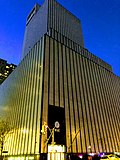
During the real estate boom of the late 20th century, Amsterdam Avenue from roughly 59th Street to 96th Street became one of the city's most expensive residential districts.

Transportation

The M11 bus runs northbound along Tenth and Amsterdam Avenues from 14th to 110th Street and in both directions from 110th to 135th Street. North of 72nd Street, the M7 bus also runs northbound on the avenue until 106th Street. The M100 and M101 serve Amsterdam Avenue north of 125th Street. [22]

As part of the 7 Subway Extension, the New York City Subway's 7 and <7> trains were extended to 34th Street in 2015. [23] An intermediate stop, Tenth Avenue, was originally planned [24] but was dropped from the official plans in 2008. [25] The 1 train serves two stations along the Inwood portion of Tenth Avenue: 207th Street and 215th Street. [26] The IND Eighth Avenue Line has a station at 163rd Street

A protected bike lane was installed in 2016 from 72nd Street to 110th Street. [27] [28] In August 2023, work began on a 10-foot-wide (3.0 m) protected bike lane from 38th to 52nd Street. [29] [30]

Notable sites

Related Research Articles

<span class="mw-page-title-main">Broadway (Manhattan)</span> Avenue in New York

Broadway is a road in the U.S. state of New York. Broadway runs from State Street at Bowling Green for 13 mi (20.9 km) through the borough of Manhattan and 2 mi (3.2 km) through the Bronx, exiting north from New York City to run an additional 18 mi (29.0 km) through the Westchester County municipalities of Yonkers, Hastings-On-Hudson, Dobbs Ferry, Irvington, and Tarrytown, and terminating north of Sleepy Hollow.

<span class="mw-page-title-main">Fifth Avenue</span> North-south avenue in Manhattan, New York

Fifth Avenue is a major and prominent thoroughfare in the borough of Manhattan in New York City, New York, United States. It stretches north from Washington Square Park in Greenwich Village to West 143rd Street in Harlem. It is one of the most expensive shopping streets in the world.

<span class="mw-page-title-main">Second Avenue (Manhattan)</span> North-south avenue in Manhattan, New York

Second Avenue is located on the East Side of the New York City borough of Manhattan extending from Houston Street at its south end to the Harlem River Drive at 128th Street at its north end. A one-way street, vehicular traffic on Second Avenue runs southbound (downtown) only, except for a one-block segment of the avenue in Harlem. South of Houston Street, the roadway continues as Chrystie Street south to Canal Street.

<span class="mw-page-title-main">Sixth Avenue</span> North/south avenue in Manhattan, New York City, also known as Avenue of the Americas

Sixth Avenue – also known as Avenue of the Americas, although this name is seldom used by New Yorkers – is a major thoroughfare in New York City's borough of Manhattan, on which traffic runs northbound, or "uptown". It is commercial for much of its length.

<span class="mw-page-title-main">West Side Highway</span> Boulevard in Manhattan, New York

The Joe DiMaggio Highway, commonly called the West Side Highway and formerly the Miller Highway, is a 5.42-mile-long (8.72 km) mostly surface section of New York State Route 9A (NY 9A), running from West 72nd Street along the Hudson River to the southern tip of Manhattan in New York City. It replaced the West Side Elevated Highway, built between 1929 and 1951, which was shut down in 1973 due to neglect and lack of maintenance, and was dismantled by 1989. North of 72nd Street the roadway continues north as the Henry Hudson Parkway.

<span class="mw-page-title-main">Cathedral Parkway–110th Street station (IND Eighth Avenue Line)</span> New York City Subway station in Manhattan

The Cathedral Parkway–110th Street station is a local station on the IND Eighth Avenue Line of the New York City Subway. It is located in the Upper West Side and Morningside Heights, Manhattan, at West 110th Street and Frederick Douglass Boulevard at the northwest corner of Central Park. The station is served by the B on weekdays, the C train at all times except nights, and the A train during late nights only.

<span class="mw-page-title-main">Eighth Avenue (Manhattan)</span> North-south avenue in Manhattan, New York

Eighth Avenue is a major north–south avenue on the west side of Manhattan in New York City, carrying northbound traffic below 59th Street. It is one of the original avenues of the Commissioners' Plan of 1811 to run the length of Manhattan, though today the name changes twice: At 59th Street/Columbus Circle, it becomes Central Park West, where it forms the western boundary of Central Park, and north of 110th Street/Frederick Douglass Circle, it is known as Frederick Douglass Boulevard before merging onto Harlem River Drive north of 155th Street.

<span class="mw-page-title-main">Third Avenue</span> North-south avenue in Manhattan and the Bronx, New York

<span class="mw-page-title-main">First Avenue (Manhattan)</span> North-south avenue in Manhattan, New York

First Avenue is a north-south thoroughfare on the East Side of the New York City borough of Manhattan, running from Houston Street northbound to 127th Street. At 125th Street, most traffic continues onto the Willis Avenue Bridge over the Harlem River, which continues into the Bronx. South of Houston Street, the roadway continues as Allen Street south to Division Street. Traffic on First Avenue runs northbound (uptown) only.

<span class="mw-page-title-main">Ninth Avenue (Manhattan)</span> North-south avenue in Manhattan, New York City

Ninth Avenue, known as Columbus Avenue between West 59th and 110th Streets, is a thoroughfare on the West Side of Manhattan in New York City, United States. Traffic runs downtown (southbound) along the full stretch from Chelsea to the Upper West Side, except for the lowermost three blocks where traffic runs northbound carrying traffic from Greenwich Street.

<span class="mw-page-title-main">Eleventh Avenue (Manhattan)</span> North-south avenue in Manhattan, New York

Eleventh Avenue is a north–south thoroughfare on the far West Side of the borough of Manhattan in New York City, located near the Hudson River. Eleventh Avenue originates in the Meatpacking District in the Greenwich Village and West Village neighborhoods at Gansevoort Street, where Eleventh Avenue, Tenth Avenue, and West Street intersect. It is considered part of the West Side Highway between 22nd and Gansevoort Streets.

<span class="mw-page-title-main">59th Street (Manhattan)</span> West-east street in Manhattan, New York

<span class="mw-page-title-main">Hudson Street (Manhattan)</span> Street in Manhattan, New York

Hudson Street is a north–south oriented street in the New York City borough of Manhattan running from Tribeca to the south, through Hudson Square and Greenwich Village, to the Meatpacking District.

<span class="mw-page-title-main">M11 (New York City bus)</span> Bus route in Manhattan, New York

The Ninth and Tenth Avenues Line or Ninth Avenue Line is a surface transit line in the New York City borough of Manhattan, running mostly along Ninth Avenue and Amsterdam Avenue from Lower Manhattan to Manhattanville. Originally a streetcar line operated by the Manhattan and Bronx Surface Transit Operating Authority, it is now the M11 bus route operated by the New York City Transit Authority.

<span class="mw-page-title-main">M7 (New York City bus)</span> Bus route in Manhattan, New York

The Columbus Avenue Line is a public transit line in Manhattan, New York City, running mostly along Columbus Avenue, 116th Street, and Lenox Avenue from Lower Manhattan to Harlem. Originally a streetcar line, it is now the M7 bus route, operated by the New York City Transit Authority, a division of the Metropolitan Transportation Authority.

<span class="mw-page-title-main">M1, M2, M3, and M4 buses</span> Bus routes in Manhattan, New York

The M1, M2, M3, and M4 are four local bus routes that operate the Fifth and Madison Avenues Lines – along the one-way pair of Madison and Fifth Avenues in the Manhattan borough of New York City. Though the routes also run along other major avenues, the majority of their route is along Madison and Fifth Avenues between Greenwich Village and Harlem.

<span class="mw-page-title-main">Dyckman Street</span> Street in Manhattan

Dyckman Street, occasionally called West 200th Street, is a street in the Inwood neighborhood of Manhattan, New York City. It is commonly considered to be a crosstown street because it runs from the Hudson River to the Harlem River and intersects Broadway. However, in its true geographical orientation, Dyckman Street runs roughly from north-northwest to south-southeast, and the majority of the street that lies southeast of Broadway runs closer to a north-south direction than east-west.

<span class="mw-page-title-main">Fourth Avenue (Brooklyn)</span> Avenue in Brooklyn, New York

Fourth Avenue is a major thoroughfare in the New York City borough of Brooklyn. It stretches for 6 miles (9.7 km) south from Times Plaza, which is the triangle intersection created by Atlantic and Flatbush Avenues in Downtown Brooklyn, to Shore Road and the Belt Parkway in Bay Ridge.

<span class="mw-page-title-main">Lincoln Tunnel Expressway</span>

The Lincoln Tunnel Expressway is an eight block-long, mostly four-lane, north–south arterial road between the portals of the Lincoln Tunnel and West 30th Street in Midtown Manhattan in New York City. Dyer Avenue is an at-grade roadway paralleling part of the mostly depressed roadway and serves traffic entering and leaving the expressway and the tubes of the tunnel. Like the tunnel, the roads are owned and operated by the Port Authority of New York and New Jersey. They traverse the Manhattan neighborhoods of Hell's Kitchen and Chelsea between Ninth and Tenth avenues. The highway serves as the entrance to the Lincoln Tunnel from Manhattan, with the entrance from Weehawken, New Jersey being the Lincoln Tunnel Helix.

References

  1. Google (December 1, 2015). "Tenth Avenue / Amsterdam Avenue" (Map). Google Maps . Google. Retrieved December 1, 2015.
  2. Meyer, David (June 21, 2018). "Safer Bikeways Slated for Columbus Circle and Amsterdam Avenue". StreetsBlog . Archived from the original on July 17, 2019. On 10th Avenue/Amsterdam Avenue — the street name shifts at 59th Street — DOT plans to extend the protected bike lane design it installed between 72nd Street and 110th Street two years ago.
  3. Meyer, David (October 16, 2018). "OUTRAGE! DOT Delays Life-Saving Amsterdam Avenue Redesign in Fight With NIMBYs". StreetsBlog . Archived from the original on July 17, 2019. Thompson spoke to Streetsblog after the meeting, where she and the board's Vice Chairman Victor Edwards opposed the traffic-calming plan, which is not even as complete as the improvements made to one-way Amsterdam Avenue below 110th Street. Indeed, instead of a protected bike lane, the plan for the two-way stretch from 110th Street to 162nd Street would install unprotected lanes, painted medians, and turn lanes in both directions.
  4. Robbins, L.H. (June 3, 1934). "Transforming the West Side: A Huge Project Marches On". The New York Times . Retrieved July 17, 2019.
  5. Hudson River and the Hudson River Rail-Road. Boston: Bradbury & Guild. 1851. p. 12. Retrieved September 18, 2015.
  6. Highline Photo of the Week West Side Cowboy
  7. "High Line History". Friends of the High Line. Archived from the original on September 22, 2014.
  8. 1 2 Amateau, Albert (April 30, 2008). "Newspaper was there at High Line's birth and now its rebirth". The Villager . Vol. 77, no. 48. Archived from the original on July 13, 2011.
  9. Gray, Christopher (December 22, 2011). "When a Monster Plied the West Side". The New York Times. Archived from the original on May 17, 2014. Retrieved May 12, 2014. The New York World referred to the West Side route as Death Avenue in 1892, long after the Park Avenue problem had been solved, saying 'many had been sacrificed' to 'a monster which has menaced them night and day.'
  10. Dunlap, David W. (February 18, 2015). "New York City Rail Crossings Carry a Deadly Past". The New York Times. ISSN   0362-4331 . Retrieved February 12, 2018.
  11. "'Death Ave.' Ends as Last Rusty Rail Goes; Huge West Side Improvement Completed" (PDF). The New York Times. June 26, 1941. ISSN   0362-4331 . Retrieved February 12, 2018.
  12. "The Highline: past and present". GeoWeb, Harvard University. May 13, 2010. Archived from the original on October 23, 2014. Retrieved October 23, 2014.
  13. Walsh, Kevin (September 2012). ""High Line"'s Last Frontier". Forgotten NY . Archived from the original on October 24, 2014.
  14. "High Line History". Friends of the High Line. Archived from the original on September 22, 2014. Retrieved August 2, 2009.
  15. Shepard, Richard F. (February 6, 1981). "Exploring the New Amsterdam Avenue". The New York Times. ISSN   0362-4331 . Retrieved July 17, 2019.
  16. Feirstein, Sanna (2001). Naming New York: Manhattan Places & How They Got Their Names. New York: New York University Press. p. 169. ISBN   978-0-8147-2712-6.
  17. Moscow, Henry (1978). The Street Book: An Encyclopedia of Manhattan's Street Names and Their Origins. New York: Hagstrom Company. p. 22. ISBN   978-0-8232-1275-0.
  18. Martens, Victoria (August 1, 2019). "Fort George Amusement Park". Museum of the City of New York. Retrieved September 2, 2019.
  19. Ingraham, Joseph (7 November 1948). "Traffic Speeded on 9th, 10th Aves. By One-way Plan". The New York Times. Retrieved 28 August 2012.
  20. "Ninth and Tenth Avenues Are One Way Permanently". The New York Times. 14 May 1949. Retrieved 28 August 2012.
  21. "Two More Avenues One-way Thursday". The New York Times. 4 December 1951. Retrieved 28 August 2012.
  22. "Manhattan Bus Map" (PDF). Metropolitan Transportation Authority. July 2019. Retrieved December 1, 2020.
  23. Chan, Sewell; Bagli, Charles V. (April 2, 2005). "M.T.A. Links Stadium Bid to Rail Extension". The New York Times.
  24. Neuman, William (September 19, 2008). "No. 7 Extension Won't Include 10th Ave. Station". The New York Times.
  25. "Subway Map" (PDF). Metropolitan Transportation Authority. September 2021. Retrieved September 17, 2021.
  26. Meyer, David (May 20, 2016). "Eyes on the Street: First Signs of Amsterdam Avenue's Protected Bike Lane". StreetsBlog . Archived from the original on July 17, 2019.
  27. Garofalo, Michael (June 26, 2018). "DOT plans new UWS bike lanes". West Side Spirit . Archived from the original on July 17, 2019. The protected lane would continue past 59th Street, where 10th Avenue becomes Amsterdam Avenue, and connect to the existing protected bike lane on Amsterdam Avenue that begins at 72nd Street and runs to 110th Street.
  28. Carlin, Dave (August 29, 2023). "New bicycle lane on 10th Avenue to be among widest in Manhattan, and it already has New Yorkers taking sides". CBS New York. Retrieved September 1, 2023.
  29. Brachfeld, Ben (August 23, 2023). "10th Avenue build out: DOT set to create protected bike lane on Midtown/Hell's Kitchen thoroughfare". amNewYork. Retrieved September 1, 2023.
Listen to this article (7 minutes)
Sound-icon.svg
This audio file was created from a revision of this article dated 10 November 2018 (2018-11-10), and does not reflect subsequent edits.