The M12 bus route begins at Abingdon Square in the West Village, and heads northbound on 8th Ave before turning left on 14th Street. Northbound buses use 15th Street to access 12th Avenue, whereas southbound buses use 18th Street and 9th Avenue. At 24th Street, the two directions split, with northbound buses using 12th Avenue and southbound buses using 11th Avenue. Passengers can transfer to the 7 train at 34th Street - Hudson Yards. This arrangement continues until 57th Street, where the M12 goes crosstown to 8th Avenue. It then terminates at 58th Street and Broadway, where passengers can connect to the 1, A, B, C, and D subways at 59th Street–Columbus Circle station.[3][4]
History
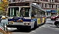
A 2006 OrionVII OG HEV (6738) on the Columbus Circle-bound M12
The MTA started planning for a far west side service in 2013, in conjunction with the 7 train's extension to 34 Street - Hudson Yards.[5] It originally was planned to go from 59th Street to Spring Street, via the West Side Highway until 14th Street, and Washington/Greenwich Streets south of there. It was also scheduled to only run every 30 minutes. After numerous complaints by the community boards in the area, the route was redrawn in 2014.[6] This routing was revised one more time to its current state, and the intervals changed to 20 minutes before the start of service on August 31, 2014.
This page is based on this Wikipedia article Text is available under the CC BY-SA 4.0 license; additional terms may apply. Images, videos and audio are available under their respective licenses.