M35 and X80 buses

Last updated

m35
x80
Randalls/Wards Island Buses
NYC Transit 697 - Flickr - njt4148.jpg
Overview
System MTA Regional Bus Operations
Operator New York City Transit (both)
MTA Bus Company (X80)
Garage Mother Clara Hale Depot (M35)
Vehicle New Flyer Xcelsior XDE40
New Flyer Xcelsior XD60
Nova Bus LFS articulated
Began service1936 (M35)
2000s? (X80)
Route
Locale Manhattan, New York, U.S.
Communities served Randalls and Wards Islands, East Harlem
Start East Harlem   Lexington Avenue & 125th Street
Via RFK Bridge
EndRandalls Island/Wards Island
Length3.0 miles (4.8 km)
Service
OperatesAll times except late nights (M35)
Special events (X80)
Annual patronageM35: 48,659 (2023) [1]
TransfersYes
Timetable M35
  M34
X68
 {{{system_nav}}}  M42
BM1  

The M35 and X80 constitute bus routes between the 125th Street station at Lexington Avenue in Harlem and Randalls and Wards Islands.

Contents

Route description

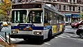
The M35 and X80 begin at 125th Street and Lexington Avenue. They both continue south until 124th Street, where they turn and run east until turning onto the RFK Bridge before exiting onto Randalls Island. They both then run south on Central Road and they pass Icahn Stadium, where the X80 terminates. The M35 takes a deviation at Rivers Edge Road to serve the Manhattan Psychiatric Center. The route continues south on Central Road as it becomes Hell Gate Circle, taking another deviation at Sunken Garden Loop to serve Sunken Garden and the Charles H. Gay Center. It then continues south on Hell Gate Circle until it loops back around onto Central Road where it heads north and passes by Icahn Stadium, where the X80 joins it as it continues north onto Bronx Shore Road, u-turning at the end of the road before turning right onto the RFK Bridge. They then turn onto 126th Street, where they continue westbound until turning left on Lexington Avenue and terminating there. [2] [3]

The X80 only runs during special events, and costs $7.00 for travel towards Randalls/Wards Islands, and is free towards Harlem.[ citation needed ]

History

The TB bus route was started on July 11, 1936, by New York Omnibus Company, when the Triborough Bridge opened, after being announced that it would be studied if a shuttle service could be operated on the bridge. [4] The route ran between Harlem, Randalls and Wards Islands, Port Morris and Astoria. [5]

In 1974, the TB was split into three routes, with the M34 running between Harlem and Randalls Island, the M35 running between Harlem and Astoria, and the Bx21 running between Astoria and Port Morris. [6]

The Bx21 was discontinued on February 18, 1984, due to low ridership. The M34 was combined with the M35 in the 1980s, sometime before the M34 designation was reused for the 34th Street Crosstown service.[ citation needed ]

In September 1992, when the M60 started service, M35 service to Astoria was reduced to rush hours only until 1995, when it was discontinued due to an ongoing budget crisis. [7]

The X80 was started sometime in the 2000s as an express shuttle bus to Randalls Island during special events, with the M35 skipping the stop neat Icahn Stadium whenever the X80 operates.[ citation needed ] On June 28, 2015, westbound M35 buses were rerouted to serve Hell Gate Circle after running on Sunken Garden Loop. [8]

Related Research Articles

<span class="mw-page-title-main">Robert F. Kennedy Bridge</span> Bridge complex in New York City

The Robert F. Kennedy Bridge is a complex of bridges and elevated expressway viaducts in New York City. The bridges link the boroughs of Manhattan, Queens, and the Bronx. The viaducts cross Randalls and Wards Islands, previously two islands and now joined by landfill.

<span class="mw-page-title-main">Q (New York City Subway service)</span> New York City Subway service

The Q Second Avenue/Broadway Express/Brighton Local is a rapid transit service in the B Division of the New York City Subway. Its route emblem, or "bullet", is colored yellow since it is a part of the BMT Broadway Line in Manhattan.

<span class="mw-page-title-main">Bronx Kill</span> River in New York City

The Bronx Kill is a narrow strait in New York City delineating the southernmost extent of the Bronx. It separates the Bronx from Randalls Island. It connects the Harlem River to the East River.

<span class="mw-page-title-main">S (New York City Subway service)</span> New York City Subway shuttle services

Three services in the New York City Subway are designated as a dark gray S (shuttle) service. These services operate as full-time or almost full-time shuttles. In addition, three services run as shuttles during late night hours but retain their regular service designations.

<span class="mw-page-title-main">125th Street (Manhattan)</span> West-east street in Manhattan, New York

125th Street, co-named Martin Luther King Jr., Boulevard is a two-way street that runs east–west in the New York City borough of Manhattan, from First Avenue on the east to Marginal Street, a service road for the Henry Hudson Parkway along the Hudson River in the west. It is often considered to be the "Main Street" of Harlem.

The T Second Avenue Local is a prospective rapid transit service in the B Division of the New York City Subway. It is proposed to run on the Second Avenue Subway in Manhattan and its route symbol will be turquoise.

The BMT Astoria Line is a rapid transit line in the B Division of the New York City Subway, serving the Queens neighborhood of Astoria. It runs south from Ditmars Boulevard in Astoria to 39th Avenue in Long Island City above 31st Street. It then turns west and serves Queensboro Plaza over Queens Plaza.

<span class="mw-page-title-main">Randalls and Wards Islands</span> Conjoined islands in New York City

Randalls Island and Wards Island are conjoined islands, collectively called Randalls and Wards Island, in New York City. Part of the borough of Manhattan, is separated from Manhattan Island by the Harlem River, from Queens by the East River and Hell Gate, and from the Bronx by the Bronx Kill. A channel named Little Hell Gate separated Randalls Island to the north from Wards Island to the south; the channel was filled by the early 1960s. A third, smaller island, Sunken Meadow Island, was located east of Randalls Island and was connected to it in 1955.

<span class="mw-page-title-main">Astoria Boulevard station</span> New York City Subway station in Queens

The Astoria Boulevard station is an express station on the BMT Astoria Line of the New York City Subway. Located on 31st Street between Astoria Boulevard and the Grand Central Parkway in Astoria, Queens, the station is served by the N train at all times, as well as by the W train on weekdays.

<span class="mw-page-title-main">Q59 (New York City bus)</span> Bus route in Queens and Brooklyn, New York

The Grand Street Line is a public transit line in Brooklyn and Queens, New York City, running mostly along the continuous Grand Street and Grand Avenue between Williamsburg, Brooklyn and Maspeth, Queens. It then continues down Queens Boulevard to the 63rd Drive–Rego Park station. Originally a streetcar line, it is now the Q59 bus route, operated by the New York City Transit Authority between Williamsburg and Rego Park, Queens.

<span class="mw-page-title-main">M60 (New York City bus)</span> Bus route in Manhattan and Queens, New York

The M60 Select Bus Service is a bus route in New York City. It is part of MTA Regional Bus Operations, operated by the Manhattan and Bronx Surface Transit Operating Authority (MaBSTOA) under the New York City Transit brand. The M60 provides service between the Upper West Side of Manhattan and LaGuardia Airport in East Elmhurst, Queens, traveling between boroughs via the RFK-Triborough Bridge. It is the only direct public transit option between Manhattan and LaGuardia Airport.

<span class="mw-page-title-main">M1, M2, M3, and M4 buses</span> Bus routes in Manhattan, New York

The M1, M2, M3, and M4 are four local bus routes that operate the Fifth and Madison Avenues Lines – along the one-way pair of Madison and Fifth Avenues in the Manhattan borough of New York City. Though the routes also run along other major avenues, the majority of their route is along Madison and Fifth Avenues between Greenwich Village and Harlem.

Ditmars Boulevard, originally known as Ditmars Avenue, is a street located in northwest Queens, New York City. It is divided into two segments; one travels through the neighborhood of Ditmars, located within Astoria, and the other acts as a service road for the Grand Central Parkway near LaGuardia Airport in East Elmhurst.

<span class="mw-page-title-main">Select Bus Service</span> Bus service in New York City

Select Bus Service is a service provided by the Metropolitan Transportation Authority (MTA)'s Regional Bus Operations for limited-stop bus routes with some bus rapid transit features in New York City. The first SBS route was implemented in 2008 to improve speed and reliability on long, busy corridors.

<span class="mw-page-title-main">Astoria Boulevard</span> Boulevard in Queens, New York

Astoria Boulevard is an important east–west commercial street in Astoria and East Elmhurst, Queens, New York City. It runs from 1st Street at the East River to the World's Fair Marina on Flushing Bay, where it merges with Northern Boulevard. Just before the junction of the two boulevards, there is a large two lane ramp leading to the Whitestone Expressway. Most of the traffic on Astoria Boulevard heads toward this ramp, and then onto the Expressway.

The Q69 and Q100 Limited bus routes constitute a public transit line in western Queens, New York City. Beginning at Queens Plaza in Long Island City, the routes run primarily along 21st Street through the neighborhoods of Long Island City and Astoria. The Q69 makes all local stops, while the Q100 makes four limited stops along the shared corridor between Queens Plaza and Ditmars Boulevard. At Ditmars Boulevard, the Q69 turns east towards Jackson Heights and East Elmhurst near LaGuardia Airport. The Q100, meanwhile, continues north of Queens across Bowery Bay to the city jail complex on Rikers Island in the Bronx, providing the only public transit service to the island.

<span class="mw-page-title-main">M86 (New York City bus)</span> Bus route in Manhattan, New York

The 86th Street Crosstown Line is a bus line in Manhattan, New York City, running mostly along 86th Street on the Upper West and Upper East Sides of Manhattan. Originally a streetcar line, it now comprises the M86 Select Bus Service bus line.

<span class="mw-page-title-main">Hylan Boulevard express buses</span> Bus routes in Staten Island and Manhattan, New York

The SIM1, SIM1C, SIM7,SIM10, and SIM11 bus routes constitute a public transit line in Staten Island and Manhattan, New York. The routes all operate on Richmond Avenue and Hylan Boulevard on Staten Island, but go to three separate terminals in Manhattan.

<span class="mw-page-title-main">M34 and M34A buses</span> Bus routes in Manhattan, New York

The 34th Street Crosstown Line is a surface transit line on 34th Street in Manhattan, New York City, United States. It currently hosts the M34/M34A SBS routes of MTA's Regional Bus Operations. The M34 runs from 12th Avenue to FDR Drive via 34th Street, while the M34A runs from Port Authority Bus Terminal to Waterside Plaza.

References

  1. "Subway and bus ridership for 2023". mta.info. April 29, 2024. Archived from the original on May 2, 2024. Retrieved May 2, 2024.
  2. "Manhattan Bus Map" (PDF). Metropolitan Transportation Authority. July 2019. Retrieved December 1, 2020.
  3. MTA Regional Bus Operations. "M35 bus schedule".
  4. "City Gives Permit For Bridge Buses; Authorization to Use Street Terminals Is Temporary and for Summer Months. Moses To Study Fares Board Allows Shuttle Service on Triborough Structure to Facilitate Opening". The New York Times. May 16, 1936. Archived from the original on August 29, 2024. Retrieved August 29, 2024.
  5. "Travel around New York by motorcoach: route map, Fifth Avenue Coach Lines, Inc". mapcollections.brooklynhistory.org. Retrieved August 29, 2024.
  6. "2 Boroughs' Buses Get New Numbers". The New York Times. June 20, 1974. ISSN   0362-4331. Archived from the original on July 11, 2024. Retrieved August 29, 2024.
  7. "Coming Transit Reductions: What They Mean for You". The New York Times. August 20, 1995. Retrieved August 30, 2024.
  8. "Reroute and Bus Stop Relocation on Randall's Island Along Hell Gate Circle". web.mta.info. Metropolitan Transportation Authority. June 2015. Archived from the original on October 1, 2023. Retrieved August 29, 2024.