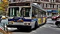
M31 and M57 buses

Last updated
m31, m57
57th Street Crosstown Line
57th St 7th Av td (2018-08-16) 12.jpg
NYC Transit Joins NYPD to Ticket Vehicles Illegally Parked in Bus Lanes (53397727558).jpg
An OBI Orion VII OG HEV 07.501 operating on the M57 and an NovaBus LFS HEV operating on the M31
Overview
System MTA Regional Bus Operations
Operator New York City Transit
Garage Tuskegee Airmen Depot (M31)
Michael J. Quill Depot (M57)
Vehicle Nova Bus LFS HEV
New Flyer Xcelsior XD40 (M57)
    Route
    Locale Manhattan, New York, U.S.
    Communities served Upper West Side, Riverside South, Hell's Kitchen, Midtown, Sutton Place, Upper East Side
    StartM31: Hell's Kitchen  –54th Street and 11th Avenue
    M57: Upper West Side  –72nd Street and Amsterdam Avenue
    Via 57th Street
    M31: York Avenue
    M57: West End Avenue
    EndM31: Upper East Side  –1st Avenue and 92nd Street
    M57: Sutton Place  –1st Avenue and 55th Street
    Length2.8 miles (4.5 km) (eastbound M57)
    3.1 miles (5.0 km) (westbound M57)
    3.8 miles (6.1 km) (M31)
    Service
    OperatesM31: 5 a.m. (7 a.m. weekends) to 12:30 a.m. [1]
    M57: 5 a.m. (6:30 a.m. weekends) to 12:30 a.m. [2]
    RidershipM31: 2,030,247 (2022) [3]
    M57: 1,434,822 (2022) [3]
    TransfersYes
    Timetable M31 M57
      M23 SBS
    M50
     {{{system_nav}}}  M34 SBS
    M60 SBS  

    The M31 and M57 bus routes constitute the 57th Street Crosstown Line, a public transit line in Manhattan, New York City, running primarily along 57th Street. The M31 runs between 11th Avenue and 54th Street in Hell's Kitchen to 1st Avenue and 92nd Street in Yorkville. The M57 runs from 72nd Street and Amsterdam Avenue in the Upper West Side to Sutton Place and 57th Street in Sutton Place. [4] [5]

    Contents

    The M31 and M57 are operated by MTA Regional Bus Operations under the New York City Transit brand.

    Route description and service

    M31 bus at Columbus Circle Turnstyle at Columbus Circle (26109472913).jpg
    M31 bus at Columbus Circle

    For most of its length, the M31 uses 57th Street to travel crosstown, then uses York Avenue to travel uptown to 92nd Street and First Avenue. [1] [6] At its western end, the M31 turns left on Eleventh Avenue, then left on 54th Street to terminate; eastbound buses return to 57th Street using Tenth Avenue. [1] [6] At its northern/eastern end, the M31 goes left on 91st Street then right on First Avenue, terminating along 92nd Street before returning southbound on York Avenue. [6]

    The M57 mostly duplicates the M31 along 57th Street. [2] [6] The only major difference is that the M57 uses West End Avenue to reach its western terminus at 72nd Street and Amsterdam Avenue. At its eastern end, the M57 reaches First Avenue, eastbound buses turn on 1st, then terminate. Westbound buses then use Sutton Place, 55th Street, and First Avenue to access 57th Street, where they turn back crosstown. [6]

    The M57 operates out of Michael J. Quill Depot whereas the M31 operates out of the Tuskegee Airmen Depot.

    History

    M31

    East Side Omnibus Corporation began operating bus route (M11) on June 25, 1933. [4]

    The route was renumbered as the M31 on July 1, 1974, as part of the renumbering of bus routes in Manhattan. [7] [8]

    M57

    Buses were introduced on April 17, 1934. [4] Service formerly went between Columbus Circle and Sutton Place. [9] Fifth Avenue Coach Company began operating bus #20 on March 15, 1937, from Sutton Place to 12th Avenue to provide river-to-river service for Sutton Place residents at five-minute headways. [9] [10]

    The route, formerly numbered M20, became M28 on July 1, 1974, as part of the renumbering of bus routes in Manhattan. [11] [7] [8]

    On September 10, 1989, the M28 (57th Street Crosstown) and M103 (59th/60th Street Crosstown) routes were merged to form the M57. M57 buses began operating from 57th Street and Sutton Place South to Broadway and 72nd Street, running via 57th Street and West End Avenue. [12]

    An RTS-06 bus on the M57, seen in 2018. 57th St 7th Av td (2018-08-16) 21.jpg
    An RTS-06 bus on the M57, seen in 2018.

    Related Research Articles

    <span class="mw-page-title-main">B (New York City Subway service)</span> New York City Subway service

    The B Sixth Avenue Express is a rapid transit service in the B Division of the New York City Subway. Its route emblem, or "bullet", is colored orange, since it uses the IND Sixth Avenue Line in Manhattan.

    <span class="mw-page-title-main">M23 (New York City bus)</span> Bus route in Manhattan, New York

    The 23rd Street Crosstown is a surface transit line on 23rd Street in Manhattan, New York City. It currently hosts the M23 SBS bus route of the Metropolitan Transportation Authority (MTA)'s Regional Bus Operations. The M23 runs between Chelsea Piers, along the West Side Highway near 22nd Street, via 23rd Street, to Avenue C and 20th Street in Stuyvesant Town–Peter Cooper Village.

    <span class="mw-page-title-main">Eleventh Avenue (Manhattan)</span> North-south avenue in Manhattan, New York

    Eleventh Avenue is a north–south thoroughfare on the far West Side of the borough of Manhattan in New York City, located near the Hudson River. Eleventh Avenue originates in the Meatpacking District in the Greenwich Village and West Village neighborhoods at Gansevoort Street, where Eleventh Avenue, Tenth Avenue, and West Street intersect. It is considered part of the West Side Highway between 22nd and Gansevoort Streets.

    <span class="mw-page-title-main">57th Street (Manhattan)</span> West-east street in Manhattan, New York

    57th Street is a broad thoroughfare in the New York City borough of Manhattan, one of the major two-way, east-west streets in the borough's grid. As with Manhattan's other "crosstown" streets, it is divided into its east and west sections at Fifth Avenue. The street runs from a small park overlooking the East River in the east to the West Side Highway along the Hudson River in the west. 57th Street runs through the neighborhoods of Sutton Place, Midtown Manhattan, and Hell's Kitchen from east to west.

    <span class="mw-page-title-main">Third and Lexington Avenues Line</span> Bus routes in Manhattan, New York

    The Third and Lexington Avenues Line, also known as the Third Avenue Line, is a public transit line in Manhattan, New York City, running from Lower Manhattan to Fort George in Washington Heights. Originally a streetcar line, it now consists of the M98, M101, M102, and M103 bus routes, operated by the New York City Transit Authority. The M98 bus route operates on Third Avenue between East 65th Street and East 127th Street, although it previously continued to 32nd Street. The M101, M102 and M103 bus routes run southbound on Lexington Avenue north of East 24th Street.

    <span class="mw-page-title-main">M10 and M20 buses</span> Bus routes in Manhattan, New York

    The Eighth Avenue Line is a public transit line in Manhattan, New York City, running mostly along Eighth Avenue from Lower Manhattan to Harlem. Originally a streetcar line, it is now the M10 bus route and the M20 bus route, operated by the New York City Transit Authority. The M10 bus now only runs north of 57th Street, and the M20 runs south of 66th Street. The whole line was a single route, the M10, until 2000 when the M20 was created.

    <span class="mw-page-title-main">M5 and M55 buses</span> Bus routes in Manhattan, New York

    The M5 and M55 bus routes constitute a public transit corridor in Manhattan, New York City, running along the Fifth / Sixth Avenues / Riverside Drive Line as well as the southern portion of the Broadway Line after the discontinuation of the M6. The routes primarily run along Broadway, Fifth and Sixth Avenues, and Riverside Drive from South Ferry, Lower Manhattan to Washington Heights. The M5 covers the northern portion of the route north of 31st Street, while the M55 operates along the southern portion of the route south of 44th Street. The two routes overlap in Midtown Manhattan. The portion along Broadway south of East 8th Street was originally a streetcar line.

    <span class="mw-page-title-main">M7 (New York City bus)</span> Bus route in Manhattan, New York

    The Columbus Avenue Line is a public transit line in Manhattan, New York City, running mostly along Columbus Avenue, 116th Street, and Lenox Avenue from Lower Manhattan to Harlem. Originally a streetcar line, it is now the M7 bus route, operated by the New York City Transit Authority, a division of the Metropolitan Transportation Authority.

    <span class="mw-page-title-main">B61 and B62 buses</span> Bus routes in Brooklyn, New York

    The Crosstown Line is a public transit line in Brooklyn, New York City, running along Van Brunt Street and Manhattan Avenue between Red Hook and Long Island City, Queens. Originally a streetcar line, it is now the B61 and the B62 bus routes. The northern section, the B62, is operated by MTA New York City Bus' Grand Avenue Depot in Maspeth, Queens, and the southern section is the B61, operated by MTA New York City Bus' Jackie Gleason Depot in Sunset Park. The entire route was a single line, the B61, until January 3, 2010; the B62 was previously a separate, parallel route between Downtown Brooklyn and Greenpoint, now part of the B43 route. The streetcar line, B61 and the original B62 previously operated from the now-closed Crosstown Depot in Greenpoint.

    <span class="mw-page-title-main">M72 (New York City bus)</span> Bus route in Manhattan, New York

    The M72 constitutes a public transit line in Manhattan, running crosstown on 72nd Street from the Upper East Side to the Upper West Side.

    <span class="mw-page-title-main">Bus depots of MTA Regional Bus Operations</span> New York City Suburban Bus Depots

    MTA Regional Bus Operations operates local and express buses serving New York City in the United States out of 29 bus depots. These depots are located in all five boroughs of the city, plus one located in nearby Yonkers in Westchester County. 21 of these depots serve MTA New York City Transit (NYCT)'s bus operations, while the remaining eight serve the MTA Bus Company These facilities perform regular maintenance, cleaning, and painting of buses, as well as collection of revenue from bus fareboxes. Several of these depots were once car barns for streetcars, while others were built much later and have only served buses. Employees of the depots are represented by local divisions of the Transport Workers Union of America (TWU), particularly the TWU Local 100 or of the Amalgamated Transit Union (ATU)'s Local's 726 for all depots in Staten Island, 1056 for Casey Stengel, Jamaica, and Queens Village Depots, 1179 for JFK & Far Rockaway Depots, and 1181 for Spring Creek Depot.

    <span class="mw-page-title-main">M1, M2, M3, and M4 buses</span> Bus routes in Manhattan, New York

    The M1, M2, M3, and M4 are four local bus routes that operate the Fifth and Madison Avenues Lines – along the one-way pair of Madison and Fifth Avenues in the Manhattan borough of New York City. Though the routes also run along other major avenues, the majority of their route is along Madison and Fifth Avenues between Greenwich Village and Harlem.

    <span class="mw-page-title-main">Bx12 bus</span> Bus route in New York City

    The Bx12 is a public transit line in New York City running along the 207th Street Crosstown Line, within the boroughs of Manhattan and the Bronx. The line runs along 207th Street in Upper Manhattan and along the continuous Fordham Road and Pelham Parkway in the Bronx.

    <span class="mw-page-title-main">M12 (New York City bus)</span> Bus route on Manhattans West Side

    The M12 bus route constitutes a public transit line in Manhattan, New York City. The M12 operates between Columbus Circle and Abingdon Square, serving Manhattan's West Side. It uses 11th and 12th Avenues between 14th and 57th Streets. It was introduced in 2014 to provide better service to the far west side.

    <span class="mw-page-title-main">Q64, QM4 and QM44 buses</span> Bus routes in Queens, New York

    The Q64, QM4 and QM44 bus routes constitute a public transit line in Queens, New York City. The east-to-west Q64 route runs primarily on Jewel Avenue operating between the Forest Hills–71st Avenue subway station in Forest Hills and 164th Street in Electchester. The QM4 route is an express bus route running from Midtown Manhattan to Electchester running via Sixth Avenue in Manhattan and Jewel Avenue in Queens. The QM44 route is an express bus route running from Midtown Manhattan to Electchester via Third Avenue in Manhattan and Jewel Avenue in Queens.

    <span class="mw-page-title-main">M86 (New York City bus)</span> Bus route in Manhattan, New York

    The 86th Street Crosstown Line is a bus line in Manhattan, New York City, running mostly along 86th Street on the Upper West and Upper East Sides of Manhattan. Originally a streetcar line, it now comprises the M86 Select Bus Service bus line.

    <span class="mw-page-title-main">M79 (New York City bus)</span> Bus route in Manhattan, New York

    The M79 Select Bus Service, formerly the 79th Street Crosstown Line, is a bus line in Manhattan, New York City, running mostly along 79th Street on the Upper West and Upper East Sides of Manhattan. The route was previously owned by the private Green Bus Lines, and is now operated by MTA Regional Bus Operations under the New York City Transit brand.

    <span class="mw-page-title-main">M34 and M34A buses</span> Bus routes in Manhattan, New York

    The 34th Street Crosstown Line is a surface transit line on 34th Street in Manhattan, New York City, United States. It currently hosts the M34/M34A SBS routes of MTA's Regional Bus Operations. The M34 runs from 12th Avenue to FDR Drive via 34th Street, while the M34A runs from Port Authority Bus Terminal to Waterside Plaza.

    <span class="mw-page-title-main">Bx6 (New York City bus)</span> Bus route in New York City

    The Bx6 is a public transit line in New York City running along the 163rd Street Crosstown Line, within the boroughs of Manhattan and the Bronx.

    References

    1. 1 2 3 MTA Regional Bus Operations. "M31 bus schedule".
    2. 1 2 MTA Regional Bus Operations. "M57 bus schedule".
    3. 1 2 "Subway and bus ridership for 2022". mta.info. August 3, 2023. Retrieved March 29, 2024.
    4. 1 2 3 "MTA Bus Time". bt.mta.info. Archived from the original on 2020-11-03. Retrieved 2020-11-17.
    5. "Manhattan Bus Map" (PDF). Metropolitan Transportation Authority. July 2019. Retrieved December 1, 2020.
    6. 1 2 3 4 5 "Manhattan Bus Map". Metropolitan Transportation Authority. September 2023. Archived (PDF) from the original on April 30, 2019. Retrieved September 22, 2016.
    7. 1 2 "Historical Maps". www.nycsubway.org – 1974 Manhattan bus guide – Part 1: The Whole Map. 1974. Archived from the original on August 17, 2016. Retrieved September 22, 2016.
    8. 1 2 "2 BOROUGHS' BUSES GET NEW NUMBERS". The New York Times. June 20, 1974. ISSN   0362-4331. Archived from the original on August 1, 2017. Retrieved October 2, 2016.
    9. 1 2 "Buses to Link 2 Rivers Via 57th St. Monday". The New York Times. March 12, 1937. Archived from the original on March 7, 2016. Retrieved September 26, 2016.
    10. The New York Times , Buses to Link 2 Rivers Via 57th St. Monday Archived 2018-07-22 at the Wayback Machine , March 12, 1937, page 18
    11. "Letters to the Editor". The New York Times. July 23, 1974. ISSN   0362-4331. Archived from the original on August 1, 2017. Retrieved September 22, 2016.