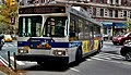
Third and Lexington Avenues Line

Last updated

m98, m101
m101, m102, m103
Third and Lexington Avenues Line
56th St Lex Av td 08.jpg
An M103 New Flyer D60HF at Lexington Avenue-56th Street in 2018
Overview
System MTA New York City Bus
Operator New York City Transit Authority
Garage Manhattanville Depot (M98)
Tuskegee Airmen Depot (M101-M103)
Vehicle Nova Bus LFS HEV (M98)
New Flyer Xcelsior XDE40 (M98)
Nova Bus LFS articulated (M101-M103)
New Flyer Xcelsior XD60 (M101-M103)
Began service1853 (train)
1947 (bus)
2010 (current alignment)
Route
Locale Manhattan, New York, U.S.
StartM98: Upper East Side  68th Street
M101-M102: East Village  6th Street
M103: City Hall
Via Third Avenue (northbound)
Lexington Avenue (southbound)
EndM98: Washington Heights  Cabrini Boulevard
M101: Fort George  193rd Street
M102: Harlem  147th Street
M103: East Harlem  125th Street
LengthM98 SB: 7.2 miles (11.6 km) [1]
M101 SB: 11.3 miles (18.2 km) [2]
M102 SB: 7.5 miles (12.1 km) [3]
M103 SB: 7.8 miles (12.6 km) [4]
Other routes M1 5th/Madison Avs/Broadway
M2 5th/Madison Avs/Powell Blvd
M3 5th/Madison/St Nicholas Avs
M4 110th St/5th/Madison/Ft Washington Avs/Broadway
Service
Operates24 hours (M101-3)
Rush hours only (M98)
Annual patronage
  • 264,521 (M98, 2022)
  • 4,412,415 (M101, 2022)
  • 2,633,391 (M102, 2022)
  • 2,196,080 (M103, 2022) [5]
TransfersYes
Timetable M98 M101 M102 M103
  M100  {{{system_nav}}}  M104  

The Third and Lexington Avenues Line, also known as the Third Avenue Line, is a public transit line in Manhattan, New York City, running from Lower Manhattan to Fort George in Washington Heights. Originally a streetcar line, it now consists of the M98, M101, M102, and M103 bus routes, operated by the New York City Transit Authority. The M98 bus route operates on Third Avenue between East 65th Street and East 127th Street, although it previously continued to 32nd Street. The M101, M102 and M103 bus routes run southbound on Lexington Avenue north of East 24th Street.

Contents

Current bus service

M98

M98 on Lexington Avenue in Upper East Side Lex Av E 92 St 03.jpg
M98 on Lexington Avenue in Upper East Side

The M98 operates between Hunter College at East 68th Street on the Upper East Side and Fort Tryon Park in Inwood near West 192nd Street. The M98 operates northbound via Third Avenue, and southbound via Lexington Avenue. At East 120th Street, southbound service shifts from Park to Lexington Avenues, while at East 127th Street, the M98 northbound service shifts onto the Harlem River Drive. The M98 exits the Harlem River Drive via the Interstate 95/Amsterdam Avenue exit. The M98 travels westbound along West 179th Street and eastbound along West 178th Street between Amsterdam Avenue and Fort Washington Avenue, where the M98 turns north on Fort Washington Avenue until its terminal at the entrance to Fort Tryon Park. [6]

M101

East-Village bound M101 traveling along 125th Street NYC Transit 6069 - Flickr - njt4148.jpg
East-Village bound M101 traveling along 125th Street

The M101 spans between Cooper Square in the East Village and West 193rd Street and Amsterdam Avenue in Fort George. The M101 runs northbound along Third Avenue from Astor Place to East 125th Street, while southbound buses use Lexington Avenue north of East 24th Street. The M101 continues crosstown on 125th Street to Amsterdam Avenue, running north towards West 193rd Street after Amsterdam Avenue becomes Fort George Avenue. To begin the southbound trip, the M101 turns south onto Saint Nicholas Avenue, then left (east) onto West 190th Street, followed by a right (south) back onto Amsterdam Avenue.

The M101 runs as a limited-stop service during the day south of East 116th Street, with no other local service. Local service is provided by the M102 and M103 buses, during that time. Overnight and weekend morning service runs local. [7]

M102

Harlem-bound M102 at Third Avenue and 50th Street 50th St 3rd Av td 21.jpg
Harlem-bound M102 at Third Avenue and 50th Street

The M102 begins at Cooper Square and follows the M101 until East 116th Street in East Harlem. The route travels west across 116th Street to Lenox Avenue, where it continues north to the Harlem–148th Street subway station. [8]

M103

The M103 begins its route at City Hall and travels north via Park Row and the Bowery. At Astor Place, it continues north alongside the M101 and M102 along Third to East 125th Street, where it terminates. Southbound service uses Lexington Avenue from East 125th to 24th Streets, then uses Third Avenue, Bowery, and Park Row. [9]

History

Streetcar service

The Third Avenue Railroad opened a line in 1853, from Astor House at Broadway and Park Row to 86th Street, running north along Park Row, Bowery, where it shared tracks with the Second Avenue Line, and Third Avenue. In 1859, an extension to East Harlem opened. Using the 125th Street Crosstown Line and tracks along Amsterdam Avenue, Third Avenue cars were also operated to Fort George. A trolley park called the Fort George Amusement Park operated at that end of the line from 1895 to 1914. [10]

Bus service

New York Railways' Lexington Avenue Line streetcar was replaced by New York City Omnibus Corporation (NYCO) bus (M21 - 3/4) on March 25, 1936. [11] In 1936, the NYCO and Fifth Avenue were placed under common ownership. In 1941, Surface Transportation Corporation began operating former Third Avenue Railway routes. The Third Avenue Railway's Third Avenue and Amsterdam Avenue Line streetcar was replaced by the M101 bus operated by the Surface Transportation Corporation on May 18, 1947. [12]

On July 17, 1960, Third Avenue north of 24th Street became one-way northbound, and southbound buses were moved to Lexington Avenue, and the two parallel bus lines were combined as a one-way pair, keeping the route number M101. [13]

After a strike in 1962, the entire Fifth Avenue system was transferred to the newly formed Manhattan and Bronx Surface Transit Operating Authority on March 22, 1962. [14] [15] [16]

Route M101A, formerly NYCO Fifth, Madison and Lenox Avenues route 2, was started on March 2, 1969. [17] This route was renumbered the M102 on July 1, 1974. [18]

Limited-stop service

New M98 Limited Stop service running between 32nd Street and Washington Heights was introduced on September 14, 1987, as a rush hour-only service. [19] [20] A public hearing had been held on March 12, 1987 concerning the proposed introduction of the route. Service initially ran every 15 minutes between 6:30 and 9:30 a.m. southbound, and every 15 minutes northbound from 4 to 7 p.m.. with service every 30 minutes in the reverse-peak. Stops were added to the route in response to community requests at 187th Street, 125th Street, 116th Street and 107th Street. The route was designed to keep the number of stops to a minimum to attract ridership. [21]

Limited-stop service on the M101 began on October 14, 1991, with alternate buses running limited between 7 a.m. and 7 p.m. [22]

On September 10, 1995, the M103 was created to improve reliability along Third and Lexington Avenues, curtailing the M101 and M102 south of Astor Place. [23]

In 2009, buses along the corridor were involved in a total of 268 accidents. The number is attributed to both inexperienced operators and the number of "obstacles" along the route. [24]

On June 27, 2010, due to shortfalls in the Metropolitan Transportation Authority's budget, the M98 was truncated from 32nd Street to 68th Street. At the same time, southbound M98 service into the George Washington Bus Terminal was discontinued. These two changes were estimated to annually save $800,000. [25]

Related Research Articles

<span class="mw-page-title-main">116th Street station (IRT Lexington Avenue Line)</span> New York City Subway station in Manhattan

The 116th Street station is a local station on the IRT Lexington Avenue Line of the New York City Subway. Located at the intersection of Lexington Avenue and 116th Street in East Harlem, it is served by the 6 train at all times, the <6> train during weekdays in the peak direction, and the 4 train during late nights.

<span class="mw-page-title-main">125th Street station (IRT Lexington Avenue Line)</span> New York City Subway station in Manhattan

The 125th Street station is an express station with four tracks and two island platforms. It is the northernmost Manhattan station on the IRT Lexington Avenue Line of the New York City Subway. Located at Lexington Avenue and East 125th Street in East Harlem, it is served by the 4 and 6 trains at all times, the 5 train at all times except late nights, and the <6> train during weekdays in peak direction. This station was constructed as part of the Dual Contracts by the Interborough Rapid Transit Company and opened in 1918.

<span class="mw-page-title-main">Second Avenue (Manhattan)</span> North-south avenue in Manhattan, New York

Second Avenue is located on the East Side of the New York City borough of Manhattan extending from Houston Street at its south end to the Harlem River Drive at 128th Street at its north end. A one-way street, vehicular traffic on Second Avenue runs southbound (downtown) only, except for a one-block segment of the avenue in Harlem. South of Houston Street, the roadway continues as Chrystie Street south to Canal Street.

<span class="mw-page-title-main">Lexington Avenue</span> North-south avenue in Manhattan, New York

Lexington Avenue, often colloquially abbreviated as "Lex", is an avenue on the East Side of Manhattan in New York City. The avenue carries southbound one-way traffic from East 131st Street to Gramercy Park at East 21st Street. Along its 5.5-mile (8.9-kilometer), 110-block route, Lexington Avenue runs through Harlem, Carnegie Hill, the Upper East Side, Midtown, and Murray Hill to a point of origin that is centered on Gramercy Park. South of Gramercy Park, the axis continues as Irving Place from 20th Street to East 14th Street.

<span class="mw-page-title-main">125th Street (Manhattan)</span> West-east street in Manhattan, New York

125th Street, co-named Martin Luther King Jr. Boulevard, is a two-way street that runs east–west in the New York City borough of Manhattan, from First Avenue on the east to Marginal Street, a service road for the Henry Hudson Parkway along the Hudson River in the west. It is often considered to be the "Main Street" of Harlem.

<span class="mw-page-title-main">M23 (New York City bus)</span> Bus route in Manhattan, New York

The 23rd Street Crosstown is a surface transit line on 23rd Street in Manhattan, New York City. It currently hosts the M23 SBS bus route of the Metropolitan Transportation Authority (MTA)'s Regional Bus Operations. The M23 runs between Chelsea Piers, along the West Side Highway near 22nd Street, via 23rd Street, to Avenue C and 20th Street in Stuyvesant Town–Peter Cooper Village.

<span class="mw-page-title-main">Third Avenue</span> North-south avenue in Manhattan and the Bronx, New York

Third Avenue is a north-south thoroughfare on the East Side of the New York City borough of Manhattan, as well as in the center portion of the Bronx. Its southern end is at Astor Place and St. Mark's Place. It transitions into Cooper Square, and further south, the Bowery, Chatham Square, and Park Row. The Manhattan side ends at East 128th Street. Third Avenue is two-way from Cooper Square to 24th Street, but carries only northbound (uptown) traffic while in Manhattan above 24th Street; in the Bronx, it is again two-way. However, the Third Avenue Bridge carries vehicular traffic in the opposite direction, allowing only southbound vehicular traffic, rendering the avenue essentially non-continuous to motor vehicles between the boroughs.

<span class="mw-page-title-main">FDR Drive</span> Highway in New York

Franklin D. Roosevelt East River Drive, commonly called FDR Drive for short, is a controlled-access parkway on the east side of the New York City borough of Manhattan. It starts near South and Broad Streets, just north of the Battery Park Underpass, and runs north along the East River to the 125th Street / Robert F. Kennedy Bridge / Willis Avenue Bridge interchange, where it becomes Harlem River Drive. All of FDR Drive is designated New York State Route 907L (NY 907L), an unsigned reference route.

<span class="mw-page-title-main">M15 (New York City bus)</span> Bus route in Manhattan, New York

The First and Second Avenues Line, also known as the Second Avenue Line, is a bus line in Manhattan, New York City, running mostly along Second Avenue from Lower Manhattan to East Harlem. Originally a streetcar line along Second Avenue, it is now the M15 bus route, the busiest bus route in the city and United States, carrying 16.4 million riders annually. MTA Regional Bus Operations, under the New York City Bus and Select Bus Service brands, operates the local out of the Tuskegee Airmen Bus Depot and the SBS from the Mother Clara Hale Bus Depot. Service is operated exclusively with articulated buses.

<span class="mw-page-title-main">M10 and M20 buses</span> Bus routes in Manhattan, New York

The Eighth Avenue Line is a public transit line in Manhattan, New York City, running mostly along Eighth Avenue from Lower Manhattan to Harlem. Originally a streetcar line, it is now the M10 bus route and the M20 bus route, operated by the New York City Transit Authority. The M10 bus now only runs north of 57th Street, and the M20 runs south of 66th Street. The whole line was a single route, the M10, until 2000 when the M20 was created.

<span class="mw-page-title-main">M11 (New York City bus)</span> Bus route in Manhattan, New York

The Ninth and Tenth Avenues Line or Ninth Avenue Line is a surface transit line in the New York City borough of Manhattan, running mostly along Ninth Avenue and Amsterdam Avenue from Lower Manhattan to Manhattanville. Originally a streetcar line operated by the Manhattan and Bronx Surface Transit Operating Authority, it is now the M11 bus route operated by the New York City Transit Authority.

<span class="mw-page-title-main">M5 and M55 buses</span> Bus routes in Manhattan, New York

The M5 and M55 bus routes constitute a public transit corridor in Manhattan, New York City, running along the Fifth / Sixth Avenues / Riverside Drive Line as well as the southern portion of the Broadway Line after the discontinuation of the M6. The routes primarily run along Broadway, Fifth and Sixth Avenues, and Riverside Drive from South Ferry, Lower Manhattan to Washington Heights. The M5 covers the northern portion of the route north of 31st Street, while the M55 operates along the southern portion of the route south of 44th Street. The two routes overlap in Midtown Manhattan. The portion along Broadway south of East 8th Street was originally a streetcar line.

<span class="mw-page-title-main">M7 (New York City bus)</span> Bus route in Manhattan, New York

The Columbus Avenue Line is a public transit line in Manhattan, New York City, running mostly along Columbus Avenue, 116th Street, and Lenox Avenue from Lower Manhattan to Harlem. Originally a streetcar line, it is now the M7 bus route, operated by the New York City Transit Authority, a division of the Metropolitan Transportation Authority.

<span class="mw-page-title-main">M60 (New York City bus)</span> Bus route in Manhattan and Queens, New York

The M60 Select Bus Service is a bus route in New York City. It is part of MTA Regional Bus Operations, operated by the Manhattan and Bronx Surface Transit Operating Authority (MaBSTOA) under the New York City Transit brand. The M60 provides service between the Upper West Side of Manhattan and LaGuardia Airport in East Elmhurst, Queens, traveling between boroughs via the RFK-Triborough Bridge. It is the only direct public transit option between Manhattan and LaGuardia Airport.

<span class="mw-page-title-main">M104 (New York City bus)</span> Bus route in Manhattan, New York

The Broadway Line is a surface transit line in Manhattan, New York City, running mainly along 42nd Street and Broadway from Murray Hill to Harlem. Formerly a streetcar line operated by the Third Avenue Railway, it is now the M104 bus route operated by the New York City Transit Authority, a subsidiary of the Metropolitan Transportation Authority. This bus route no longer runs along the entire route of the former streetcar.

The Surface Transportation Corporation was the bus-operating subsidiary of the Third Avenue Railway in New York City which operated under that name following the conversion of the streetcar lines in Manhattan and the Bronx to bus service between March 1941 and August 1948. On December 17, 1956, the corporation was bought by Fifth Avenue Coach Lines, Inc. as part of its acquisition of the Third Avenue Railway, and its routes placed under a newly created operating subsidiary, Surface Transit, Inc.

<span class="mw-page-title-main">M1, M2, M3, and M4 buses</span> Bus routes in Manhattan, New York

The M1, M2, M3, and M4 are four local bus routes that operate the Fifth and Madison Avenues Lines – along the one-way pair of Madison and Fifth Avenues in the Manhattan borough of New York City. Though the routes also run along other major avenues, the majority of their route is along Madison and Fifth Avenues between Greenwich Village and Harlem.

<span class="mw-page-title-main">Bus lanes in New York City</span> Bus priority system

Since 1963, New York City has been using a system of bus lanes that are intended to give priority to buses, which contain more occupants than passenger and commercial vehicles. Most of these lanes are restricted to buses only at certain days and times, but some bus lanes are restricted 24/7. As of May 2021, there are 138.4 miles (222.7 km) of bus lanes within New York City.

<span class="mw-page-title-main">Bx15 and M125 buses</span> Bus routes in Manhattan and the Bronx, New York

The Bx15 and M125 bus routes constitute the Third Avenue/125th Street Line, a public transit line in New York City. The Bx15 runs between Fordham Plaza and the Hub in the Bronx, running primarily along Third Avenue. The M125 runs between the Hub in the Bronx and Manhattanville in Manhattan, running along Willis Avenue in the South Bronx and along 125th Street in Harlem, Manhattan.

References

  1. Google (May 8, 2017). "M98" (Map). Google Maps . Google. Retrieved May 8, 2017.
  2. Google (May 8, 2017). "M101" (Map). Google Maps . Google. Retrieved May 8, 2017.
  3. Google (May 8, 2017). "M102" (Map). Google Maps . Google. Retrieved May 8, 2017.
  4. Google (May 8, 2017). "M103" (Map). Google Maps . Google. Retrieved May 8, 2017.
  5. "Subway and bus ridership for 2022". mta.info. August 3, 2023. Retrieved March 29, 2024.
  6. MTA Regional Bus Operations. "M98 bus schedule".
  7. MTA Regional Bus Operations. "M101 bus schedule".
  8. MTA Regional Bus Operations. "M102 bus schedule"
  9. MTA Regional Bus Operations. "M103 bus schedule".
  10. Martens, Victoria (August 1, 2019). "Fort George Amusement Park". Museum of the City of New York. Retrieved September 2, 2019.
  11. Maeder, Jay (1999). Big Town, Big Time: A New York Epic : 1898-1998. New York Daily News. p. 75. ISBN   9781582610283.
  12. "Buses On 3d Ave. Sunday; ' Gay Nineties' Group to Make Trip on Last Trolley Car". The New York Times. May 16, 1947. Retrieved August 30, 2018.
  13. "One-Way Bus Schedules Given For Lexington and 3d Avenues". The New York Times. July 12, 1960. Retrieved August 30, 2018.
  14. "New York City Transit Facts & Figures: 1979" (PDF). La Guardia and Wagner Archives . Metropolitan Transportation Authority, New York City Transit Authority. 1979. Retrieved October 24, 2016.
  15. Kenneth T. Jackson; Lisa Keller; Nancy Flood (December 1, 2010). The Encyclopedia of New York City: Second Edition. Yale University Press. ISBN   978-0-300-18257-6.
  16. Sibley, John (March 22, 1962). "City Seizes Buses; Full Service Due 6 A.M. Saturday" (PDF). The New York Times . Retrieved September 6, 2016.
  17. "Manhattan and Bronx Surface Transit Authority: The First Ten Years." Motor Coach Age, May 1972.
  18. "2 Boroughs' Buses Get New Numbers". The New York Times. June 20, 1974. ISSN   0362-4331 . Retrieved October 2, 2016.
  19. M98 pamphlets
  20. "Limited-stop bus set for rush hour". New York Daily News. September 3, 1987. Retrieved August 30, 2018.
  21. Gunn, David L. (August 18, 1987). "September 1987 Bus Changes" (PDF). laguardiawagnerarchive.lagcc.cuny.edu. New York City Transit Authority. Retrieved March 21, 2019.
  22. "M2 & M101 Buses Are Pulling Out The Stops Limited-Stop Service Starts October 14th". New York Daily News. October 11, 1991. Retrieved August 17, 2018.
  23. "On September 10, a new bus route, the M103, will be introduced. The M101 and M102 Lexington Ave. routes will end at East 6th Street, instead of City Hall". New York Daily News. September 14, 1995. Retrieved August 17, 2018.
  24. Blau, Reuven (October 24, 2010). "M101 tops bus crash courses". New York Post. Retrieved August 30, 2018.
  25. "Evaluation of 2010 Service Reductions" (PDF). MTA New York City Transit. September 23, 2011. pp. B48–B49. Retrieved May 15, 2017.