
Harlem is a neighborhood in Upper Manhattan, New York City. It is bounded roughly by the Hudson River on the west; the Harlem River and 155th Street on the north; Fifth Avenue on the east; and Central Park North on the south. The greater Harlem area encompasses several other neighborhoods and extends west and north to 155th Street, east to the East River, and south to Martin Luther King Jr. Boulevard, Central Park, and East 96th Street.
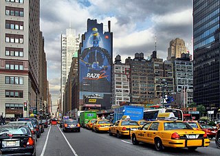
Madison Avenue is a north-south avenue in the borough of Manhattan in New York City, United States, that carries northbound one-way traffic. It runs from Madison Square to meet the southbound Harlem River Drive at 142nd Street, passing through Midtown, the Upper East Side, East Harlem, and Harlem. It is named after and arises from Madison Square, which is itself named after James Madison, the fourth President of the United States.

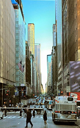
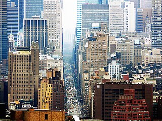
Fifth Avenue is a major thoroughfare in the borough of Manhattan in New York City. The avenue stretches southward from West 143rd Street in Harlem to Washington Square Park in Greenwich Village. The section in Midtown Manhattan is one of the most expensive shopping streets in the world.

Sixth Avenue, also known as Avenue of the Americas, is a major thoroughfare in the New York City borough of Manhattan. The avenue is commercial for much of its length, and traffic runs northbound, or uptown.
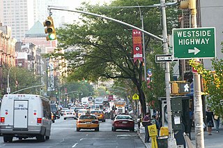
125th Street, co-named Martin Luther King Jr., Boulevard is a two-way street that runs east–west in the New York City borough of Manhattan, from First Avenue on the east to Marginal Street, a service road for the Henry Hudson Parkway along the Hudson River in the west. It is often considered to be the "Main Street" of Harlem.
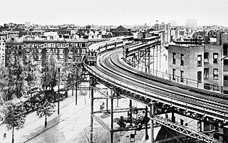
The Lenox Avenue Line is a line of the New York City Subway, part of the A Division, mostly built as part of the first subway line. Located in Manhattan, New York City, it consists of six stations between Central Park North–110th Street and Harlem–148th Street, all of which are situated within the neighborhood of Harlem in Upper Manhattan.
Seventh Avenue—co-named Fashion Avenue in the Garment District and known as Adam Clayton Powell Jr. Boulevard north of Central Park—is a thoroughfare on the West Side of the borough of Manhattan in New York City. It is southbound below the park and a two-way street north of it.
Eighth Avenue is a major north–south avenue on the west side of Manhattan in New York City, carrying northbound traffic below 59th Street. It is one of the original avenues of the Commissioners' Plan of 1811 to run the length of Manhattan, though today the name changes twice: At 59th Street/Columbus Circle, it becomes Central Park West, where it forms the western boundary of Central Park, and north of 110th Street/Frederick Douglass Circle, it is known as Frederick Douglass Boulevard before merging onto Harlem River Drive north of 155th Street.
Ninth Avenue, known as Columbus Avenue between West 59th and 110th Streets, is a thoroughfare on the West Side of Manhattan in New York City, United States. Traffic runs downtown (southbound) from the Upper West Side to Chelsea. Two short sections of Ninth Avenue also exist in the Inwood neighborhood, carrying two-way traffic.

Tenth Avenue, known as Amsterdam Avenue between 59th Street and 193rd Street, is a north-south thoroughfare on the West Side of Manhattan in New York City. It carries uptown (northbound) traffic as far as West 110th Street, after which it continues as a two-way street.

Lenox Avenue – also named Malcolm X Boulevard; both names are officially recognized – is the primary north–south route through Harlem in the upper portion of the New York City borough of Manhattan. This two-way street runs from Farmers' Gate at Central Park North to 147th Street. Its traffic is figuratively described as "Harlem's heartbeat" by Langston Hughes in his poem Juke Box Love Song.
110th Street is a street in the New York City borough of Manhattan. It is commonly known as the boundary between Harlem and Central Park, along which it is known as Central Park North. In the west, between Central Park West/Frederick Douglass Boulevard and Riverside Drive, it is co-signed as Cathedral Parkway.

The Central Park North–110th Street station is a station on the IRT Lenox Avenue Line of the New York City Subway, located at the intersection of 110th Street and Lenox Avenue at the southern edge of Harlem, Manhattan. It is served by the 2 and 3 trains at all times.

The Eighth Avenue Line is a public transit line in Manhattan, New York City, running mostly along Eighth Avenue from Lower Manhattan to Harlem. Originally a streetcar line, it is now the M10 bus route and the M20 bus route, operated by the New York City Transit Authority. The M10 bus now only runs north of 57th Street, and the M20 runs south of 66th Street. The whole line was a single route, the M10, until 2000 when the M20 was created.

Harlem Meer is a man-made lake at the northeast corner of New York City's Central Park. It lies west of Fifth Avenue, south of 110th Street, and north of the Conservatory Garden, near the Harlem and East Harlem neighborhoods of Manhattan. The lake, as originally constructed, was 12.634 acres (51,130 m2), but after the completion in 1966 of the Lasker skating rink and swimming pool, it was reduced to approximately 11 acres (45,000 m2) in area and approximately 0.75 miles (1.21 km) in circumference.

The M1, M2, M3, and M4 are four local bus routes that operate along the one-way pair of Madison and Fifth Avenues in the borough of Manhattan in New York City between Greenwich Village and Harlem.

The Park Avenue main line, which consists of the Park Avenue Tunnel and the Park Avenue Viaduct, is a railroad line in the New York City borough of Manhattan, running entirely along Park Avenue. The line carries four tracks of the Metro-North Railroad as a tunnel from Grand Central Terminal at 42nd Street to a portal at 97th Street, where it rises to a viaduct north of 99th Street and continues over the Harlem River into the Bronx over the Park Avenue Bridge. During rush hours, Metro-North uses three of the four tracks in the peak direction.

The Will Marion Cook House is a historic townhouse at 221 West 138th Street, in the part of Harlem known as Strivers' Row in Manhattan, New York City. It was the home of Will Marion Cook (1869-1944), a leading African-American musician and composer of the period, from 1918 until his death in 1944. Cook was a major influence on later musicians including Sidney Bechet, Duke Ellington, and Josephine Baker. It was declared a National Historic Landmark in 1976.

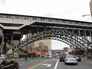
Frederick Douglass Circle is a traffic circle located at the northwest corner of Central Park at the intersection of Eighth Avenue and 110th Street in the New York City borough of Manhattan. The traffic circle is named for the American abolitionist, women's suffragist, editor, orator, author, statesman, and reformer Frederick Douglass.

