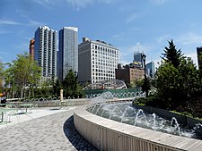
Herald Square is a major commercial intersection in the Midtown Manhattan neighborhood of New York City, formed by the intersection of Broadway, Sixth Avenue, and 34th Street. Named for the now-defunct New York Herald, a newspaper formerly headquartered there, it also gives its name to the surrounding area. The bow tie-shaped intersection consists of two named sections: Herald Square to the north (uptown) and Greeley Square to the south (downtown).
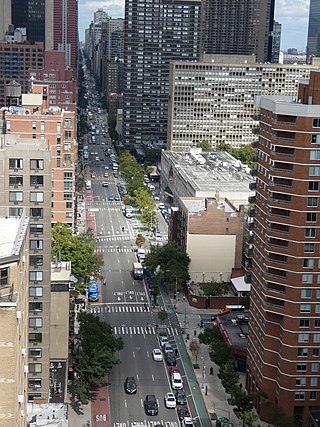
Second Avenue is located on the East Side of the New York City borough of Manhattan extending from Houston Street at its south end to the Harlem River Drive at 128th Street at its north end. A one-way street, vehicular traffic on Second Avenue runs southbound (downtown) only, except for a one-block segment of the avenue in Harlem. South of Houston Street, the roadway continues as Chrystie Street south to Canal Street.
The IND Sixth Avenue Line is a rapid transit line of the B Division of the New York City Subway in the United States. It runs mainly under Sixth Avenue in Manhattan, and continues south to Brooklyn. The B, D, F, and M trains, which use the Sixth Avenue Line through Midtown Manhattan, are colored orange. The B and D trains use the express tracks, while the F, <F> and M trains use the local tracks.

The Park Avenue Tunnel, also called the Murray Hill Tunnel, is a 1,600-foot-long (488 m) tunnel that passes under seven blocks of Park Avenue in Murray Hill, in the New York City borough of Manhattan. Traffic used to travel northbound from 33rd Street toward the Park Avenue Viaduct. The tunnel is under the jurisdiction of the New York City Department of Transportation. It is designed to carry one lane of northbound car traffic from East 33rd Street to East 40th Street. From 40th Street north, traffic must follow the Park Avenue Viaduct around Grand Central Terminal to 46th Street. The vertical clearance is 8 ft 11 in (2.72 m).
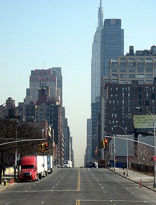
34th Street is a major crosstown street in the New York City borough of Manhattan. It runs the width of Manhattan Island from the West Side Highway on the West Side to FDR Drive on the East Side. 34th Street is used as a crosstown artery between New Jersey to the west and Queens to the east, connecting the Lincoln Tunnel to New Jersey with the Queens–Midtown Tunnel to Long Island.
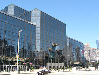
Eleventh Avenue is a north–south thoroughfare on the far West Side of the borough of Manhattan in New York City, located near the Hudson River. Eleventh Avenue originates in the Meatpacking District in the Greenwich Village and West Village neighborhoods at Gansevoort Street, where Eleventh Avenue, Tenth Avenue, and West Street intersect. It is considered part of the West Side Highway between 22nd and Gansevoort Streets.

The 34th Street–Herald Square station is an underground station complex on the BMT Broadway Line and the IND Sixth Avenue Line of the New York City Subway. It is located at Herald Square in Midtown Manhattan where 34th Street, Broadway and Sixth Avenue intersect, and is served by the D, F, N, and Q trains at all times; the R train at all times except late nights; the B, M, and W trains on weekdays; and the <F> train during rush hours in the peak direction.

The West Side Line, also called the West Side Freight Line, is a railroad line on the west side of the New York City borough of Manhattan. North of Penn Station, from 34th Street, the line is used by Amtrak passenger service heading north via Albany to Toronto; Montreal; Niagara Falls and Buffalo, New York; Burlington, Vermont; and Chicago. South of Penn Station, a 1.45-mile (2.33 km) elevated section of the line, abandoned since 1980, has been transformed into an elevated park called the High Line. The south section of the park from Gansevoort Street to 20th Street opened in 2009 and the second section up to 30th Street opened in 2011, while the final section to 34th Street opened in 2014.

Hudson Yards is a neighborhood on the West Side of Midtown Manhattan in New York City, bounded roughly by 30th Street in the south, 41st Street in the north, the West Side Highway in the west, and Eighth Avenue in the east. The area is the site of a large-scale redevelopment program that is being planned, funded, and constructed under a set of agreements among the State of New York, City of New York, and Metropolitan Transportation Authority (MTA), with the aim of expanding the Midtown Manhattan business district westward to the Hudson River. The program includes a major rezoning of the Far West Side, an extension of the New York City Subway's 7 and <7> trains to a new subway station at 34th Street and 11th Avenue, a renovation and expansion of the Javits Center, and a financing plan to fund the various components. The various components are being planned by New York City Department of City Planning and New York City Economic Development Corporation.
The 7 Subway Extension is a subway extension of the New York City Subway's IRT Flushing Line, which is served by the 7 local and <7> express services. The extension stretches 1.5 miles (2.4 km) southwest from its previous terminus at Times Square, at Seventh Avenue and 41st Street, to one new station at 34th Street and Eleventh Avenue. A second station at 10th Avenue and 41st Street was dropped from the plans in October 2007. The entirety of the extension is located within the New York City borough of Manhattan. The extension, a key part of the Hudson Yards Redevelopment Project, is expected to bring business and entertainment into the area, as well as aid redevelopment of nearby Chelsea and Hell's Kitchen, located around the Long Island Rail Road's West Side Yard. The extension also serves the nearby Jacob K. Javits Convention Center.

34th Street station is a station on the Hudson–Bergen Light Rail (HBLR) in Bayonne, New Jersey. The third of four stations in the city of Bayonne, 34th Street is located at the intersection of Avenue E and East 34th Street, the station doubles as a park and ride with access to Route 440 southbound.

The 36th Street station is a local station on the IND Queens Boulevard Line of the New York City Subway. Located at the intersection of 36th Street and Northern Boulevard in Queens, it is served by the M train on weekdays, the R train at all times except nights, and the E and F trains at night. The <F> train skips this station when it operates.

Dyer Avenue is a short, north-south thoroughfare in the Hell's Kitchen neighborhood of Manhattan in New York City, located between Ninth Avenue and Tenth Avenue. It is primarily used by traffic exiting the Lincoln Tunnel. Dyer Avenue runs between 30th Street and 42nd Street but functions as three distinct sections due to its connections with the south and center tubes of the Lincoln Tunnel. The southernmost section, between 30th and 31st Streets, leads to and from the Lincoln Tunnel Expressway. Dyer Avenue also exists between 34th and 36th Streets, and between 40th and 42nd Streets; both sections lead directly from the tunnel, but the 34th-36th Streets section also contains a roadway leading to the tunnel. The avenue is owned by the Port Authority of New York and New Jersey.

The East River Greenway is an approximately 9.44-mile-long (15.19 km) foreshoreway for walking or cycling on the east side of the island of Manhattan on the East River. It is part of the Manhattan Waterfront Greenway. The largest portions are operated by the New York City Department of Parks and Recreation. It is separated from motor traffic, and many sections also separate pedestrians from cyclists. The greenway is parallel to the Franklin D. Roosevelt East River Drive for a majority of its length.

The 34th Street–Hudson Yards station is a New York City Subway station in Manhattan's West Side on the IRT Flushing Line, and is the western terminus for the 7 local and <7> express services. It has two tracks and one island platform, with two levels of mezzanines: one directly above the platform and the other directly below street level. The station directly serves the Hudson Yards mega-development above it, and is located within the greater Hudson Yards neighborhood. The station contains two entrances along Hudson Boulevard: a primary entrance south of 34th Street, and a secondary entrance south of 35th Street.
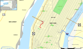
The Lincoln Tunnel Expressway is an eight block-long, mostly four-lane, north–south divided highway between the portals of the Lincoln Tunnel and West 31st Street in Midtown Manhattan in New York City. Dyer Avenue is an at-grade roadway paralleling part of the mostly depressed roadway and serves traffic entering and leaving the highway and the tubes of the tunnel. Like the tunnel, the roads are owned and operated by the Port Authority of New York and New Jersey. They traverse the Manhattan neighborhoods of Hell's Kitchen and Chelsea between Ninth and Tenth avenues. The highway serves as the entrance to the Lincoln Tunnel from Manhattan, with the entrance from Weehawken, New Jersey being the Lincoln Tunnel Helix.
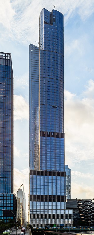
35 Hudson Yards is a mixed-use skyscraper in Manhattan's West Side composed of apartment units and a hotel. Located near Hell's Kitchen, Chelsea, and the Penn Station area, the building is a part of the Hudson Yards project, a plan to redevelop the Metropolitan Transportation Authority's West Side Yards. As of November 2022, it was the 28th-tallest building in the United States.

55 Hudson Yards is a skyscraper in Hudson Yards, Manhattan, New York City, just outside the Hudson Yards Redevelopment Project. It and 50 Hudson Yards will add a combined 4 million square feet (370,000 m2) of space to the Hudson Yards project, even though the two buildings are located outside the redevelopment site itself.
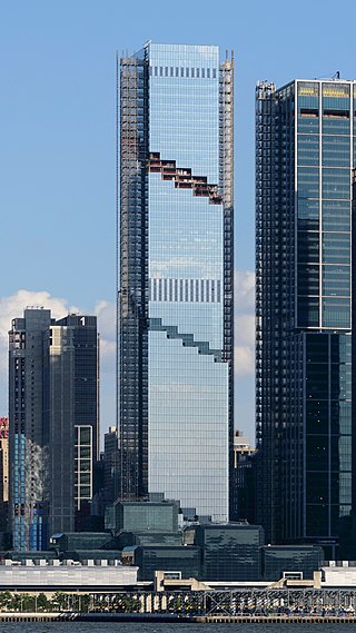
The Spiral, also known as 66 Hudson Boulevard, is a 66-floor, 1,031-foot (314 m) skyscraper with 2.85 million square feet (265,000 m2), on 34th Street between Hudson Boulevard and Tenth Avenue in Hudson Yards, Manhattan, New York City. It was developed by Tishman Speyer, constructed by Turner Construction, and opened in 2023.

Hudson Yards is a 28-acre (11 ha) real estate development in the Hudson Yards neighborhood in Manhattan, New York City, between the Chelsea and Hell's Kitchen neighborhoods. It is located on the waterfront of the Hudson River. Upon completion, 13 of the 16 planned structures on the West Side of Midtown South would sit on a platform built over the West Side Yard, a storage yard for Long Island Rail Road trains. The first of its two phases, opened in 2019, comprises a public green space and eight structures that contain residences, a hotel, office buildings, a mall, and a cultural facility. The second phase, on which construction had not started as of 2023, will include residential space, an office building, and a school.
