Prospect Park is an urban park in Brooklyn, New York City. The park is situated between the neighborhoods of Park Slope, Prospect Heights, Prospect Lefferts Gardens, Flatbush, and Windsor Terrace, and is adjacent to the Brooklyn Museum, Grand Army Plaza, and the Brooklyn Botanic Garden. With an area of 526 acres (213 ha), Prospect Park is the second largest public park in Brooklyn, behind Marine Park.

Seth Low was an American educator and political figure who served as the mayor of Brooklyn from 1881 to 1885, the president of Columbia University from 1890 to 1901, a diplomatic representative of the United States, and the mayor of New York City from 1902 to 1903. He was a leading municipal reformer fighting for efficiency during the Progressive Era.

Bath Beach is a neighborhood in Brooklyn, New York City, United States. It is located at the southwestern edge of the borough on Gravesend Bay. The neighborhood borders Bensonhurst and New Utrecht to the northeast across 86th Street; Dyker Beach Park and Golf Course to the northwest across 14th Avenue; and Gravesend to the east across Stillwell Avenue.

Bay Parkway is a 2.7-mile (7.82 km) boulevard/parkway in the west portion of the New York City borough of Brooklyn.

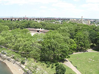
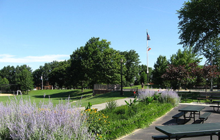
Astoria Park is a 59.96-acre (24.26 ha) public park in the Astoria neighborhood of Queens in New York City. The park is situated on the eastern shore of the Hell Gate, a strait of the East River, between Ditmars Boulevard to the north and Hoyt Avenue to the south. The Robert F. Kennedy (Triborough) and Hell Gate Bridges respectively pass over the park's southern and northern sections. Astoria Park contains a playground, a soccer field, a running track, a skate park, and courts for tennis, basketball, and bocce. Astoria Park also includes the Astoria Play Center, which consists of a recreation center and a pool. The park and play center are maintained by the New York City Department of Parks and Recreation.

Highland Park is a park located in Brooklyn, New York City, on the border with Queens. The Brooklyn neighborhood to its south is commonly regarded as Cypress Hills which is part of the East New York neighborhood. The Queens neighborhoods to the north are Glendale and Ridgewood.

Juniper Valley Park is a 55.247-acre (223,580 m2) public park located within Middle Village, Queens, New York, United States. The park is bordered by Juniper Boulevard North on the north, Juniper Boulevard South on the south, Lutheran Avenue on the west, and Dry Harbor Road on the east; it is split into two parts by 80th Street.

Mapleton is a neighborhood in southern Brooklyn, New York City, bounded by 16th Avenue on the west, Dahill Road on the east, 57th Street on the north, and 65th Street on the south. It borders Bensonhurst and Borough Park to the west, and Midwood to the east.

Playground 52 is a 1.8-acre (0.73 ha) playground at 681 Kelly Street in the Longwood neighborhood of the Bronx, in New York City. The playground features basketball and handball courts, bathrooms, a spray shower, and a skate park. as well as an amphitheater with a large dance floor.
Lieutenant Joseph Petrosino Park is a New York City public park located in Bensonhurst, Brooklyn, New York City between 70th Street to the north, 71st Street to the south, 16th Avenue to the east, and New Utrecht Avenue to the west. It is on the east side of the 71st Street subway station. This part of Bensonhurst was within the Town of Nieuw Utrecht when it was founded during the Dutch colonial era in 1657. The town had its name Anglicized to New Utrecht during the English colonial era. The town lost its autonomous status and became part of the City of Brooklyn in 1894. Since 16th Avenue and New Utrecht Avenue do not run parallel to each other, the footprint of the park is trapezoidal in shape.
Linden Park, officially known as Park of the Americas, is a 3.08-acre (1.25 ha) park located in the center of the Corona neighborhood of Queens, New York City. It has stood out as a green square block on maps since the village of West Flushing was first mapped out in 1853, long before the village became the suburb or urban neighborhood known as Corona.
Bensonhurst Park is a park in Bath Beach, Brooklyn, New York City. The park stretches from the north border at Cropsey Avenue to the south border at Lower New York Bay. The park has a playground on the north-east side, a field in the middle of the playground and several basketball courts on the west side. There is also a bathroom in the northwest side of the park.

Sunset Park is a 24.5-acre (9.9 ha) public park in the neighborhood of Sunset Park, Brooklyn, New York City, between 41st and 44th Streets and 5th and 7th Avenues. The modern-day park contains a playground, recreation center, and pool. The recreation center and pool comprise the Sunset Play Center, which was designated as both an exterior and interior landmark by the New York City Landmarks Preservation Commission. The park is operated by the New York City Department of Parks and Recreation, also known as NYC Parks.

Betsy Head Park is a 10.55-acre (4.27 ha) public park in the Brownsville neighborhood of Brooklyn in New York City. The park occupies two non-contiguous plots diagonally across from each other at the intersection of Dumont Avenue and Thomas S. Boyland Street, covering a collective 10.55 acres (4.27 ha). The modern-day park contains a playground, a swimming complex, and fields for baseball, football, tennis, and basketball. The park's swimming complex, the Betsy Head Play Center, was designed by Ely Jacques Kahn and consists of a bathhouse, a general swimming pool, and an infilled diving pool. The park is operated by the New York City Department of Parks and Recreation, also known as NYC Parks.

Calvert Vaux Park is an 85.53-acre (34.61 ha) public park in Gravesend, Brooklyn, in New York City. Created in 1934, it is composed of several disconnected sections along the Belt Parkway between Bay 44th and Bay 49th Streets. The peninsula upon which the park is located faces southwest into Gravesend Bay, immediately north of the Coney Island Creek. The park was expanded in the 1960s by waste from the construction of the Verrazzano-Narrows Bridge, and was renamed after architect Calvert Vaux in 1998. It is operated by the New York City Department of Parks and Recreation, also known as NYC Parks.

Golconda Skate Park, known as Fat Kid, is a public skate park in the Downtown Brooklyn/Fort Greene neighborhoods of Brooklyn, New York City, that originated as a DIY skate spot. Built under the Brooklyn Queens Expressway, the 18,000 square foot professionally built skate park was completed in 2016 and sits within Golconda Playground.

Martin "Marty" Maher is the Brooklyn Parks Commissioner for the New York City Department of Parks and Recreation, assuming the office in 2017.

Bowne Park is a 11.79-acre (4.77 ha) park in Broadway–Flushing, Queens, New York, east of downtown Flushing. It is bordered by 29th Avenue on the north, 32nd Avenue on the south, 155th Street on the west, and 159th Street on the east. The park consists of a playground, basketball courts, bocce court, and a kettle pond. The area immediately surrounding the park, developed in the late 19th and early 20th centuries, was originally also marketed as "Bowne Park" and is part of modern-day Murray Hill and Broadway–Flushing.

Captain Tilly Park is a 9.16-acre (3.71 ha) park in Jamaica Hills, Queens, New York, north of downtown Jamaica. It is bordered by 165th Street to the west, 85th Avenue to the north, Chapin Parkway and Gothic Drive to the northeast, and Highland Avenue to the south. The park consists of a kettle pond named Goose Pond, the only remaining kettle pond in Jamaica Hills.


