Interstate 278 (I-278) is an auxiliary Interstate Highway in New Jersey and New York in the United States. The road runs 35.62 miles (57.32 km) from U.S. Route 1/9 (US 1/9) in Linden, New Jersey, northeast to the Bruckner Interchange in the New York City borough of the Bronx. The majority of I-278 is in New York City, where it serves as a partial beltway and passes through all five of the city's boroughs. I-278 follows several freeways, including the Union Freeway in Union County, New Jersey; the Staten Island Expressway (SIE) across Staten Island; the Gowanus Expressway in southern Brooklyn; the Brooklyn–Queens Expressway (BQE) across northern Brooklyn and Queens; a small part of the Grand Central Parkway in Queens; and a part of the Bruckner Expressway in the Bronx. I-278 also crosses multiple bridges, including the Goethals, Verrazzano-Narrows, Kosciuszko, and Triborough Bridges.

East Williamsburg is a name for the area in the northwestern portion of Brooklyn, New York City. East Williamsburg consists roughly of what was the 3rd District of the Village of Williamsburg and what is now called the East Williamsburg In-Place Industrial Park (EWIPIP), bounded by the neighborhoods of Northside and Southside Williamsburg to the west, Greenpoint to the north, Bushwick to the south and southeast, and both Maspeth and Ridgewood in Queens to the east. Much of this area is still referred to as either Bushwick, Williamsburg, or Greenpoint with the term East Williamsburg falling out of use since the 1990s.
Union Grounds was a baseball park located in the Williamsburg section of Brooklyn, New York. The grounds opened in 1862, its inaugural match being played on May 15. It was the first baseball park enclosed entirely by a fence, thereby allowing proprietor William Cammeyer or his tenant to charge admission. This permitted paying customers to watch the games from benches in a stand while non-paying spectators could only watch from embankments outside the grounds.

Maspeth is a residential and commercial community in the borough of Queens in New York City. It was founded in the early 17th century by Dutch and English settlers. Neighborhoods sharing borders with Maspeth are Woodside to the north; Sunnyside to the northwest; Greenpoint, Brooklyn to the west; East Williamsburg, Brooklyn to the southwest; Fresh Pond and Ridgewood to the south; and Middle Village and Elmhurst to the east.
Interstate 78 (I-78) is a part of the Interstate Highway System that runs from Union Township, Lebanon County, Pennsylvania, to New York City. In the U.S. state of New York, I-78 extends 0.90 miles (1.45 km). The entirety of I-78 consists of the Holland Tunnel, which crosses under the Hudson River from New Jersey and ends at an exit rotary in Lower Manhattan. The tunnel and its approaches are maintained by the Port Authority of New York and New Jersey (PANYNJ).

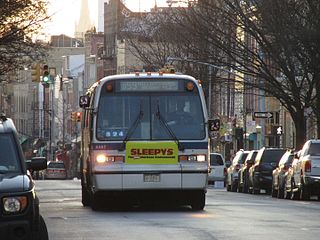
The Grand Street Line is a public transit line in Brooklyn and Queens, New York City, running mostly along the continuous Grand Street and Grand Avenue between Williamsburg, Brooklyn and Maspeth, Queens. It then continues down Queens Blvd to the 63rd Drive station. Originally a streetcar line, it is now the Q59 bus route, operated by the New York City Transit Authority between Williamsburg and Rego Park, Queens.

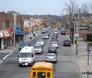
Grand Street and Grand Avenue are the respective names of a street which runs through the boroughs of Brooklyn and Queens, New York City, United States. Originating in Williamsburg, Brooklyn, Grand Street runs roughly northeast until crossing Newtown Creek into Queens, whereupon Grand Street becomes Grand Avenue, continuing through Maspeth where it is a main shopping street, until reaching its northern end at Queens Boulevard in Elmhurst.

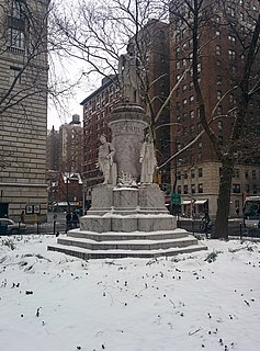
Verdi Square is a small triangle on Upper West Side of Manhattan, New York City. It is between 72nd Street on the south, 73rd Street on the north, Broadway on the west, and Amsterdam Avenue on the east. On the south the square fronts West 72nd Street; across the street to the south lies Sherman Square. On the north side, the park faces the Apple Bank for Savings' central building at 2112 Broadway, designed by York and Sawyer.
The Seventh Avenue Line is a public transit line in Brooklyn, New York City. It currently serves the B67 bus of MTA Regional Bus Operations. The B67 is dispatched out of the Jackie Gleason Depot in Sunset Park, Brooklyn.

MTA Regional Bus Operations operates local and express buses serving New York City in the United States out of 29 bus depots. These depots are located in all five boroughs of the city, with one located in nearby Yonkers in Westchester County. 21 of these depots serve MTA New York City Transit (NYCT)'s bus operations, while the remaining eight serve the MTA Bus Company. These facilities perform regular maintenance, cleaning, and painting of buses, as well as collection of revenue from bus fareboxes. Several of these depots were once car barns for streetcars, while others were built much later and have only served buses. Employees of the depots are represented by local divisions of the Transport Workers Union of America (TWU), particularly the TWU Local 100 and 101, or of the Amalgamated Transit Union (ATU)'s Local's 726 for all depots in Staten Island, 1056 for Casey Stengel, Jamaica, and Queens Village Depots, and 1179 for JFK & Far Rockaway Depots.

Flushing Avenue is a street running through northern Brooklyn and western Queens, beginning at Nassau Street in Fort Greene, Brooklyn, and ending at Grand Avenue in Maspeth. It divides the neighborhood of Williamsburg from Clinton Hill and East Williamsburg from Bushwick. After crossing the Queens border, the avenue serves as the dividing line between Ridgewood, Queens and West Maspeth. Flushing Avenue then terminates in Maspeth. Despite its name, however, the avenue does not extend to Flushing.

Fourth Avenue is a major thoroughfare in the New York City borough of Brooklyn. It stretches for 6 miles (9.7 km) south from Times Plaza, which is the triangle intersection created by Atlantic and Flatbush Avenues in Downtown Brooklyn, to Shore Road and the Belt Parkway in Bay Ridge.

Mapleton is a neighborhood in southern Brooklyn, New York City, bounded by 16th Avenue on the west, Dahill Road on the east, 57th Street on the north, and 65th Street on the south. It borders Bensonhurst and Borough Park to the west, and Midwood to the east.

Metropolitan Avenue is a major east-west street in Queens and northern Brooklyn, New York City. Its western end is at the East River in Williamsburg, Brooklyn, and the eastern end at Jamaica Avenue in Jamaica, Queens. The avenue was constructed in 1816 as the Williamsburgh and Jamaica Turnpike, though previously it served as an Indian trail.
Ascenzi Square is a small plaza formed by the intersection of two street grids that meet at Metropolitan Avenue in the Williamsburg neighborhood of Brooklyn, New York City. Roebling Street traverses both grids, making a slight jog to the southwest between North Fourth Street and Metropolitan Avenue. On March 29, 1939, the New York City Council designated this triangle as Ascenzi Square, in honor of brothers Joseph and William Ascenzi, residents of Williamsburg who were killed in the First World War.
Anthony Catanzaro Square is located within a traffic triangle that is the result of three street grids that meet in the Bath Beach neighborhood of Brooklyn, New York. At this junction, West 16 Street meets its northern end at the same place where Avenue Y meets its western end, both of these roads meeting Bay 50th Street.

Ingram Woods is a 3.7-acre forest preserve in the Westerleigh neighborhood of Staten Island, New York, bound by Warwick Avenue, Purdy Avenue, Ingram Avenue, and Gannon Avenue North. The streets around Ingram Woods Park were laid out in 1907 by the firm of Wood, Harmon & Co. for the planned community of South New York. The properties were offered at the bargain price of $190, but because of the neighborhood's isolated location, only a few homes were built by the time that the City began laying out the Staten Island Expressway.
Walter J. Wetzel Triangle is small park bound by Cohancy Street, 156th Avenue, 99th Street, and 157th Avenue, in the Howard Beach neighborhood of Queens, New York City.


