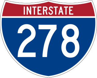
Interstate 278 (I-278) is an auxiliary Interstate Highway in New Jersey and New York in the United States. The road runs 35.62 miles (57.32 km) from US Route 1/9 (US 1/9) in Linden, New Jersey, northeast to the Bruckner Interchange in the New York City borough of the Bronx. The majority of I-278 is in New York City, where it serves as a partial beltway and passes through all five of the city's boroughs. I-278 follows several freeways, including the Union Freeway in Union County, New Jersey; the Staten Island Expressway (SIE) across Staten Island; the Gowanus Expressway in southern Brooklyn; the Brooklyn–Queens Expressway (BQE) across Northern Brooklyn and Queens; a small part of the Grand Central Parkway in Queens; and a part of the Bruckner Expressway in the Bronx. I-278 also crosses multiple bridges, including the Goethals, Verrazzano-Narrows, Kosciuszko, and Robert F. Kennedy bridges.

Windsor Terrace is a small residential neighborhood in the central part of the New York City borough of Brooklyn. It is bounded by Prospect Park on the east and northeast, Park Slope at Prospect Park West, Green-Wood Cemetery, and Borough Park at McDonald Avenue on the northwest, west, and southwest, and Kensington at Caton Avenue on the south. As of the 2010 United States Census, Windsor Terrace had 20,988 people living within its 0.503-square-mile (1.30 km2) area.

The term East Shore is frequently applied to a series of neighborhoods along the Lower New York Bay and the Raritan Bay and within New York City's borough of Staten Island.
Mid-Island is frequently applied to a series of neighborhoods within the New York City borough of Staten Island.

West Shore refers to the section of the New York City borough of Staten Island that borders the Arthur Kill, between the Staten Island Expressway and the Fresh Kills. The Arthur Kill shoreline north of the expressway—most commonly called Port Ivory—is considered part of the North Shore, while the land along the Arthur Kill south of Fresh Kills is generally included within the South Shore.

Oakwood is a neighborhood located in east central Staten Island, New York City, near the South Shore. It is bordered by Tysens Lane (north); the Atlantic Ocean (east); Great Kills Park (south); Kensico Street, and Clarke Avenue (west).
Westerleigh is a residential neighborhood in the north-western part of Staten Island in New York City.
Graniteville is a neighborhood in Staten Island, one of the five boroughs of New York City.

Concord is a neighborhood located in the borough of Staten Island in New York City, New York, United States.

Port Ivory is a coastal area in the northwestern corner of Staten Island, New York City, New York, United States. It is located on Newark Bay near the entrances the Kill van Kull in the east and Arthur Kill in the west. It is bordered by Arlington to the east, Old Place to the south, Newark Bay to the north, and the Arthur Kill to the west.
The BMT Fourth Avenue Line is a rapid transit line of the New York City Subway, mainly running under Fourth Avenue in Brooklyn. The line is served by the D, N, and R at all times; the R typically runs local, while the D and N run express during the day and local at night. During rush hours, select W trains also serve the line. Northbound D and N trains run local along the line after 6:45 p.m. during weekdays as well. The line was originally built by the Brooklyn Rapid Transit Company and is now internally operated as part of the New York City Subway's B Division.
Oakland Park was a ballpark in The Heights neighborhood of Jersey City, New Jersey. It was the home of the minor league baseball club, the Jersey City Skeeters, from 1888 to 1890. The club briefly disbanded in July 1890, but the park continued to be used by other local teams for several years after. It hosted the New York Giants of Major League Baseball for their first two home games in 1889 following their eviction from the Polo Grounds.
Vanderbilt Avenue is the name of three thoroughfares in the New York City boroughs of Brooklyn, Manhattan, and Staten Island. They were named after Cornelius Vanderbilt (1794–1877), the builder of Grand Central Terminal in Midtown Manhattan.

New York State Route 439 (NY 439) was an east–west state highway on Staten Island in New York in the United States. The western terminus of the route was at the Goethals Bridge, where it continued into New Jersey as its Route 439. Its eastern terminus was at the Staten Island Ferry terminal in the St. George neighborhood. In between, NY 439 followed the Staten Island Expressway, Forest Avenue, Victory Boulevard, and Bay Street.

MTA Regional Bus Operations operates local and express buses serving New York City in the United States out of 28 bus depots. These depots are located in all five boroughs of the city, plus one located in nearby Yonkers in Westchester County. 20 of these depots serve MTA New York City Transit (NYCT)'s bus operations, while the remaining eight serve the MTA Bus Company These facilities perform regular maintenance, cleaning, and painting of buses, as well as collection of revenue from bus fareboxes. Several of these depots were once car barns for streetcars, while others were built much later and have only served buses.
The 2007 Brooklyn tornado was the strongest tornado on record to strike in New York City. It formed in the early morning hours of August 8, 2007, skipping along an approximately 9 miles (14 km)-long path, from Staten Island across The Narrows to Brooklyn. The worst damage was in and around Sunset Park and Bay Ridge, in Brooklyn. The U.S. National Weather Service estimated its strength there as an EF2 on the Enhanced Fujita scale.

Paerdegat Basin is a channel that connects to Jamaica Bay between the neighborhoods of Bergen Beach and Canarsie in southeast Brooklyn, New York, United States. It connects to Jamaica Bay to the south, and the north end of the basin is adjacent to the intersection of Ralph Avenue and Flatlands Avenue. "Paerdegat" derives from the old Dutch paardengat, meaning "horse gate".

The Staten Island Tunnel is an abandoned, incomplete railway and subway tunnel in Staten Island, New York City. It was intended to connect railways on Staten Island to the BMT Fourth Avenue Line of the New York City Subway, in Brooklyn, via a new crossing under the Narrows. Planned to extend 10,400 feet (3,200 m), the tunnel would have been among the world's longest at the time of its planning, in the late 19th and early 20th centuries.

Fort Hamilton Parkway is a parkway in Brooklyn, New York. It runs for 4.1 miles from the neighborhood of Windsor Terrace to Bay Ridge, its southern end at the entrance to its namesake military base at Fort Hamilton.
