
Brooklyn is a borough of New York City, coextensive with Kings County, in the U.S. state of New York. It is the most populous county in New York State, as well as the second-most densely populated county in the United States. It is also New York City's most populous borough, with 2,736,074 residents in 2020. If each borough were ranked as a city, Brooklyn would rank as the third-most populous in the U.S., after Los Angeles and Chicago.

Coney Island is a peninsular neighborhood and entertainment area in the southwestern section of the New York City borough of Brooklyn. The neighborhood is bounded by Brighton Beach to its east, Lower New York Bay to the south and west, and Gravesend to the north, and includes the subsections of Sea Gate to its west and Brighton Beach to its east. Coney Island was formerly the westernmost of the Outer Barrier islands on the southern shore of Long Island, but in the early 20th century it became a peninsula, connected to the rest of Long Island by land fill.

New York Harbor is at the mouth of the Hudson River where it empties into New York Bay near the East River tidal estuary, and then into the Atlantic Ocean on the east coast of the United States. It is one of the largest natural harbors in the world. Although the United States Board on Geographic Names does not use the term, New York Harbor has important historical, governmental, commercial, and ecological usages. It is the largest part of the Port of New York and New Jersey.
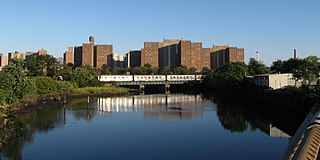
Coney Island Creek is a 1.8-mile-long (2.9 km) tidal inlet in Brooklyn, New York City. It used to be a 3-mile-long (4.8 km) continual strait and a partial mudflat connecting Gravesend Bay and Sheepshead Bay, making Coney Island an actual island, but the eastern half of the creek was filled in by land owners and city construction projects during a period spanning the early to mid 20th century.
Red Hook is a neighborhood in northwestern Brooklyn, New York City, New York, within the area once known as South Brooklyn. It is located on a peninsula projecting into the Upper New York Bay and is bounded by the Gowanus Expressway and the Carroll Gardens neighborhood on the northeast, Gowanus Canal on the east, and the Upper New York Bay on the west and south. A prosperous shipping and port area in the early 20th century, the area declined in the latter part of the century.

Sheepshead Bay is a neighborhood in southern Brooklyn, New York City. It is bounded by Ocean Parkway to the west; Avenue T and Kings Highway to the north; Nostrand Avenue and Gerritsen Avenue to the east; and the Atlantic Ocean to the south. Sheepshead Bay is abutted by the neighborhoods of Brighton Beach and Homecrest to the west; Midwood to the north; and Gerritsen Beach to the east.

South Brooklyn is a historic term for a section of the former City of Brooklyn – now the New York City borough of Brooklyn – encompassing what are now the Boerum Hill, Carroll Gardens, Cobble Hill, Gowanus, Park Slope, Windsor Terrace, Sunset Park and Red Hook neighborhoods. It was named for its location along the waterfront that was the southern border of the original Village of Brooklyn, and has remained widely used as a colloquialism despite it no longer being the southernmost point of the borough. It should not be confused with the geographic southern region of the modern borough of Brooklyn, which includes the neighborhoods of Gravesend, Seagate, Coney Island, Brighton Beach, Manhattan Beach, Sheepshead Bay, Gerritsen Beach, Marine Park, Mill Basin, and Bergen Beach.

Ocean Parkway is a 4.86-mile (7.82 km) boulevard in the west-central portion of the New York City borough of Brooklyn. It is inventoried by the New York State Department of Transportation (NYSDOT) as New York State Route 908H (NY 908H), an unsigned reference route.

The Port of New York and New Jersey is the port district of the New York-Newark metropolitan area, encompassing the region within approximately a 25-mile (40 km) radius of the Statue of Liberty National Monument. It includes the system of navigable waterways in the New York–New Jersey Harbor Estuary, which runs along 650 miles (1,050 km) of shoreline in the vicinity of New York City and northeastern New Jersey, as well as the region's airports and supporting rail and roadway distribution networks. Considered one of the largest natural harbors in the world, the port has become the second busiest port by tonnage in the United States as of 2019, and the busiest on the East Coast.

St. George Terminal is a ferry, railway, bus, and park and ride transit center in the St. George neighborhood of Staten Island, New York City. It is located at the intersection of Richmond Terrace and Bay Street, near Staten Island Borough Hall, Richmond County Bank Ballpark and Richmond County Supreme Court. St. George is one of the few remaining rail-boat connections in the United States.

The Riegelmann Boardwalk is a 2.7-mile-long (4.3 km) boardwalk along the southern shore of the Coney Island peninsula in the New York City borough of Brooklyn, facing the Atlantic Ocean. Opened in 1923, the boardwalk runs between West 37th Street at the edge of the Sea Gate neighborhood to the west and Brighton 15th Street in Brighton Beach to the east. It is operated by the New York City Department of Parks and Recreation.

The West Midtown Ferry Terminal is a passenger bus and ferry terminal serving ferries along the Hudson River in New York City and northeastern New Jersey. It is located at Piers 78 and 79 in Hudson River Park adjacent to the West Side Highway at West 39th Street in Midtown Manhattan. The facility first opened in 1986 with the start of NY Waterway commuter ferry service.

The Battery Park City Ferry Terminal, is a passenger ferry terminal in Battery Park City, Manhattan, serving ferries along the Hudson River in New York City and northeastern New Jersey. It provides slips to ferries, water taxis, and sightseeing boats in the Port of New York and New Jersey.

Empire Outlets New York City is a 350,000-square-foot (33,000 m2) retail complex in the St. George neighborhood of Staten Island, New York City. Construction on Empire Outlets started in 2015, and it opened on May 15, 2019. Tentative plans called for 100 designer stores when complete, but there is only space for about 70 stores, less than half of which are currently occupied. It is the first outlet mall in New York City. The mall is located next to the St. George Terminal, a major ferry, train, and bus hub.
NYC Ferry is a public network of ferry routes in New York City operated by Hornblower Cruises. As of August 2021, there are six routes, as well as one seasonal route, connecting 24 ferry piers in the Bronx, Brooklyn, Manhattan, Queens, and Staten Island. NYC Ferry has the largest passenger fleet in the United States with a total of 38 vessels, providing between 20-90 minute service on each of the routes, depending on the season. One additional route and two new piers are planned as of August 2021.

Shirley Chisholm State Park is a 407-acre (1.65 km2) state park that is under construction in southeastern Brooklyn, New York City. It is bound by Belt Parkway and Spring Creek Park to the north and Jamaica Bay to the south, situated atop the former Pennsylvania Avenue and Fountain Avenue Landfills. The first sections of the park opened in 2019; it is expected to be completed by 2021.

The Coney Island History Project, or CIHP, founded in 2004, is a not-for-profit organization that works to record and increase awareness of Coney Island's history.
Coney Island Beautification Project is an environmentally focused civic organization formed after Hurricane Sandy to involve the Coney Island community in the repair and enhancement of the local environment. Focused on Coney Island and surrounding areas, the Coney Island Beautification Project engages the community through community gardening and maintenance of parks, street tree beds, and other public green spaces. Pamela Pettyjohn, a retired New York City Subway train operator, co-founded and is president of the organization.

Kaiser Park is a public park on the northwestern coast of Coney Island in Brooklyn, New York City. It abuts Coney Island Creek, Gravesend Bay, and Coney Island Creek Park and is across Coney Island Creek from Calvert Vaux Park and Six Diamonds Park.


