
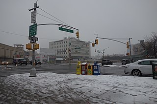
Flushing is a neighborhood in the north-central portion of the New York City borough of Queens. The neighborhood is the fourth-largest central business district in New York City. Downtown Flushing, a major commercial and retail area centered on the intersection of Main Street and Roosevelt Avenue, is the third-busiest intersection in New York City, behind Times Square and Herald Square.
Elmhurst is a neighborhood in the borough of Queens in New York City. It is bounded by Roosevelt Avenue on the north; the Long Island Expressway on the south; Junction Boulevard on the east; and the New York Connecting Railroad on the west.

Jamaica is a middle-class neighborhood in the New York City borough of Queens. It is mainly composed of a large commercial and retail area, though part of the neighborhood is also residential. Jamaica is bordered by Hollis to the east; St. Albans, Springfield Gardens, Rochdale Village to the southeast; South Jamaica to the south; Richmond Hill and South Ozone Park to the west; Briarwood to the northwest; and Kew Gardens Hills, Jamaica Hills, and Jamaica Estates to the north.
Forest Hills is a mostly residential neighborhood in the central portion of the borough of Queens in New York City. It is adjacent to Corona to the north, Rego Park and Glendale to the west, Forest Park to the south, Kew Gardens to the southeast, and Flushing Meadows–Corona Park to the east.

Kew Gardens is a neighborhood in the central area of the New York City borough of Queens. Kew Gardens, shaped roughly like a triangle, is bounded to the north by the Union Turnpike and the Jackie Robinson Parkway, to the east by the Van Wyck Expressway and 131st Street, to the south by Hillside Avenue, and to the west by Park Lane, Abingdon Road, and 118th Street. Forest Park and the neighborhood of Forest Hills are to the west, Flushing Meadows–Corona Park north, Richmond Hill south, Briarwood southeast, and Kew Gardens Hills east.

Woodhaven is a neighborhood in the southwestern section of the New York City borough of Queens. It is bordered on the north by Park Lane South and Forest Park, on the east by Richmond Hill, on the south by Ozone Park and Atlantic Avenue, and on the west by the Cypress Hills neighborhood of Brooklyn.

Fresh Meadows is a neighborhood in the northeastern section of the New York City borough of Queens. Fresh Meadows used to be part of the broader town of Flushing and is bordered to the north by the Horace Harding Expressway; to the west by Pomonok, St. John's University and the sub-neighborhoods of Hillcrest and Utopia; to the east by Cunningham Park and the Clearview Expressway; and to the south by the Grand Central Parkway.

Glendale is a neighborhood in the west-central portion of the New York City borough of Queens. It is bounded by Forest Hills to the east, Ridgewood to the west, Woodhaven to the south, and Middle Village to the north.

Richmond Hill is a commercial and residential neighborhood located in the southwestern section of the borough of Queens, in New York City, New York, United States. The neighborhood is split between Queens Community Board 9 and 10. The area borders Kew Gardens and Forest Park to the north, Jamaica and South Jamaica to the east, South Ozone Park to the south, and Woodhaven and Ozone Park to the west.

Queens Botanical Garden is a botanical garden located at 43-50 Main Street in Flushing, Queens, New York City. The 39-acre (16 ha) site features rose, bee, herb, wedding, and perennial gardens; an arboretum; an art gallery; and a LEED-certified Visitor & Administration Building. Queens Botanical Garden is located on property owned by the City of New York, and is funded from several public and private sources. It is operated by Queens Botanical Garden Society, Inc.

Forest Park is a park in the New York City borough of Queens, spanning 538 acres (218 ha). It is the tenth-largest park in New York City and the third-largest in Queens. Created on August 9, 1895, it was originally referred to as Brooklyn Forest Park, as the area was part of Brooklyn at the time.

Kew Gardens Hills is a neighborhood in the middle of the New York City borough of Queens. The borders are Flushing Meadows-Corona Park to the west, the Long Island Expressway to the north, Union Turnpike to the south, and Parsons Boulevard to the east.

The Flushing River, also known as Flushing Creek, is a waterway that flows northward through the borough of Queens in New York City, mostly within Flushing Meadows–Corona Park, emptying into the Flushing Bay and the East River. The river runs through a valley that may have been a larger riverbed before the last Ice Age, and it divides Queens into western and eastern halves. Until the 20th century, the Flushing Creek was fed by three tributaries: Mill Creek and Kissena Creek on the eastern bank, and Horse Brook on the western bank.

Union Turnpike is a thoroughfare stretching across part of Long Island in southern New York state, mostly within central and eastern Queens in New York City. It runs from Myrtle Avenue in Glendale, Queens, to Marcus Avenue in North New Hyde Park, Nassau County, about 1 mile (1.6 km) outside New York City border. The name memorializes the Union Racetrack, once a famous attraction for Queens residents.

Main Street is a major north-south street in the borough of Queens in New York City, extending from Queens Boulevard in Briarwood to Northern Boulevard in Flushing. Created in the 17th century as one of Flushing's main roads, Main Street has been lengthened at various points in its existence.
Kissena Boulevard is a thoroughfare spanning the Flushing and Pomonok neighborhoods of the borough of Queens in New York City, extending from Main Street in the Flushing Chinatown to Parsons Boulevard in Kew Gardens Hills. The road's name is derived from Kissena Lake, a name given by 19th century horticulturist Samuel Bowne Parsons for the Chippewa word meaning, "it is cold". The lake is located in Kissena Park.

Kissena Creek is a buried stream located in the neighborhoods of Flushing, Fresh Meadows, Hillcrest, and Kew Gardens Hills in the New York City borough of Queens. Kissena Creek originates in a now-filled swamp within Kew Gardens Hills and Pomonok in central Queens, flowing east to Hillcrest. The creek then travels mostly north and west, largely flowing beneath Kissena Park Golf Course, Kissena Park, Kissena Corridor Park, and Queens Botanical Garden, before merging with the Flushing River in Flushing Meadows–Corona Park.
Vleigh Playground is a 2.243-acre park in Kew Gardens Hills, Queens, New York City. It takes its name from Head of the Vleigh Road, a colonial period path that ran along the northern boundary of the playground site. This path is presently followed by Vleigh Place and 70th Road. This road connected the town of Flushing to Brooklyn during colonial times, allowing travelers to circumvent Flushing Meadows, then an impassible swamp.

Judge Moses Weinstein Playground is a 3.25-acre triangular park located in the Kew Gardens Hills neighborhood of Queens, New York City.

Bowne Park is a 11.79-acre (4.77 ha) park in Broadway–Flushing, Queens, New York, east of downtown Flushing. It is bordered by 29th Avenue on the north, 32nd Avenue on the south, 155th Street on the west, and 159th Street on the east. The park consists of a playground, basketball courts, bocce court, and a kettle pond. The area immediately surrounding the park, developed in the late 19th and early 20th centuries, was originally also marketed as "Bowne Park" and is part of modern-day Murray Hill and Broadway–Flushing.
