Broadway is a road in the U.S. state of New York. Broadway runs from State Street at Bowling Green for 13 mi (21 km) through the borough of Manhattan and 2 mi (3.2 km) through the Bronx, exiting north from New York City to run an additional 18 mi (29 km) through the Westchester County municipalities of Yonkers, Hastings-On-Hudson, Dobbs Ferry, Irvington, and Tarrytown, and terminating north of Sleepy Hollow.

Queens is a borough of New York City, coextensive with Queens County, in the U.S. state of New York. It is the largest borough of New York City in area and is adjacent to the borough of Brooklyn at the western end of Long Island, with Nassau County to the east. Queens also shares water borders with the boroughs of Manhattan, the Bronx, and Staten Island.

Corona is a neighborhood in the borough of Queens in New York City. It is bordered by Flushing and Flushing Meadows–Corona Park to the east, Jackson Heights to the west, Forest Hills and Rego Park to the south, Elmhurst to the southwest, and East Elmhurst to the north. Corona's main thoroughfares include Corona Avenue, Roosevelt Avenue, Northern Boulevard, Junction Boulevard, and 108th Street.

Elmhurst is a neighborhood in the borough of Queens in New York City. It is bounded by Roosevelt Avenue on the north; the Long Island Expressway on the south; Junction Boulevard on the east; and the New York Connecting Railroad on the west.

Maspeth is a residential and commercial community in the borough of Queens in New York City. It was founded in the early 17th century by Dutch and English settlers. Neighborhoods sharing borders with Maspeth are Woodside to the north; Sunnyside to the northwest; Greenpoint, Brooklyn to the west; East Williamsburg, Brooklyn to the southwest; Fresh Pond and Ridgewood to the south; and Middle Village and Elmhurst to the east.

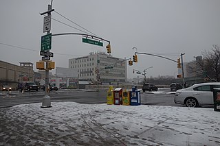
Grand Avenue–Newtown is a local station on the IND Queens Boulevard Line of the New York City Subway. Located under private property at the northeast corner of the intersection of Grand Avenue, Broadway, and Queens Boulevard in the neighborhood of Elmhurst, Queens, it is served by the M train on weekdays, the R train at all times except nights, and the E train at night.

Union Turnpike is a thoroughfare stretching across part of Long Island in southern New York state, mostly within central and eastern Queens in New York City. It runs from Myrtle Avenue in Glendale, Queens, to Marcus Avenue in North New Hyde Park, Nassau County, about 1 mile (1.6 km) outside New York City border. The name memorializes the Union Racetrack, once a famous attraction for Queens residents.

Grand Street and Grand Avenue are the respective names of a street which runs through the boroughs of Brooklyn and Queens, New York City, United States. Originating in Williamsburg, Brooklyn, Grand Street runs roughly northeast until crossing Newtown Creek into Queens, whereupon Grand Street becomes Grand Avenue, continuing through Maspeth where it is a main shopping street, until reaching its northern end at Queens Boulevard in Elmhurst.

St. James Church is a historic Episcopal church building at 86-02 Broadway in the Elmhurst neighborhood of Queens in New York City. It is the city's oldest surviving Anglican building and Church of England mission church. It is also alternatively called the Old St. James Church to distinguish it from the St. James Episcopal Church two blocks away.

McGuinness Boulevard is a boulevard in Greenpoint, a neighborhood in the New York City borough of Brooklyn. It runs between Interstate 278 to the south to the Pulaski Bridge in the north, which connects to Queens and Jackson Avenue. South of Driggs Avenue, it is called McGuinness Boulevard South.
Ascenzi Square is a small plaza formed by the intersection of two street grids that meet at Metropolitan Avenue in the Williamsburg neighborhood of Brooklyn, New York City. Roebling Street traverses both grids, making a slight jog to the southwest between North Fourth Street and Metropolitan Avenue. On March 29, 1939, the New York City Council designated this triangle as Ascenzi Square, in honor of brothers Joseph and William Ascenzi, residents of Williamsburg who were killed in the First World War.
One Room Schoolhouse Park is a small park located on the southeast corner of Astoria Boulevard and 90th Street in the East Elmhurst neighborhood of Queens, New York City. Its name recalls the site of Queens's last one-room schoolhouse, demolished in 1934. The schoolhouse was built only five years after New York State required compulsory education for children in 1874. Last called P.S. 10, the school was also known as the Bowery Bay School, after an earlier school established in 1734, and as the Frogtown School. Frogtown was a poor community located in a swampy area north of Astoria Boulevard, near the present-day LaGuardia Airport. Emma Fagan headed the school from 1879 to 1910. The 15 by 28 foot classroom had capacity for fifty-two students divided into six classes. The six rows of desks were arranged according to the age and ability of the students. The beginners were seated at the smaller desks in the front, while the more advanced students occupied the back rows. In the center of the classroom, a stove with a pipe extending to the roof that kept the space warm during winter.

Horse Brook is a buried stream located in the neighborhood of Elmhurst in the New York City borough of Queens. Its historic course flows beneath Queens Center Mall, Rego Center Mall, LeFrak City, and the Long Island Expressway, before emptying into Flushing Creek in present-day Flushing Meadows-Corona Park. Flushing Creek is a tributary of the East River.

The First Presbyterian Church of Newtown is a historic Presbyterian church in the Elmhurst neighborhood of Queens in New York City. The church complex is composed of the main church, a parish hall, and a manse. The current complex at 54th Avenue, between Seabury Street and Queens Boulevard, is the fifth church complex built for the congregation.
William M. Feehan Triangle is a 0.032-acre (130 m2) public green space in the Broadway-Flushing neighborhood of Queens, New York. It is bound by Bayside Lane, 164th Street, and 27th Avenue. The triangle’s shape is the result of the street grid imposed on the once-rural landscape of Flushing in the 1920s. Bayside Lane predates the grid, cutting across its numbered streets and avenues in a diagonal path. The park is landscaped with trees and shrubs. In 2002, the New York City Council passed legislation to name the triangle for William M. Feehan.
Walter J. Wetzel Triangle is small park bound by Cohancy Street, 156th Avenue, 99th Street, and 157th Avenue, in the Howard Beach neighborhood of Queens, New York City.
Chris Postiglione Triangle is a green space in the Fresh Meadows neighborhood of Queens, New York City, formed by the separation of the eastbound Horace Harding Expressway, 64th Avenue, and 174th Street. Its namesake, Christopher S. Postiglione (1968-1999), a construction worker at the New York City Department of Environmental Protection, who grew up in Queens.

Macri Triangle is a 0.57 acres park located at the intersection of Meeker Avenue, Union Avenue, and Metropolitan Avenue in Williamsburg, Brooklyn, New York City. The property was designated as a park in 1946 during the construction of the Brooklyn-Queens Expressway, which resulted in the demolition of buildings along its route and the extension of Meeker Avenue from Richardson Street south to Metropolitan Avenue, serving as the expressway's service road. As the highway ran through the street grid, triangular parcels that were too small to be developed were designated as public plazas, including this one.
Reverend Lawrence E. Lynch Memorial Triangle is a 0.138 acres park located at the intersection of Rockaway Boulevard, Atlantic Avenue, and 81st Street in Ozone Park, Queens, New York City. The neighborhood's streets were laid out in a grid of streets and avenues at the turn of the 20th century while Rockaway Boulevard cuts diagonally through the grid on its route between Cypress Hills and Woodmere. Triangular intersections that were too small to be developed were designated as public plazas, including this one. In 1949, the city designated this triangle in memory of Lynch, a Woodhaven resident who served as a chaplain in the Pacific Theater during World War Two.


