Columbus Park (Brooklyn)

Last updated

Columbus Park
Bklyn Boro Hall td (2018-07-07) 02 - Columbus Park.jpg
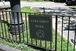
Park signage in 2018
USA New York City location map.svg
Red pog.svg
Location Brooklyn, New York City, U.S.
Coordinates 40°41′38.7″N73°59′25.4″W / 40.694083°N 73.990389°W / 40.694083; -73.990389

Columbus Park is a park at the southern end of Cadman Plaza, in Brooklyn, New York City, United States. [1]

Contents

Memorials

The park features the Robert F. Kennedy Memorial, statues of Christopher Columbus and Henry Ward Beecher, [2] and a tree commemorating John F. Kennedy. [3]

Parking lot

Beginning in 1999, Justices of the Kings County Supreme Court have utilized a portion of Columbus Park as a parking lot for their private vehicles. [4] The parking situation began as a temporary solution whilst a new parking garage was being constructed, but it has now persisted for over two decades, to the chagrin of many local residents. [5] The area which has been transformed into a parking lot sits at the southeast corner of Columbus Park, at the corner of Joralemon and Adams Streets; it is still zoned as parkland.

Related Research Articles

<span class="mw-page-title-main">Grand Army Plaza</span> Public square in Brooklyn, New York

Grand Army Plaza, originally known as Prospect Park Plaza, is a public plaza that comprises the northern corner and the main entrance of Prospect Park in the New York City borough of Brooklyn. It consists of concentric oval rings arranged as streets, with the namesake Plaza Street comprising the outer ring. The inner ring is arranged as an ovoid roadway that carries the main street – Flatbush Avenue. Eight radial roads connect Vanderbilt Avenue; Butler Place; two separate sections of Saint John's Place; Lincoln Place; Eastern Parkway; Prospect Park West; Union Street; and Berkeley Place. The only streets that penetrate to the inner ring are Flatbush Avenue, Vanderbilt Avenue, Prospect Park West, Eastern Parkway, and Union Street.

<span class="mw-page-title-main">New York City Department of Parks and Recreation</span> Government agency

The New York City Department of Parks and Recreation, also called the Parks Department or NYC Parks, is the department of the government of New York City responsible for maintaining the city's parks system, preserving and maintaining the ecological diversity of the city's natural areas, and furnishing recreational opportunities for city's residents and visitors.

<span class="mw-page-title-main">Midwood, Brooklyn</span> Neighborhood of Brooklyn in New York City

Midwood is a neighborhood in the south-central part of the New York City borough of Brooklyn. It is bounded on the north by the Bay Ridge Branch tracks just above Avenue I and by the Brooklyn College campus of the City University of New York, and on the south by Avenue P and Kings Highway. The eastern border consists of parts of Nostrand Avenue, Flatbush Avenue, and Coney Island Avenue; parts of McDonald Avenue and Ocean Parkway mark the western boundary.

<span class="mw-page-title-main">Bushwick, Brooklyn</span> Neighborhood of Brooklyn in New York City

Bushwick is a neighborhood in the northern part of the New York City borough of Brooklyn. It is bounded by the neighborhood of Ridgewood, Queens, to the northeast; Williamsburg to the northwest; East New York and the cemeteries of Highland Park to the southeast; Brownsville to the south; and Bedford–Stuyvesant to the southwest.

<span class="mw-page-title-main">Union Square, Manhattan</span> Intersection and neighborhood in New York City

Union Square is a historic intersection and surrounding neighborhood in Manhattan, New York City, United States, located where Broadway and the former Bowery Road – now Fourth Avenue – came together in the early 19th century. Its name denotes that "here was the union of the two principal thoroughfares of the island". The current Union Square Park is bounded by 14th Street on the south, 17th Street on the north, and Union Square West and Union Square East to the west and east respectively. 17th Street links together Broadway and Park Avenue South on the north end of the park, while Union Square East connects Park Avenue South to Fourth Avenue and the continuation of Broadway on the park's south side. The park is maintained by the New York City Department of Parks and Recreation.

<span class="mw-page-title-main">Woodhaven, Queens</span> Neighborhood of Queens in New York City

Woodhaven is a neighborhood in the southwestern section of the New York City borough of Queens. It is bordered on the north by Park Lane South and Forest Park, on the east by Richmond Hill, on the south by Ozone Park and Atlantic Avenue, and the west by the Cypress Hills neighborhood of Brooklyn.

<span class="mw-page-title-main">Forest Park (Queens)</span> Public park in Queens, New York

Forest Park is a park in the New York City borough of Queens, spanning 538 acres (218 ha). It is the tenth-largest park in New York City and the third-largest in Queens. Created on August 9, 1895, it was originally referred to as Brooklyn Forest Park, as the area was part of Brooklyn at the time.

<span class="mw-page-title-main">Bronx Park</span> Public park in the Bronx, New York

Bronx Park is a public park along the Bronx River, in the Bronx, New York City. The park is bounded by Southern Boulevard to the southwest, Webster Avenue to the northwest, Gun Hill Road to the north, Bronx Park East to the east, and East 180th Street to the south. With an area of 718 acres (2.91 km2), Bronx Park is the eighth-largest park in New York City.

<span class="mw-page-title-main">The Battery (Manhattan)</span> Public park in Manhattan, New York

The Battery, formerly known as Battery Park, is a 25-acre (10 ha) public park located at the southern tip of Manhattan Island in New York City facing New York Harbor. It is bounded by Battery Place on the north, with Bowling Green to the northeast, State Street on the east, New York Harbor to the south, and the Hudson River to the west. The park contains attractions such as an early 19th-century fort named Castle Clinton; multiple monuments; and the SeaGlass Carousel. The surrounding area, known as South Ferry, contains multiple ferry terminals, including the Staten Island Ferry's Whitehall Terminal; a boat launch to the Statue of Liberty National Monument ; and a boat launch to Governors Island.

A list of skateparks in New York City.

McDonald Avenue is a north-south street in Brooklyn, New York City. The avenue runs about 4.5 miles (7.2 km) between the intersection of 86th Street and Shell Road in Gravesend, north to 20th Street and 10th Avenue in Windsor Terrace. It runs underneath the New York City Subway's IND Culver Line for most of its length.

<span class="mw-page-title-main">Sunset Park (Brooklyn park)</span> Public park in Brooklyn, New York

Sunset Park is a 24.5-acre (9.9 ha) public park in the neighborhood of Sunset Park, Brooklyn, New York City, between 41st and 44th Streets and 5th and 7th Avenues. The modern-day park contains a playground, recreation center, and pool. The recreation center and pool comprise the Sunset Play Center, which was designated as both an exterior and interior landmark by the New York City Landmarks Preservation Commission. The park is operated by the New York City Department of Parks and Recreation, also known as NYC Parks.

<span class="mw-page-title-main">Millennium Skate Park</span> Skatepark in Brooklyn, New York

Millennium Skate Park, also known as Owl's Head Skate Park, is a skate park in Bay Ridge, Brooklyn, located in Owl's Head Park, adjacent to the Sunset Park Greenway.

<span class="mw-page-title-main">Far Rockaway Skate Park</span> Skatepark in Queens, New York

Far Rockaway Skate Park is a public skate park on the Rockaway Beach and Boardwalk in Far Rockaway, Queens, New York City, opened in 2011. The park is open dawn till dusk and is unsupervised. In addition to skateboarding, scooters and inline skates are permitted. The park was built over a large parking lot that was reduced in size but not eliminated. The skatepark project was part of a larger renovation of O'Donohue Park that began in 2010 and was completed in 2011. The park was designed by SITE Design Group and built by California Skateparks.

<span class="mw-page-title-main">Walt Whitman Park (Brooklyn)</span> Public park in Brooklyn, New York

Walt Whitman Park is a park in the Downtown Brooklyn section of Brooklyn, New York City, commemorating Walt Whitman. It is adjacent to Cadman Plaza East to the west and Adams Street to the east.

<span class="mw-page-title-main">Trees of New York City</span>

The land comprising New York City holds approximately 5.2 million trees and 168 different tree species, as of 2020. The New York City government, alongside an assortment of environmental organizations, actively work to plant and maintain the trees. As of 2020, New York City held 44,509 acres of urban tree canopy with 24% of its land covered in trees.

<span class="mw-page-title-main">Givans Creek Woods</span>

Givans Creek Woods is a 10.73-acre (4.34 ha) wooded area near Co-op City in The Bronx, New York City.

<span class="mw-page-title-main">Bronx Skate Park</span> Skatepark in the Bronx, New York

Bronx Skate Park is a 6,000 sq ft (560 m2) skate park inside Bronx Park, a little north of Allerton Avenue, in The Bronx, New York City. The park includes a smooth skating surface, as well as being equipped with a quarter pipe, bank ramps with ledges, skate pyramid, and grind rails. As of August 2020, it is one of six skate parks in The Bronx run by NYC Parks.

<span class="mw-page-title-main">Coney Island Creek Park</span> Public park in Brooklyn, New York

Coney Island Creek Park is a public park on the northwestern coast of Coney Island in Brooklyn, New York City. It abuts Coney Island Creek, Gravesend Bay, and Kaiser Park and is across Coney Island Creek from Calvert Vaux Park and Six Diamonds Park.

<span class="mw-page-title-main">Claremont Park</span> Public park in the Bronx, New York

Claremont Park is a park in the Morrisania section of the Bronx in New York City. The land on which the park sits was once part of the Morris family estate. It became a municipal park in 1884 as part of the New Parks Act.

References

  1. "Columbus Park : NYC Parks". www.nycgovparks.org. Archived from the original on February 23, 2020. Retrieved February 23, 2020.
  2. "Columbus Park Highlights : NYC Parks". www.nycgovparks.org. Archived from the original on February 23, 2020. Retrieved February 23, 2020.
  3. Kriegstein, Brittany (February 14, 2020). "In the footsteps of history: Presidential sites in NYC". nydailynews.com. Archived from the original on February 23, 2020. Retrieved February 23, 2020.
  4. Rubinstein, Dana (September 15, 2007). "Columbus 'Park' still parking". Brooklyn Paper. Retrieved October 11, 2023.
  5. "Brooklyn judges park in Columbus Park". New York Daily News. October 2, 2008. Retrieved October 11, 2023.