
Collect Pond, or Fresh Water Pond, was a body of fresh water in what is now Chinatown in Lower Manhattan, New York City. For the first two centuries of European settlement in Manhattan, it was the main New York City water supply system for the growing city. A jail was later built on the former pond. In the 20th century, the site became Collect Pond Park, which includes a reflecting pool to acknowledge the historic importance of this body of water.

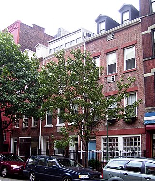
Tribeca, originally written as TriBeCa, is a neighborhood in Lower Manhattan in New York City. Its name is a syllabic abbreviation of "Triangle Below Canal Street". The "triangle" is bounded by Canal Street, West Street, Broadway, and Chambers Street. By the 2010s, a common marketing tactic was to extend Tribeca's southern boundary to either Vesey or Murray Streets to increase the appeal of property listings.

The Manhattan Community Board 1 is a New York City community board encompassing the neighborhoods of Battery Park City, the Financial District, the South Street Seaport, and TriBeCa in Lower Manhattan in the borough of Manhattan as well as Liberty Island, Ellis Island and Governors Island. It is bounded by Baxter Street, Pearl Street, the Brooklyn Bridge and the East River on the east, Upper New York Bay on the south, the Hudson River on the west and Canal Street on the north.

Foley Square, also called Federal Plaza, is a street intersection in the Civic Center neighborhood of Lower Manhattan, New York City, which contains a small triangular park named Thomas Paine Park. The space is bordered by Worth Street to the north, Centre Street to the east, and Lafayette Street to the west, and is located south of Manhattan's Chinatown and east of Tribeca. It was named after a prominent Tammany Hall district leader and local saloon owner, Thomas F. "Big Tom" Foley (1852–1925).

The Civic Center is an area and neighborhood in Lower Manhattan, Manhattan, New York City, that encompasses New York City Hall, One Police Plaza, the courthouses in Foley Square, the Metropolitan Correctional Center, and the surrounding area. The district is bound on the west by Tribeca at Broadway, on the north by Chinatown at Worth Street or Bayard Street, on the east by the East River and the Brooklyn Bridge at South Street, and on the south by the Financial District at Ann Street.

Centre Street is a north–south street in the New York City borough of Manhattan, running through the Civic Center, Chinatown, and Little Italy neighborhoods of Lower Manhattan. It connects Park Row to the south with Spring Street to the north, where it merges with Lafayette Street. Centre Street carries northbound traffic north of Reade Street and two-way traffic between Reade Street and the Brooklyn Bridge.

Chambers Street is a two-way street in the New York City borough of Manhattan. It runs from River Terrace, Battery Park City in the west, past PS 234, The Borough of Manhattan Community College, and Stuyvesant High School, to the Manhattan Municipal Building at 1 Centre Street in the east. Between Broadway and Centre Street, Chambers Street forms the northern boundary of the grounds surrounding New York City Hall and the Tweed Courthouse. Opposite the Tweed Courthouse sits the Surrogate's Courthouse for Manhattan. 280 Broadway the Marble Palace, lies west of there, on the north side of Chambers.
St. John's Park was a 19th-century park and square, and the neighborhood of townhouses around it, in what is now the Tribeca neighborhood of Lower Manhattan, New York City. The square was bounded by Varick Street, Laight Street, Hudson Street and Beach Street, now also known for that block as Ericsson Place. Although the name "St. John's Park" is still in use, it is no longer a park and is inaccessible to the public.

West Broadway is a north-south street in the New York City borough of Manhattan, separated into two parts by Tribeca Park. The northern part begins at Tribeca Park, near the intersection of Avenue of the Americas, Walker Street and Beach Street in Tribeca. It runs northbound as a one-way street past Canal Street and becomes two-way at the intersection with Grand Street one block farther north. West Broadway then operates as a main north-south thoroughfare through SoHo until its northern end at Houston Street, on the border between SoHo and Greenwich Village. North of Houston Street, it is designated as LaGuardia Place, which continues until Washington Square South.
Washington Street is a north–south street in the New York City borough of Manhattan. It runs in several distinct pieces, from its northernmost end at 14th Street in the Meatpacking District to its southern end at Battery Place in Battery Park City. Washington Street is, for most of its length, the westernmost street in lower Manhattan other than West Street. The exceptions are a one-block segment in the West Village where Weehawken Street lies between West and Washington Streets, and in Battery Park City.

Juan Pablo Duarte Square, usually shortened to Duarte Square, is a 0.45-acre (0.18 ha) triangular park in Hudson Square, in Lower Manhattan, New York City. The park, operated by the New York City Department of Parks and Recreation, is bound by Sullivan Street and the LentSpace plot to the west, Grand Street to the north, Sixth Avenue to the east, and Canal Street and Albert Capsouto Park to the south.
Church Street and Trinity Place form a single northbound roadway in Lower Manhattan, New York City. Its northern end is at Canal Street and its southern end is at Morris Street, where Trinity Place merges with Greenwich Street. The dividing point is Liberty Street.

Washington Market Park is an urban park located in the TriBeCa neighborhood of Lower Manhattan in New York City. The park, which is bounded by Greenwich, Chambers, and West Streets, covers 1.61-acre (6,500 m2). The park also has community gardens and a large playground and hosts many community events.

Hudson Square is a neighborhood in Lower Manhattan in New York City. It is bounded approximately by Clarkson Street to the north, Canal Street to the south, Varick Street to the east, and the Hudson River to the west. To the north of the neighborhood is Greenwich Village, to the south is TriBeCa, and to the east are the South Village and SoHo. The area, once the site of the colonial property named Richmond Hill, became known in the 20th century as the Printing District, and into the 21st century it remains a center of media-related activity, including in advertising, design, communications, and the arts.

St. John's Chapel belonged to the Episcopal parish of Trinity Church in Tribeca, Manhattan, New York City.

The West Street pedestrian bridges are a series of pedestrian bridges that cross West Street to connect the neighborhoods of Tribeca and the Financial District with Battery Park City in Lower Manhattan, New York City. The bridges were built to provide alternatives to crossing the busy street. Prior to the September 11 attacks, there were three bridges at Chambers Street, Vesey Street and Liberty Street. The Vesey Street and Liberty Street bridges connected the former World Trade Center complex with the World Financial Center.

LentSpace is a temporary outdoor art space and sculpture garden located in Hudson Square, Lower Manhattan, New York City. The space, which opened in September 2009, is bounded by Varick Street to the west, Canal Street and Albert Capsouto Park to the south, Grand Street to the north, and Sullivan Street and Duarte Square to the east.

Albert Capsouto Park is a triangular-shaped pocket park in the Tribeca neighborhood of Lower Manhattan in New York City. It is bounded by Canal Street to the northeast, Varick Street to the west, and Laight Street to the south. It is located just east of the Holland Tunnel exit plaza, formerly known as St. John's Park.
BMCC Tribeca Performing Arts Center is a performing arts venue located in Lower Manhattan inside the Borough of Manhattan Community College (BMCC) on 199 Chambers Street, New York, NY. Tribeca's two main theater spaces are Theatre One and Theatre Two, both of which can be rented out. The venue's programming includes music concerts, children's theater, stand-up acts, film retrospectives as well as local and international dance companies. It has also been one of the venues for the annual Tribeca Film Festival.

Elizabeth H. Berger Plaza is a public park in the Financial District of Manhattan, New York City. formed by the triangular junction of Trinity Place, Greenwich Street and Edgar Street. It faces the Manhattan exit ramp from the Brooklyn–Battery Tunnel. Formerly known as the Edgar Street Greenstreet, this park honors civic advocate Elizabeth H. Berger (1960-2013). In her role as president of the Downtown Alliance, she advocated for the fusion of two traffic triangles at this location into an expanded park. The park is located on the site of a former neighborhood known as Little Syria, a bustling immigrant community displaced by the construction of the tunnel in 1953.

