
Fort Greene Park is a city-owned and -operated park in Fort Greene, Brooklyn. The 30.2-acre (12.2 ha) park was originally named after the fort formerly located there, Fort Putnam, itself was named for Rufus Putnam, George Washington's chief of engineers in the Revolutionary War.
The Chimney Sweeps Islands are a pair of small islands located within New York City in the northern part of City Island Harbor in the borough of The Bronx. The islands, along with High Island, New York, divide City Island Harbor from Pelham Bay. The islands are entirely made out of bedrock. The islands are uninhabited, but are home to many birds, such as gulls, skuas, and great blue herons. The islands are owned by the New York City Department of Parks and Recreation, which acquired them in 1939 from the Chimney Sweeps Islands Corporation, a private group that used the islands for recreation, and are now a part of Pelham Bay Park.
Mount Prospect Park is a 7.79-acre (3.15 ha) park in the central portion of the New York City borough of Brooklyn. It includes Mount Prospect, the second highest point in Brooklyn. It is located on Eastern Parkway near Underhill Avenue, close to Grand Army Plaza. The park is operated by the New York City Department of Parks and Recreation.
The Brooklyn–Queens Greenway is a bicycling and pedestrian path connecting parks and roads in the New York City boroughs of Brooklyn and Queens, connecting Coney Island in the south to Fort Totten in the north, on Long Island Sound. The route connects major sites in the two boroughs, such as the New York Aquarium, Brooklyn Museum, the Brooklyn Botanic Garden, the New York Hall of Science, and Citi Field.

Septuagesimo Uno is a 0.04-acre (160 m2) park in the Upper West Side of the New York City borough of Manhattan. It is located on 71st Street between West End Avenue to the west and the intersection of Broadway and Amsterdam Avenue to the east. The park's name is Latin for "seventy-first". The park is operated and maintained by the New York City Department of Parks and Recreation.

Maria Hernandez Park is a municipal park in Bushwick, Brooklyn, New York City. It is located between Knickerbocker Avenue on the southwest to Irving Avenue on the northeast, and Starr Street on the northwest to Suydam Street on the southeast. The park is 6.87 acres (2.78 ha) and is near the Jefferson Street station of the New York City Subway.

J. Hood Wright Park is a park of the New York City Department of Parks and Recreation which is located between Fort Washington and Haven Avenue, and between West 173rd and 176th Streets in the Washington Heights neighborhood of Manhattan, New York City. The 6.7 acres (2.7 ha) park includes a playground – which features a model of the nearby George Washington Bridge, which is visible from the park, basketball courts, ballfields, and a recreation center, as well as a dog walk, a cave in the natural rock formations which form the park's western boundary, and an installation of a piece of modern sculpture, "3000 AD Diffussion Piece" by Terry Fugate-Wilcox.

Mau Mau Island, also called White Island, is a small uninhabited island in the New York City borough of Brooklyn, located between Gerritsen Creek and Mill Creek in the Marine Park recreation area. Historically, the area around Mau Mau Island was a salt marsh with shifting topography. The island came into existence permanently sometime after 1917, and most likely formed in 1934 as dumping led to the current shoreline.

The Henry Ward Beecher Monument, a statue of Henry Ward Beecher created by the sculptor John Quincy Adams Ward, was unveiled on June 24, 1891, in Borough Hall Park, Brooklyn and was later relocated to Cadman Plaza, Brooklyn in 1959.

Judge Moses Weinstein Playground is a 3.25-acre triangular park located in the Kew Gardens Hills neighborhood of Queens, New York City.
Linden Park, officially known as Park of the Americas, is a 3.08-acre (1.25 ha) park located in the center of the Corona neighborhood of Queens, New York City. It has stood out as a green square block on maps since the village of West Flushing was first mapped out in 1853, long before the village became the suburb or urban neighborhood known as Corona.

Seth Low Playground is a five-acre park located in the Bensonhurst neighborhood of Brooklyn. The park is named after Seth Low, a former mayor of New York City and president of Columbia University. The City acquired this playground in 1924 as a park. Prior to this, it was the site of Indian Pond, a historical watering hole and ice skating location near the border of the former towns of New Utrecht and Gravesend. The park is bounded by Stillwell Avenue, Bay Parkway, West 12th Street and Avenue P. In 1896, the pond was filled with ash from a trash incinerator, covering it entirely.
Proctor-Hopson Circle is a semicircular traffic mall in the neighborhood of South Jamaica, Queens acquired by the city for park purposes in 1924 following the widening of Merrick Boulevard. After this road was straightened in 1924, its former route became 169th Place. In 1932, the semicircular traffic island was named after two local residents who were killed in the First World War. John Proctor and James Hopson were members of the 369th Infantry of the National Guard, known informally as the Harlem Hellfighters. Among the first in the unit from Queens to die in this war were Proctor and Hopson. In their memory, the local Veterans of Foreign Wars chapter is named the Procter-Hopson Post No. 1896.
Turtle Playground, located at 138th Street and the south side of Horace Harding Expressway in Flushing, was acquired by the City of New York in 1954 as part of land condemnations for the Long Island Expressway.
Foch Sitting Area is a 0.051-acre (210 m2) green public space in the South Jamaica neighborhood of Queens, New York, at the southeast corner of Foch Boulevard and the northbound service road of the Van Wyck Expressway. Like the adjacent Foch Boulevard, it is named after Ferdinand Foch, Marshal of France in World War I. The road, running between South Ozone Park and South Jamaica, was named following its completion in 1919.
Bensonhurst Park is a park in Bath Beach, Brooklyn, New York City. The park stretches from the north border at Cropsey Avenue to the south border at Lower New York Bay. The park has a playground on the north-east side, a field in the middle of the playground and several basketball courts on the west side. There is also a bathroom in the northwest side of the park.

The Concert Grove is a section of Prospect Park, Brooklyn, New York City, that historically functioned as an outdoor music venue. It still serves as a sculpture garden lined with busts of musical figures, largely put up by German American Sängerfest participants and other cultural groups. The Concert Grove also includes the Concert Grove Pavilion, formerly known as the Oriental Pavilion, and adjoins a Lincoln sculpture facing the lake.
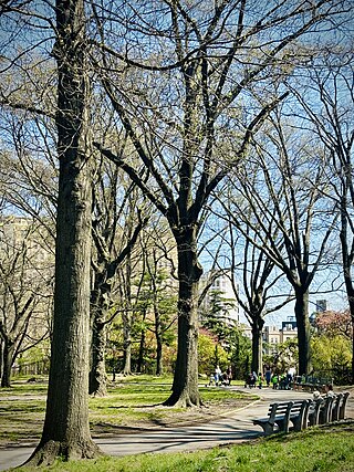
Cooper Park is an urban park in Brooklyn, New York City, between Maspeth Avenue, Sharon Street, Olive Street, and Morgan Avenue in East Williamsburg. It was established in 1895 and covers 6.40 acres (2.59 ha).

Sunswick Creek is a buried stream located in Astoria and Long Island City, in the northwestern portion of Queens in New York City. It originated to the north of Queensboro Bridge and Queens Plaza in Long Island City, flowing north to the present-day site of the Socrates Sculpture Park in Astoria, and emptying into the East River. The creek was named for a term in the Algonquin language that likely means "Woman Chief" or "Sachem’s Wife."

Maple Street Community Garden is a community garden in the Prospect Lefferts Gardens neighborhood of Brooklyn, New York City. It is located on Maple Street between Jean-Jacques Dessalines Boulevard and Nostrand Avenue.
