The Bronx River Parkway is a 19.12-mile (30.77 km) limited-access parkway in downstate New York in the United States. It is named for the nearby Bronx River, which it parallels. The southern terminus of the parkway is at Story Avenue near the Bruckner Expressway in the Bronx neighborhood of Soundview. The northern terminus is at Kensico Circle in North Castle, Westchester County, where the parkway connects to the Taconic State Parkway and via a short connector, New York State Route 22 (NY 22). Within the Bronx, the parkway is maintained by the New York State Department of Transportation and is designated New York State Route 907H (NY 907H), an unsigned reference route. In Westchester County, the parkway is maintained by the Westchester County Department of Public Works and is designated unsigned County Route 9987 (CR 9987).
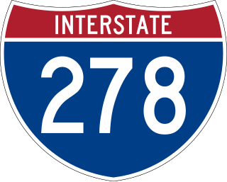
Interstate 278 (I-278) is an auxiliary Interstate Highway in New Jersey and New York in the United States. The road runs 35.62 miles (57.32 km) from US Route 1/9 (US 1/9) in Linden, New Jersey, northeast to the Bruckner Interchange in the New York City borough of the Bronx. The majority of I-278 is in New York City, where it serves as a partial beltway and passes through all five of the city's boroughs. I-278 follows several freeways, including the Union Freeway in Union County, New Jersey; the Staten Island Expressway (SIE) across Staten Island; the Gowanus Expressway in southern Brooklyn; the Brooklyn–Queens Expressway (BQE) across Northern Brooklyn and Queens; a small part of the Grand Central Parkway in Queens; and a part of the Bruckner Expressway in the Bronx. I-278 also crosses multiple bridges, including the Goethals, Verrazzano-Narrows, Kosciuszko, and Robert F. Kennedy bridges.

The Hutchinson River Parkway is a controlled-access parkway in southern New York in the United States. It extends for 18.71 miles (30.11 km) from the Bruckner Interchange in the Throggs Neck section of the Bronx to the New York–Connecticut state line at Rye Brook. The parkway continues south from the Bruckner Interchange as the Hutchinson River Expressway (Interstate 678) and north into Greenwich, Connecticut, as the Merritt Parkway. The roadway is named for the Hutchinson River, a 10-mile-long (16 km) stream in southern Westchester County that the road follows alongside. The river, in turn, was named for English colonial religious leader Anne Hutchinson.

The Belt Parkway is the name given to a series of controlled-access parkways that form a belt-like circle around the New York City boroughs of Brooklyn and Queens. The Belt Parkway comprises three of the four parkways in what is known as the Belt System: the Shore Parkway, the Southern Parkway, and the Laurelton Parkway. The three parkways in the Belt Parkway are a combined 25.29 miles (40.70 km) in length. The Cross Island Parkway makes up the fourth parkway in the system, but is signed separately.

The Cross Bronx Expressway is a major freeway in the New York City borough of the Bronx. It is mainly designated as part of Interstate 95 (I-95), but also includes portions of I-295 and U.S. Route 1 (US 1). The Cross Bronx begins at the eastern approach to the Alexander Hamilton Bridge over the Harlem River. While I-95 leaves at the Bruckner Interchange in Throgs Neck, following the Bruckner Expressway and New England Thruway to Connecticut, the Cross Bronx Expressway continues east, carrying I-295 to the merge with the Throgs Neck Expressway near the Throgs Neck Bridge. Though the road goes primarily northwest-to-southeast, the nominal directions of all route numbers west of the Bruckner Interchange are aligned with the northbound route number going southeast, and the southbound route number going northwest.

The Henry Hudson Parkway is a 10.95-mile (17.62 km) controlled-access parkway in New York City. The southern terminus is in Manhattan at 72nd Street, where the parkway continues south as the West Side Highway. It is often erroneously referred to as the West Side Highway throughout its entire course in Manhattan. The northern terminus is at the Bronx–Westchester county line, where it continues north as the Saw Mill River Parkway. All but the northernmost mile of the road is co-signed as New York State Route 9A (NY 9A). In addition, the entirety of the parkway is designated New York State Route 907V (NY 907V), an unsigned reference route.
The Bruckner Expressway is a freeway in the borough of the Bronx in New York City. It carries Interstate 278 (I-278) and I-95 from the Triborough Bridge to the south end of the New England Thruway at the Pelham Parkway interchange. The highway follows a mostly northeast–southwest alignment through the southern portion of the borough, loosely paralleling the course of the East River. It connects to several major freeways including the Bronx River Parkway, and at the Bruckner Interchange, it connects to the Cross Bronx Expressway, the Hutchinson River Expressway, and the Hutchinson River Parkway.

New York State Route 27 (NY 27) is a 120.58-mile (194.05 km) long state highway that runs east–west from Interstate 278 (I-278) in the New York City borough of Brooklyn to Montauk Point State Park on Long Island, New York. Its two most prominent components are Sunrise Highway and Montauk Highway, the latter of which includes the Montauk Point State Parkway. NY 27 acts as the primary east–west highway on southern Long Island east of the interchange with the Heckscher State Parkway in Islip Terrace. The entire route in Suffolk, Nassau, and Queens counties were designated by the New York State Senate as the POW/MIA Memorial Highway. The highway gives access to every town on the South Shore. NY 27 is the easternmost state route in the state of New York, as well as the longest highway on Long Island.
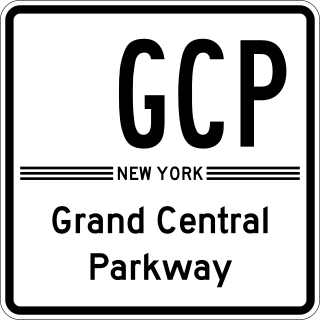
The Grand Central Parkway (GCP) is a 14.61-mile (23.51 km) controlled-access parkway that stretches from the Triborough Bridge in New York City to the Queens–Nassau County line on Long Island. At the Nassau County line, it becomes the Northern State Parkway, which runs across the northern part of Long Island into Suffolk County, where it ends in Hauppauge. The westernmost stretch also carries a short stretch of Interstate 278 (I-278). The parkway runs through Queens and passes the Cross Island Parkway, Long Island Expressway, LaGuardia Airport and Citi Field, home of the New York Mets. The parkway is designated New York State Route 907M (NY 907M), an unsigned reference route. Despite its name, the Grand Central Parkway was not named after Grand Central Terminal.

The Southern State Parkway is a 25.53-mile (41.09 km) controlled-access parkway on Long Island, New York, in the United States. The parkway begins at an interchange with the Belt and Cross Island parkways in North Valley Stream, in Nassau County, and travels east to an interchange with the Sagtikos State Parkway in West Islip, Suffolk County, where it becomes the Heckscher State Parkway. The Southern State Parkway comprises the western portion of unsigned New York State Route 908M (NY 908M), with the Heckscher Parkway occupying the eastern section.

Van Cortlandt Park is a 1,146-acre (464 ha) park located in the borough of the Bronx in New York City. Owned by the New York City Department of Parks and Recreation, it is managed with assistance from the Van Cortlandt Park Alliance. The park, the city's third-largest, was named for the Van Cortlandt family, which was prominent in the area during the Dutch and English colonial periods.

Interstate 95 (I-95) is part of the Interstate Highway System and runs from Miami, Florida, to the Canada–United States border near Houlton, Maine. In the US state of New York, I-95 extends 23.50 miles (37.82 km) from the George Washington Bridge in New York City to the Connecticut state line at Port Chester. The George Washington Bridge carries I-95 across the Hudson River from New Jersey into New York City. There, I-95 runs across Upper Manhattan on the Trans-Manhattan Expressway for 0.81 miles (1.30 km) through Washington Heights. It continues east across the Harlem River on the Alexander Hamilton Bridge and onto the Cross Bronx Expressway. In the Bronx, I-95 leaves the Cross Bronx at the Bruckner Interchange, joining the Bruckner Expressway to its end. North of the interchange with Pelham Parkway, it then continues northeast via the New England Thruway out of New York City into Westchester County and to the Connecticut state line, where I-95 continues on the Connecticut Turnpike.

Mosholu Parkway is a 3.03-mile-long (4.88 km) parkway in the borough of the Bronx in New York City, constructed from 1935 to 1937 as part of the roadway network created under Robert Moses. The roadway extends between the New York Botanical Garden and Van Cortlandt Park. The New York City Department of Transportation is responsible for the operation and maintenance of the roadway while the New York City Department of Parks and Recreation is responsible for the surrounding rights-of-way. The parkway is designated as New York State Route 908F (NY 908F), an unsigned reference route, by the New York State Department of Transportation.

U.S. Route 1 (US 1) is a part of the U.S. Highway System that extends from Key West, Florida, to the Canada–United States border at Fort Kent, Maine. In the U.S. state of New York, US 1 extends 21.54 miles (34.67 km) from the George Washington Bridge in Manhattan to the Connecticut state line at Port Chester. It closely parallels Interstate 95 (I-95) for much of its course and does not serve as a major trunk road within the state. It is not concurrent with any other highways besides I-95 and (briefly) US 9, and few other state highways intersect it.
Van Cortlandt Village is a subsection of the Kingsbridge neighborhood in the New York City borough of the Bronx. The neighborhood is part of Bronx Community Board 8. Named after Van Cortlandt Park, it is bordered by the Major Deegan Expressway to the west, the Jerome Park Reservoir to the east, West 238th Street to the south, and Van Cortlandt Park to the north. Its ZIP Code is 10463.

Gun Hill Road is a major thoroughfare in the New York City borough of the Bronx. The road stretches for 3.5 miles (5.6 km) from Mosholu Parkway in Norwood to the Hutchinson River Parkway in Baychester. Van Cortlandt Park and the Mosholu Golf Course are both located at the western terminus of Gun Hill Road.

Jerome Avenue is one of the longest thoroughfares in the New York City borough of the Bronx, New York, United States. The road is 5.6 miles (9.0 km) long and stretches from Concourse to Woodlawn. Both of these termini are with the Major Deegan Expressway which runs parallel to the west. Most of the elevated IRT Jerome Avenue Line runs along Jerome Avenue. The Cross Bronx Expressway interchanges with Jerome and the Deegan. Though it runs through what is now the West Bronx neighborhood, Jerome Avenue is the dividing avenue between nominal and some named "West" and "East" streets in the Bronx; Fifth Avenue, and to a lesser extent, Broadway, also splits Manhattan into nominal "West" and "East" streets.
East 233rd Street is a major thoroughfare in the New York City borough of The Bronx. The road is 3 miles (4.8 km) long and stretches from U.S. Route 1 in the Eastchester section of the Bronx to the Major Deegan Expressway (I-87) in Woodlawn. The road changes names from East 233rd Street to Pinkley Avenue after the eastern terminus, at Boston Road. There is one interchange with a highway along the way, which is for the Bronx River Parkway. There are two subway stations along the road, one at Dyre Avenue, serving the 5 train, and one at White Plains Road, serving the 2 and 5 trains.

New York State Route 164 (NY 164) was a state highway in the New York City Metropolitan Area. It extended for 5 miles (8 km) from U.S. Route 9 (US 9) and NY 9A in Yonkers to US 1 in the New York City borough of the Bronx. The route ran mostly along the New York City line and indirectly met both the Saw Mill River Parkway and the New York State Thruway in Yonkers. NY 164 followed McLean Avenue in Yonkers and Nereid and Baychester Avenues in the Bronx.


