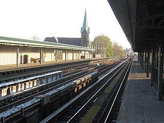
The Westchester Square–East Tremont Avenue station is a local station on the IRT Pelham Line of the New York City Subway. Located at the intersection of East Tremont and Westchester Avenues in the Westchester Square neighborhood of the Bronx, it is served by the 6 train at all times except weekdays in the peak direction, when the <6> train takes over.

The Middletown Road station is a local station of the IRT Pelham Line of the New York City Subway. Located at Middletown Road and Westchester Avenue in the Pelham Bay neighborhood of the Bronx, it is served by the 6 train at all times except weekdays in the peak direction, when the <6> train takes over.
Baychester is a neighborhood geographically located in the northeast part of the Bronx, New York City. Its boundaries are East 222nd Street to the northeast, the New England Thruway (I-95) to the east, Gun Hill Road to the southwest, and Boston Road to the northwest. Eastchester Road is the primary thoroughfare through Baychester.
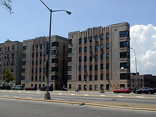
Tremont is a residential neighborhood in the West Bronx, New York City. Its boundaries are East 181st Street to the north, Third Avenue to the east, the Cross-Bronx Expressway to the south, and the Grand Concourse to the west. East Tremont Avenue is the primary thoroughfare through Tremont.
North Riverdale is the northernmost part of the Riverdale neighborhood of the borough of the Bronx in New York City, particularly above 254th Street. It is a residential sub-neighborhood, and shares its northern border with Yonkers, New York in Westchester County.

Third Avenue is a north-south thoroughfare on the East Side of the New York City borough of Manhattan, as well as in the center portion of the Bronx. Its southern end is at Astor Place and St. Mark's Place. It transitions into Cooper Square, and further south, the Bowery, Chatham Square, and Park Row. The Manhattan side ends at East 128th Street. Third Avenue is two-way from Cooper Square to 24th Street, but carries only northbound (uptown) traffic while in Manhattan above 24th Street; in the Bronx, it is again two-way. However, the Third Avenue Bridge carries vehicular traffic in the opposite direction, allowing only southbound vehicular traffic, rendering the avenue essentially non-continuous to motor vehicles between the boroughs.
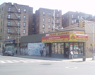
East Tremont is a residential neighborhood located in the West Bronx, New York City. From the north and moving clockwise, it is bounded by East 180th Street, Southern Boulevard, the Cross Bronx Expressway and Third Avenue. East Tremont Avenue is the primary thoroughfare through the neighborhood.
Kingsbridge Heights is a residential neighborhood geographically located in the northwest Bronx, New York City. Its boundaries are Van Cortlandt Park to the north, Jerome Avenue to the east, Kingsbridge Road to the south, and the Major Deegan Expressway to the west. Sedgwick Avenue is the primary thoroughfare through Kingsbridge Heights.

Parkchester is a planned community and neighborhood originally developed by the Metropolitan Life Insurance Company and located in the east Bronx, New York City. The immediate surrounding area also takes its name from the complex. Its boundaries, starting from the north and moving clockwise, are East Tremont Avenue to the north, Castle Hill Avenue to the east, Westchester Avenue to the south, East 177th Street/Cross Bronx Expressway to the southwest, and White Plains Road to the west. Metropolitan Avenue, Unionport Road, and White Plains Road are the primary thoroughfares through Parkchester.
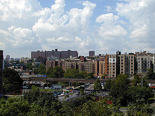
Morris Heights is a residential neighborhood located in the West Bronx. Its boundaries, starting from the north and moving clockwise are: West Burnside Avenue to the north, Jerome Avenue to the east, the Cross-Bronx Expressway to the south, and the Harlem River to the west. University Avenue is the primary thoroughfare through Morris Heights.
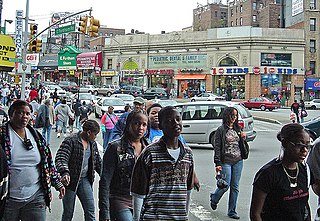
Fordham Road is a major thoroughfare in the Bronx, New York City, that runs west-east from the Harlem River to Bronx Park. Fordham Road houses the borough's largest and most diverse shopping district. It geographically separates the geopolitical North Bronx from the South Bronx.

West Farms is a residential neighborhood in The Bronx, New York City. Its boundaries are Bronx Park to the north, the Bronx River to the east, the Cross Bronx Expressway to the south, and Southern Boulevard to the west. East Tremont Avenue is the primary thoroughfare through West Farms.

Gun Hill Road is a major thoroughfare in the New York City borough of the Bronx. The road stretches for 3.5 miles (5.6 km) from Mosholu Parkway in Norwood to the Hutchinson River Parkway in Baychester. Van Cortlandt Park and the Mosholu Golf Course are both located at the western terminus of Gun Hill Road.

Jerome Avenue is one of the longest thoroughfares in the New York City borough of the Bronx, New York, United States. The road is 5.6 miles (9.0 km) long and stretches from Concourse to Woodlawn. Both of these termini are with the Major Deegan Expressway which runs parallel to the west. Most of the elevated IRT Jerome Avenue Line runs along Jerome Avenue. The Cross Bronx Expressway interchanges with Jerome and the Deegan. Though it runs through what is now the West Bronx neighborhood, Jerome Avenue is the dividing avenue between nominal and some named "West" and "East" streets in the Bronx; Fifth Avenue, and to a lesser extent, Broadway, also splits Manhattan into nominal "West" and "East" streets.
Webster Avenue is a major north–south thoroughfare in the Bronx, New York City, United States. It stretches for 5.8 miles (9.3 km) from Melrose to Woodlawn. The road starts at the intersection of Melrose Avenue, East 165th Street, Brook Avenue, and Park Avenue in the neighborhood of Melrose, ending at Nereid Avenue in the neighborhood of Woodlawn. There are no subway lines along this thoroughfare, unlike the streets it parallels—Jerome Avenue, The Grand Concourse, and White Plains Road, which all have subway lines —but until 1973, Webster Avenue north of Fordham Road was served by the Third Avenue Elevated, served by the 8 train.

White Plains Road is a major north-south thoroughfare which runs the length of the New York City borough of the Bronx. It runs from Castle Hill and Clason Point in the south to Wakefield in the north, where it crosses the city line and becomes West 1st Street of Mount Vernon, New York. The Bronx River Parkway lies to its west and parallels much of its route. Between Magenta Street & 217th Street, White Plains Road is very wide due to the presence of the Gun Hill Road station house in the road's median.

Southern Boulevard is a street in the Bronx, New York City, United States. It stretches from Bruckner Boulevard in Mott Haven to Bronx Park East in Bronx Park where it becomes Allerton Avenue.
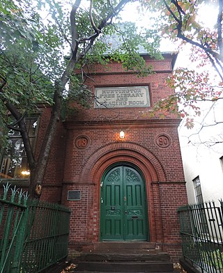
Westchester Square is a residential neighborhood geographically located in the eastern section of the New York City borough of the Bronx. Its boundaries, starting from the north and moving clockwise are: East Tremont Avenue and Silver Street, Blondell Avenue and Westchester Creek to the east, Waterbury Avenue to the south and Castle Hill Avenue to the west. The main roadways through Westchester Square are East Tremont Avenue, Westchester Avenue and Williamsbridge Road.
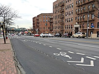
Westchester Avenue is a major east–west street in the South and East portions of the Bronx, New York City. It runs from Third Avenue and East 150th Street in the Hub to Pelham Bay Park in the Pelham Bay section. It crosses many neighborhoods of the Bronx, which include Melrose, Longwood, Soundview, Parkchester, and Pelham Bay. Westchester Avenue parallels the Bruckner Expressway until their junction at Pelham Bay Park.

The Bx40 and Bx42 bus routes constitute a public transit line between River Park Towers in Morris Heights and the neighborhood of Throggs Neck, running primarily along Burnside Avenue, East 180th Street and East Tremont Avenue.


