Related Research Articles

Coney Island is a peninsular neighborhood and entertainment area in the southwestern section of the New York City borough of Brooklyn. The neighborhood is bounded by Brighton Beach to its east, Lower New York Bay to the south and west, and Gravesend to the north and includes the subsection of Sea Gate on its west. More broadly, the Coney Island peninsula consists of Coney Island proper, Brighton Beach, and Manhattan Beach. This was formerly the westernmost of the Outer Barrier islands on the southern shore of Long Island, but in the early 20th century it became a peninsula, connected to the rest of Long Island by land fill.
The BMT Brighton Line, also known as the Brighton Beach Line, is a rapid transit line in the B Division of the New York City Subway in Brooklyn, New York City, United States. Local service is provided at all times by the Q train, but is joined by the B express train on weekdays. The Q train runs the length of the entire line from Coney Island–Stillwell Avenue to the Manhattan Bridge south tracks. The B begins at Brighton Beach and runs via the bridge's north tracks.
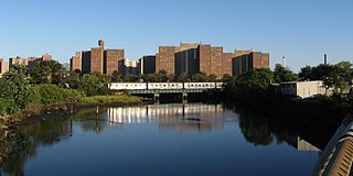
Coney Island Creek is a 1.8-mile-long (2.9 km) tidal inlet in Brooklyn, New York City. It was created from a series of streams and inlets by land filling and digging activities starting in the mid-18th century which, by the 19th century, became a 3-mile-long (4.8 km) continual strait and a partial mudflat connecting Gravesend Bay and Sheepshead Bay, separating Coney Island from the mainland. The strait was closed off in the early 20th century due to further land development and later construction projects. Today only the western half of Coney Island Creek exists.
The BMT West End Line is a line of the New York City Subway, serving the Brooklyn communities of Sunset Park, Borough Park, New Utrecht, Bensonhurst, Bath Beach and Coney Island. The D train operates local on the entire line at all times. Although there is a center express track and three express stations along the line, there is no regular express service.

Steeplechase Park was an amusement park that operated in the Coney Island neighborhood of Brooklyn in New York City, United States, from 1897 to 1964. Steeplechase Park was created by the entrepreneur George C. Tilyou as the first of the three large amusement parks built on Coney Island, the other two being Luna Park (1903) and Dreamland (1904). Of the three, Steeplechase was the longest-lasting, running for 67 years.

A pocket park is a small park accessible to the general public. While the locations, elements, and uses of pocket parks vary considerably, the common defining characteristic of a pocket park is its small size. Typically, a pocket park occupies one to three municipal lots and is smaller than 0.5 hectares in size.
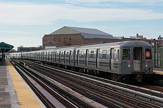
The D Sixth Avenue Express is a rapid transit service in the B Division of the New York City Subway. Its route emblem, or "bullet", is colored orange, since it uses the IND Sixth Avenue Line in Manhattan.

The Trustees of Reservations is a non-profit land conservation and historic preservation organization dedicated to preserving natural and historical places in the Commonwealth of Massachusetts. It is the oldest land conservation nonprofit organization of its kind in the world and has 100,000 member households as of 2021. In addition to land stewardship, the organization is also active in conservation partnerships, community supported agriculture (CSA), environmental and conservation education, community preservation and development, and green building. The Trustees owns title to 120 properties on 27,000 acres (11,000 ha) in Massachusetts, all of which are open to the public. In addition, it holds 393 conservation restrictions to protect an additional 20,000 acres (8,100 ha). Properties include historic mansions, estates, and gardens; woodland preserves; waterfalls; mountain peaks; wetlands and riverways; coastal bluffs, beaches, and barrier islands; farmland and CSA projects; and archaeological sites.

Ocean Parkway is a 4.86-mile-long (7.82 km) boulevard in the west-central portion of the New York City borough of Brooklyn. Designed by Frederick Law Olmsted and Calvert Vaux, it was built between 1874 and 1876. It is maintained by the New York State Department of Transportation (NYSDOT) as New York State Route 908H (NY 908H), an unsigned reference route. Ocean Parkway runs roughly north to south from Machate Circle, at the southwestern corner of Prospect Park, to the Atlantic Ocean waterfront, at Brighton Beach. South of Church Avenue, the parkway consists of a main roadway, two landscaped medians, and two service roads.
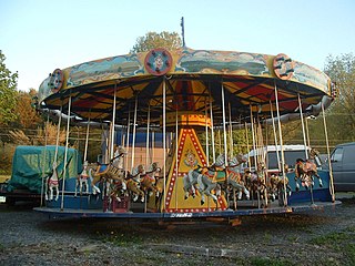
William F. Mangels was an amusement manufacturer and inventor. He worked at Coney Island and was a major player in the development of American amusement parks at the start of the 20th century. In addition to manufacturing carousels and inventing rides, including The Whip, he wrote a book titled The Outdoor Amusement Industry: From Earliest Times to the Present (ISBN 0848820029). Mangels is interred at Green-Wood Cemetery in Brooklyn, New York.

The 18th Avenue station is a local station on BMT West End Line of the New York City Subway in Bensonhurst, Brooklyn. It is served by the D train at all times. The station opened in 1916 as part of the BMT West End Line, which was upgraded into an elevated line as part of the Dual Contracts. Its platforms were extended to accommodate ten-car trains in the 1960s, and the station was renovated in 2012. The station is scheduled to become compliant with the Americans with Disabilities Act of 1990 through the installation of elevators.
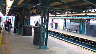
The Bay Parkway station is an express station on the BMT West End Line of the New York City Subway, located in Bensonhurst, Brooklyn at the intersection of Bay Parkway and 86th Street. The station is served by the D train at all times.

The Riegelmann Boardwalk is a 2.7-mile-long (4.3 km) boardwalk along the southern shore of Coney Island in the New York City borough of Brooklyn, facing the Atlantic Ocean. Opened in 1923, the boardwalk runs between West 37th Street to the west, at the edge of the Sea Gate neighborhood, and Brighton 15th Street to the east, in Brighton Beach. It is operated by the New York City Department of Parks and Recreation.

Cabot Square is an urban square in Montreal, Quebec, Canada between the former Montreal Forum and the former Montreal Children's Hospital. The square is in the Shaughnessy Village neighbourhood, an area recently re-dubbed the Quartier des Grands Jardins and has been slated for redevelopment.
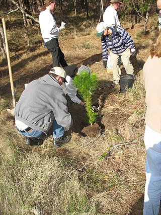
Urban reforestation is the practice of planting trees, typically on a large scale, in urban environments. It may also include urban horticulture and urban farming.
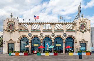
The Childs Restaurant Building on the Boardwalk is a New York City designated landmark on the Riegelmann Boardwalk at West 21st Street in Coney Island, Brooklyn, New York City. It was completed in 1923 for Childs Restaurants, an early restaurant chain and one of the largest in the United States at that time. It was designed in a "resort style with Spanish Revival influence" with colorful exterior terra cotta ornamentation that references its seaside location, with depictions of Poseidon, sailing ships, and sea creatures. It was a very large restaurant, with three stories and a roof garden.
Pamela Harris is a Democratic politician who was a member of the New York State Assembly representing the 46th Assembly District from 2015 to 2018, covering the neighborhoods of Bath Beach, Bay Ridge, Brighton Beach, Coney Island, Dyker Heights, and Seagate, in Brooklyn, until she resigned under a fraud indictment.
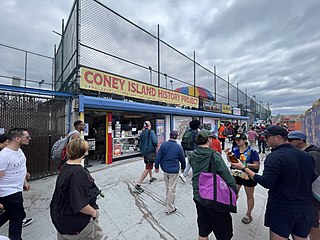
The Coney Island History Project, or CIHP, founded in 2004, is a 501(c)(3) nonprofit organization that works to record and increase awareness of Coney Island's history.

Kaiser Park is a public park on the northwestern coast of Coney Island in Brooklyn, New York City. It abuts Coney Island Creek, Gravesend Bay, and Coney Island Creek Park and is across Coney Island Creek from Calvert Vaux Park and Six Diamonds Park.

Coney Island Creek Park is a public park on the northwestern coast of Coney Island in Brooklyn, New York City. It abuts Coney Island Creek, Gravesend Bay, and Kaiser Park and is across Coney Island Creek from Calvert Vaux Park and Six Diamonds Park.
References
- ↑ "DEP transforms NYC water with 'Harbor Protectors'". Brooklyn Eagle. April 23, 2021. Retrieved July 3, 2021.
- ↑ "Locals Fear New Projects at Coney Island Creek Will Worsen Pollution". Bklyner. December 20, 2019. Retrieved July 3, 2021.
- ↑ "Coney Island and Prospect Park to host New Year's Eve celebrations". PIX11. December 28, 2015. Retrieved July 3, 2021.
- ↑ "Green Infrastructure Plan for a Resilient Coney Island | Department of Landscape Architecture". landscape.cals.cornell.edu. Retrieved July 3, 2021.
- ↑ "Pamela Pettyjohn | Cabot Celebrity Volunteer | Cabot Community Celebrity Cruise". www.cabotcelebritycruise.com. Retrieved July 3, 2021.
- ↑ "Pamela Pettyjohn". Coney Island History Project. May 19, 2020. Retrieved July 3, 2021.

