
Broadway is a street and major thoroughfare in the U.S. state of New York. The street runs from Battery Place at Bowling Green in the south of Manhattan for 13 mi (20.9 km) through the borough, over the Broadway Bridge, and 2 mi (3.2 km) through the Bronx, exiting north from New York City to run an additional 18 mi (29.0 km) through the Westchester County municipalities of Yonkers, Hastings-On-Hudson, Dobbs Ferry, Irvington, Tarrytown, and Sleepy Hollow, after which the road continues, but is no longer called "Broadway". The latter portion of Broadway north of the George Washington Bridge/I-95 underpass comprises a portion of U.S. Route 9.
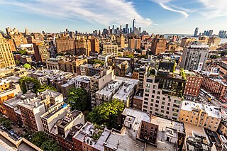
Greenwich Village, or simply the Village, is a neighborhood on the west side of Lower Manhattan in New York City, bounded by 14th Street to the north, Broadway to the east, Houston Street to the south, and the Hudson River to the west. Greenwich Village also contains several subsections, including the West Village west of Seventh Avenue and the Meatpacking District in the northwest corner of Greenwich Village.

Fifth Avenue is a major thoroughfare in the borough of Manhattan in New York City. The avenue stretches southward from West 143rd Street in Harlem to Washington Square Park in Greenwich Village. The section in Midtown Manhattan is one of the most expensive shopping streets in the world.

Sixth Avenue, also known as Avenue of the Americas, is a major thoroughfare in the New York City borough of Manhattan. The avenue is commercial for much of its length, and traffic runs northbound, or uptown.

8th Street is a street in the New York City borough of Manhattan that runs from Sixth Avenue to Third Avenue and also from Avenue B to Avenue D; its addresses switch from West to East as it crosses Fifth Avenue. Between Third Avenue and Avenue A it is named St. Mark's Place, after the nearby St. Mark's Church in-the-Bowery on 10th Street at Second Avenue.

Lexington Avenue, often colloquially abbreviated as "Lex", is an avenue on the East Side of Manhattan in New York City. The avenue carries southbound one-way traffic from East 131st Street to Gramercy Park at East 21st Street. Along its 5.5-mile (8.9-kilometer), 110-block route, Lexington Avenue runs through Harlem, Carnegie Hill, the Upper East Side, Midtown, and Murray Hill to a point of origin that is centered on Gramercy Park. South of Gramercy Park, the axis continues as Irving Place from 20th Street to East 14th Street.

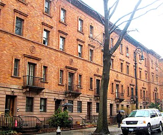
Astor Row is a group of 28 row houses on the south side of West 130th Street, between Fifth and Lenox Avenues in the Harlem neighborhood of Manhattan, New York City, which were among the first speculative townhouses built in the area. Designed by Charles Buek, the houses were built between 1880 and 1883. Astor's grandson, William Backhouse Astor, Jr., was the driving force behind the development.

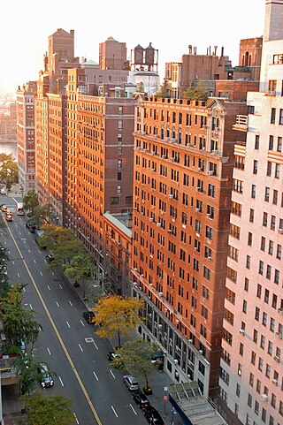
York Avenue, Sutton Place, and Sutton Place South are the names of segments of a north–south thoroughfare in the Yorkville, Lenox Hill, and Sutton Place neighborhoods of the East Side of Manhattan, in New York City. York Avenue runs from 59th to 92nd Streets through eastern Lenox Hill and Yorkville on the Upper East Side. Sutton Place and Sutton Place South run through their namesake neighborhood along the East River and south of the Queensboro Bridge. Sutton Place South runs from 57th to 53rd Streets. Unlike most north–south streets in Manhattan, building address numbers along Sutton Place South increase when headed south. Sutton Place runs from 57th to 59th Streets. The streets are considered among the city's most affluent, and both portions are known for upscale apartments, much like the rest of the Upper East Side.

4th Street is a street in Lower Manhattan, New York City. It starts at Avenue D as East 4th Street and continues to Broadway, where it becomes West 4th Street. It continues west until the Avenue of the Americas, where West 4th Street turns north and confusingly intersects with West 10th, 11th, 12th, and 13th Streets in Greenwich Village. Most of the street has the same 40-foot (12 m) width between curbstones as others in the prevailing street grid, striped as two curbside lanes and one traffic lane, with one-way traffic eastbound. The portion from Seventh to Eighth Avenues is westbound and is approximately 35 feet (11 m) wide, a legacy of the original Greenwich Village street grid. The section of four short blocks from MacDougal Street to University Place which forms the southern border of Washington Square Park is called Washington Square South.

Washington Mews is a private gated street in Manhattan, New York City between Fifth Avenue and University Place just north of Washington Square Park. Along with MacDougal Alley and Stuyvesant Street, it was originally part of a Lenape trail which connected the Hudson and East Rivers, and was first developed as a mews that serviced horses from homes in the area. Since the 1950s the former stables have served as housing, offices and other facilities for New York University.
57th Street is a broad thoroughfare in the New York City borough of Manhattan, one of the major two-way, east-west streets in the borough's grid. As with Manhattan's other “crosstown” streets, it is divided into its east and west sections at Fifth Avenue. The street runs from a small park overlooking the East River in the east to the West Side Highway along the Hudson River in the west. 57th Street runs through the Midtown Manhattan neighborhoods of Sutton Place, Billionaire's Row, and Hell's Kitchen from east to west.

53rd Street is an east–west street in Midtown Manhattan, New York City, which measures 1.83 miles (2.94 km) long. The street runs westbound from Sutton Place across most of the island's width, ending at DeWitt Clinton Park at Eleventh Avenue.

West Broadway is a north-south street in the New York City borough of Manhattan, separated into two parts by Tribeca Park. The northern part begins at Tribeca Park, near the intersection of Avenue of the Americas, Walker Street and Beach Street in Tribeca. It runs northbound as a one-way street past Canal Street and becomes two-way at the intersection with Grand Street one block farther north. West Broadway then operates as a main north-south thoroughfare through SoHo until its northern end at Houston Street, on the border between SoHo and Greenwich Village. North of Houston Street, it is designated as LaGuardia Place, which continues until Washington Square South.
Washington Street is a north–south street in the New York City borough of Manhattan. It runs in several distinct pieces, from its northernmost end at 14th Street in the Meatpacking District to its southern end at Battery Place in Battery Park City. Washington Street is, for most of its length, the westernmost street in lower Manhattan other than West Street. The exceptions are a one-block segment in the West Village where Weehawken Street lies between West and Washington Streets, and in Battery Park City.

MacDougal Street is a one-way street in the Greenwich Village and SoHo neighborhoods of Manhattan, New York City. The street is bounded on the south by Prince Street and on the north by West 8th Street; its numbering begins in the south. Between Waverly Place and West 3rd Street it carries the name Washington Square West and the numbering scheme changes, running north to south, beginning with #29 Washington Square West at Waverly Place and ending at #37 at West 3rd Street. Traffic on the street runs southbound (downtown).

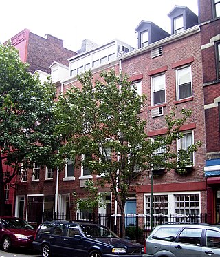
Bank Street is a primarily residential street in the West Village part of Greenwich Village in the borough of Manhattan in New York City. It runs for a total length of about 725 metres (2,379 ft) from West Street, crossing Washington Street and Greenwich Street, to Hudson Street and Bleecker Street where it is interrupted by the Bleecker Playground, north of which is Abingdon Square; it then continues to Greenwich Avenue, crossing West 4th Street and Waverly Place. Vehicular traffic runs west-east along this one-way street. As with several other east-west streets in the Far West Village, the three blocks west of Hudson Street are paved with setts.
74th Street is an east–west street carrying pedestrian traffic and eastbound automotive/bicycle traffic in the New York City borough of Manhattan. It runs through the Upper East Side neighborhood, and the Upper West Side neighborhood, on both sides of Central Park.
The St. Nicholas Historic District, known colloquially as "Striver's Row", is a historic district located on both sides of West 138th and West 139th Streets between Adam Clayton Powell Jr. Boulevard and Frederick Douglass Boulevard, in the Harlem neighborhood of Upper Manhattan, New York City. It is both a national and a New York City historic district, and consists of row houses and associated buildings designed by three architectural firms and built in 1891–93 by developer David H. King Jr. These are collectively recognized as gems of New York City architecture, and "an outstanding example of late 19th-century urban design":
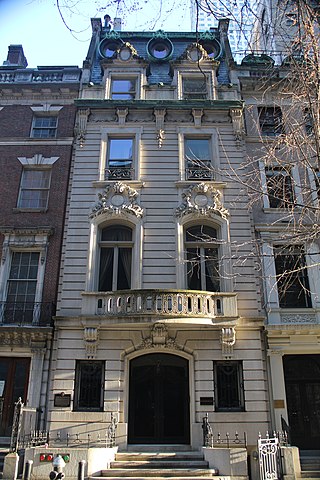
7 West 54th Street is a commercial building in the Midtown Manhattan neighborhood of New York City. It is along 54th Street's northern sidewalk between Fifth Avenue and Sixth Avenue. The four-story building was designed by John H. Duncan in the French Beaux-Arts style and was constructed between 1899 and 1900 as a private residence. It is one of five consecutive townhouses erected along the same city block during the 1890s, the others being 5, 11, and 13 and 15 West 54th Street.
