Related Research Articles
The New York and Harlem Railroad was one of the first railroads in the United States, and was the world's first street railway. Designed by John Stephenson, it was opened in stages between 1832 and 1852 between Lower Manhattan to and beyond Harlem. Horses initially pulled railway carriages, followed by a conversion to steam engines, then on to battery-powered Julien electric traction cars. In 1907, the then leaseholders of the line, New York City Railway, a streetcar operator, went into receivership. Following a further receivership in 1932, the New York Railways Corporation converted the line to bus operation. The Murray Hill Tunnel now carries a lane of road traffic, but not the buses.

The 23rd Street Crosstown is a surface transit line on 23rd Street in Manhattan, New York City. It currently hosts the M23 SBS bus route of the Metropolitan Transportation Authority (MTA)'s Regional Bus Operations. The M23 runs between Chelsea Piers, along the West Side Highway near 22nd Street, via 23rd Street, to Avenue C and 20th Street in Stuyvesant Town–Peter Cooper Village.

The IRT Third Avenue Line, commonly known as the Third Avenue Elevated, Third Avenue El, or Bronx El, was an elevated railway in Manhattan and the Bronx, New York City. Originally operated by the New York Elevated Railway, an independent railway company, it was acquired by the Interborough Rapid Transit Company (IRT) and eventually became part of the New York City Subway system.

The B68 is a bus route that constitutes a public transit line operating in Brooklyn, New York City. The B68 is operated by the MTA New York City Transit Authority. Its precursor was a streetcar line that began operation in June 1862, and was known as the Coney Island Avenue Line. The route became a bus line in 1955.
The Third Avenue Railway System (TARS), founded 1852, was a streetcar system serving the New York City boroughs of Manhattan and the Bronx along with lower Westchester County. For a brief period of time, TARS also operated the Steinway Lines in Long Island City.

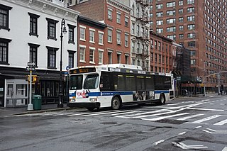
The First and Second Avenues Line, also known as the Second Avenue Line, is a bus line in Manhattan, New York City, running mostly along Second Avenue from Lower Manhattan to East Harlem. Originally a streetcar line along Second Avenue, it is now the M15 bus route, the busiest bus route in the city, carrying over 8.1 million people annually. MTA Regional Bus Operations, under the New York City Bus and Select Bus Service brands, operates the local out of the Tuskegee Airmen Bus Depot and the SBS is operated from the Mother Clara Hale Bus Depot. Service is operated exclusively with articulated buses.
The Ninth and Tenth Avenues Line or Ninth Avenue Line is a surface transit line in the New York City borough of Manhattan, running mostly along Ninth Avenue and Amsterdam Avenue from Lower Manhattan to Manhattanville. Originally a streetcar line operated by the Manhattan and Bronx Surface Transit Operating Authority, it is now the M11 bus route operated by the New York City Transit Authority.

The M5 and M55 bus routes constitute a public transit corridor in Manhattan, New York City, running along the Fifth / Sixth Avenues / Riverside Drive Line as well as the southern portion of the Broadway Line after the discontinuation of the M6. The routes primarily run along Broadway, Fifth and Sixth Avenues, and Riverside Drive from South Ferry, Lower Manhattan to Washington Heights. The M5 covers the northern portion of the route north of 31st Street, while the M55 operates along the southern portion of the route south of 44th Street. The two routes overlap in Midtown Manhattan. The portion along Broadway south of East 8th Street was originally a streetcar line.
The 14th Street Crosstown Line is a public transit line in Manhattan, New York City, running primarily along 14th Street from Chelsea or the West Village to the Lower East Side. Originally a streetcar line, it is now the M14 bus route, operated by the New York City Transit Authority. The line's two variants, the M14A SBS and M14D SBS, use Avenue A and Avenue D respectively from 14th Street south into the Lower East Side.

The M9 is a local bus route that operates along the Avenue C Line, in Manhattan, New York City. The route runs mostly along Essex Street and Avenue C from Battery Park City to Kips Bay. Originally a streetcar line, the Avenue C Line is now part of the M9 route, as well as the M21, which operates on the Houston Street Line. Both the Avenue C and Houston Street segments were served by a single route, the M21, until June 2010. The M9 and M21 are operated by the New York City Transit Authority, and based out of the Michael J. Quill Depot.
The New York Railways Company operated street railways in Manhattan, New York City, United States between 1911 and 1925. The company went into receivership in 1919 and control was passed to the New York Railways Corporation in 1925 after which all of its remaining lines were replaced with bus routes.

The Broadway Line is a surface transit line in Manhattan, New York City, running mainly along 42nd Street and Broadway from Murray Hill to Harlem. Formerly a streetcar line operated by the Third Avenue Railway, it is now the M104 bus route operated by the New York City Transit Authority, a subsidiary of the Metropolitan Transportation Authority. This bus route no longer runs along the entire route of the former streetcar.

The M1, M2, M3, and M4 are four local bus routes that operate the Fifth and Madison Avenues Lines – along one-way pair of Madison and Fifth Avenues in the Manhattan borough of New York City. Though the routes also run along other major avenues, the majority of their route is along Madison and Fifth Avenues between Greenwich Village and Harlem.
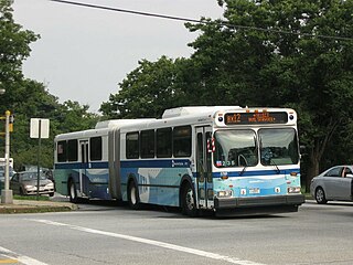
The Bx12 is a public transit line in New York City running along the 207th Street Crosstown Line, within the boroughs of Manhattan and the Bronx. The line runs along 207th Street in Upper Manhattan and along the continuous Fordham Road and Pelham Parkway in the Bronx.

The Williamsburg Bridge Plaza, sometimes called Washington Plaza or the Williamsburg Bridge Transit Center, is a major bus terminal and former trolley terminal located at the foot of the Williamsburg Bridge in the New York City borough of Brooklyn, one block west of the Brooklyn-Queens Expressway (I-278). It is situated by the boundaries of Broadway, Havemeyer Street, Roebling Street, and South 5th Street, south of the LaGuardia Playground. It contains five bus lanes, and serves as a terminal for numerous MTA New York City Transit Authority bus routes of Brooklyn and Queens that start and end their runs there.

The Q60 bus route constitutes a public transit line running primarily along Queens Boulevard in Queens, New York City, extending from Jamaica, Queens, to Midtown Manhattan via Queens Boulevard and the Queensboro Bridge. It is city-operated under the MTA Bus Company brand of MTA Regional Bus Operations.

The Bx15 and M125 bus routes constitute the Third Avenue/125th Street Line, a public transit line in New York City. The Bx15 runs between Fordham Plaza and the Hub in the Bronx, running primarily along Third Avenue. The M125 runs between the Hub in the Bronx and Manhattanville in Manhattan, running along Willis Avenue in the South Bronx and along 125th Street in Harlem, Manhattan.

The 86th Street Crosstown Line is a bus line in Manhattan, New York City, running mostly along 86th Street on the Upper West and Upper East Sides of Manhattan. Originally a streetcar line, it now comprises the M86 Select Bus Service bus line.

The 34th Street Crosstown Line is a surface transit line on 34th Street in Manhattan, New York City, United States. It currently hosts the M34/M34A Select Bus Service routes of MTA's Regional Bus Operations. The M34 runs from 12th Avenue to FDR Drive via 34th Street, while the M34A runs from Port Authority Bus Terminal to Waterside Plaza.
References
- ↑ "SECOND-AVENUE RAILROAD.; Damage Done to Streets by the Railroad Tracks What the City Pays for Repairs". The New York Times. 1872-11-22. ISSN 0362-4331 . Retrieved 2022-10-11.
- ↑ Supreme Court of New York. Matter of the Second Avenue Railroad Company. JSTOR. The American Law Register (1852-1891). 1873-07-01.
{{cite book}}: CS1 maint: others (link)
| Current routes | 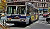 | |
|---|---|---|
| Former local routes | ||
| Former express routes | ||
| | This New York City transportation–related article is a stub. You can help Wikipedia by expanding it. |