Related Research Articles

Greenpoint is the northernmost neighborhood in the New York City borough of Brooklyn, in the U.S. state of New York. It is bordered on the southwest by Williamsburg at Bushwick Inlet Park and McCarren Park; on the southeast by the Brooklyn-Queens Expressway and East Williamsburg; on the north by Newtown Creek and the neighborhood of Long Island City in Queens; and on the west by the East River. The neighborhood has a large Polish immigrant and Polish-American community, containing many Polish restaurants, markets, and businesses, and it is often referred to as Little Poland.

The Brooklyn City Railroad (BCRR) was the oldest and one of the largest operators of streetcars in the City of Brooklyn, New York, continuing in that role when Brooklyn became a borough of New York City in 1898.

The B68 is a bus route that constitutes a public transit line operating in Brooklyn, New York City. The B68 is operated by the MTA New York City Transit Authority. Its precursor was a streetcar line that began operation in June 1862, and was known as the Coney Island Avenue Line. The route became a bus line in 1955.
The Culver Line, Gravesend Avenue Line, or McDonald Avenue Line was a surface public transit line in Brooklyn, New York City, United States, running along McDonald Avenue and built by the Prospect Park and Coney Island Railroad. Most of its main line has been essentially replaced by the IND Culver Line of the New York City Subway.

The DeKalb Avenue Line is a public transit line in Brooklyn and Queens, New York City, running mostly along DeKalb Avenue, as well as eastbound on Lafayette Avenue, between downtown Brooklyn and Ridgewood, Queens. Originally a streetcar line, it is now the B38 DeKalb/Lafayette Avenues bus route, operated by the New York City Transit Authority.

The Bergen Street Line is a public transit line in Brooklyn, New York City, running westbound mostly along Bergen Street, as well as eastbound on Dean Street, between Downtown Brooklyn and Ocean Hill. Originally a streetcar line, it is now the B65 bus route, operated by the New York City Transit Authority. The B65 is based out of the East New York Depot in East New York, Brooklyn.
The Grand Street Line is a public transit line in Brooklyn and Queens, New York City, running mostly along the continuous Grand Street and Grand Avenue between Williamsburg, Brooklyn and Maspeth, Queens. It then continues down Queens Blvd to the 63rd Drive station. Originally a streetcar line, it is now the Q59 bus route, operated by the New York City Transit Authority between Williamsburg and Rego Park, Queens.
The Bushwick Avenue Line or Bushwick Line was a public transit line in Brooklyn, New York City, United States, running mostly along Bushwick Avenue and Myrtle Avenue between Williamsburg and Ridgewood, Queens.
The Hudson Avenue Line was a horse car street railway line in Brooklyn, New York City, United States, running mostly along Hudson Avenue in Vinegar Hill, near Downtown Brooklyn. It was short-lived, operating only from 1867 to 1871, but its trackage rights over the Brooklyn City Rail Road allowed the Atlantic Avenue Railroad to operate South Ferry-Prospect Park cars for many years.
The Vanderbilt Avenue Line is a public transit line in Brooklyn, New York City, running along 7th Avenue and Vanderbilt Avenue between Kensington and Dumbo. Originally a streetcar line, it is now the B69 bus route, operated by MTA New York City Bus' Jackie Gleason Depot in Sunset Park.
The St. Johns Place Line is a public transit line in Brooklyn, New York, mainly along Atlantic Avenue, Washington Avenue, Sterling Place, and St. Johns Place between Downtown Brooklyn and Crown Heights. Originally a streetcar line, it is now the B45 bus route, operated by the New York City Transit Authority.

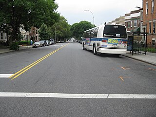
The Crosstown Line is a public transit line in Brooklyn, New York City, running along Van Brunt Street and Manhattan Avenue between Red Hook and Long Island City, Queens. Originally a streetcar line, it is now the B61 and the B62 bus routes. The northern section, the B62, is operated by MTA New York City Bus' Grand Avenue Depot in Maspeth, Queens, and the southern section is the B61, operated by MTA New York City Bus' Jackie Gleason Depot in Sunset Park. The entire route was a single line, the B61, until January 3, 2010; the B62 was previously a separate, parallel route between Downtown Brooklyn and Greenpoint, now part of the B43 route. The streetcar line, B61 and the original B62 previously operated from the now-closed Crosstown Depot in Greenpoint.
The Broadway Line was a public transit line in Brooklyn, New York City, United States along Broadway between Williamsburg and East New York. Originally a streetcar line, it later became a bus route, but no bus currently operates over the entire length of Broadway, with the BMT Jamaica Line above.

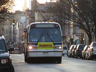
The Graham Avenue Line and Tompkins Avenue Line were two public transit lines in Brooklyn, New York City with the Graham Avenue Line running mainly along Graham Avenue and Manhattan Avenue and the Tompkins Avenue Line running mainly along Tompkins Avenue. The Graham Avenue line ran between Downtown Brooklyn and Greenpoint and the Tompkins Avenue Line ran between Prospect Lefferts Gardens and Williamsburg. Originally streetcar lines, they were replaced by the B47 and B62 bus routes which were then combined to form the B43 route which currently operates between Prospect-Lefferts Gardens and Greenpoint. The line is dispatched from Jackie Gleason Depot in Sunset Park, Brooklyn.
The Union Avenue Line was a public transit line in Brooklyn, New York City, United States, running mostly along Myrtle Avenue, Knickerbocker Avenue, Flushing Avenue, Throop Avenue, and Union Avenue from Ridgewood, Queens northwest to Greenpoint, Brooklyn.
The B48 bus route constitutes a public transit line in Brooklyn, New York City, running along Lorimer Street, Franklin Avenue, and Classon Avenue between Flatbush and Greenpoint. Originally the Lorimer Street streetcar line, it is now a bus route operated by MTA New York City Bus.

The Broadway Line is a surface transit line in Manhattan, New York City, running mainly along 42nd Street and Broadway from Murray Hill to Harlem. Formerly a streetcar line operated by the Third Avenue Railway, it is now the M104 bus route operated by the New York City Transit Authority, a subsidiary of the Metropolitan Transportation Authority. This bus route no longer runs along the entire route of the former streetcar.

The West End Line or New Utrecht Avenue Line was a surface transit line in Brooklyn, New York City, United States, running along New Utrecht Avenue and other streets between Coney Island and Sunset Park. Built by the Brooklyn, Bath and Coney Island Railroad as a steam line, it became a trolley line, along which elevated trains ran until the new elevated BMT West End Line opened. This route is no longer part of any bus line; its southern part was part of a bus route. In 2013, the B64 route to Coney Island was restored.
Nassau Railroad Company was a streetcar company that ran in Queens and Kings Counties in the State of New York during the 1850s and 1860s. It should not be confused with the Nassau Electric Railroad.

McGuinness Boulevard is a boulevard in Greenpoint, a neighborhood in the New York City borough of Brooklyn. It runs between Interstate 278 to the south to the Pulaski Bridge in the north, which connects to Queens and Jackson Avenue. South of Driggs Avenue, it is called McGuinness Boulevard South.
References
- ↑ New York State Public Service Commission for the 1st District 1913 Report
- ↑ "What is Being Done at Albany". Brooklyn Daily Eagle. April 25, 1868. p. 2 – via Newspapers.com.

Companies and predecessors of the Brooklyn–Manhattan Transit Corporation | |||||
|---|---|---|---|---|---|
| Elevated railroads and subways |
|   | |||
| Streetcars and cable cars |
| ||||
| Buses | |||||
| Streetcar lists | |||||
| Other |
| ||||