Related Research Articles

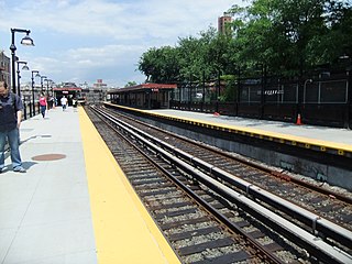
The Spring Street station is a local station on the IRT Lexington Avenue Line of the New York City Subway. Located at the intersection of Lafayette Street and Spring Street in SoHo and Little Italy, Manhattan, it is served by 6 trains at all times, <6> trains during weekdays in the peak direction, and 4 trains during late night hours.
The IRT Lexington Avenue Line is one of the lines of the A Division of the New York City Subway, stretching from Lower Manhattan north to 125th Street in East Harlem. The line is served by the 4, 5, 6, and <6> trains.

New York City Subway chaining is a method to precisely specify locations along the New York City Subway lines. It measures distances from a fixed point, called chaining zero, following the twists and turns of the railroad line, so that the distance described is understood to be the "railroad distance," not the distance by the most direct route.

The 23rd Street Crosstown is a surface transit line on 23rd Street in Manhattan, New York City. It currently hosts the M23 SBS bus route of the Metropolitan Transportation Authority (MTA)'s Regional Bus Operations. The M23 runs between Chelsea Piers, along the West Side Highway near 22nd Street, via 23rd Street, to Avenue C and 20th Street in Stuyvesant Town–Peter Cooper Village.

The 238th Street station is a local station on the IRT Broadway–Seventh Avenue Line of the New York City Subway. Located at the intersection of 238th Street and Broadway in the Kingsbridge Heights neighborhood of the Bronx, it is served by the 1 train at all times.

The 96th Street station is an express station on the IRT Broadway–Seventh Avenue Line of the New York City Subway. Located at the intersection of 96th Street and Broadway on the Upper West Side of Manhattan, it is served by the 1, 2, and 3 trains at all times.
The Dyckman Street station is a station on the IRT Broadway–Seventh Avenue Line of the New York City Subway. Located roughly at the intersection of Dyckman Street and Nagle Avenue in Inwood, Manhattan, it is served by the 1 train at all times.

The Canal Street station is a New York City Subway station complex. It is located in the Manhattan neighborhoods of Chinatown and SoHo, and is shared by the BMT Broadway Line, the IRT Lexington Avenue Line, and the BMT Nassau Street Line. It is served by the 6, J, N, and Q trains at all times; the R train at all times except late nights; the W train during weekdays; the <6> train during weekdays in the peak direction; the Z train during rush hours in the peak direction; and the 4 train during late nights.
The Sixth Avenue Line was a public transit line in Manhattan, New York City, running mostly along Sixth Avenue from Lower Manhattan to Central Park. Originally a streetcar line and later a bus route, it has been absorbed into the M5 bus route, which replaced the Broadway Line, as its northbound direction.

The Eighth Avenue Line is a public transit line in Manhattan, New York City, running mostly along Eighth Avenue from Lower Manhattan to Harlem. Originally a streetcar line, it is now the M10 bus route and the M20 bus route, operated by the New York City Transit Authority. The M10 bus now only runs north of 57th Street, and the M20 runs south of 66th Street. The whole line was a single route, the M10, until 2000 when the M20 was created.
The Ninth and Tenth Avenues Line or Ninth Avenue Line is a surface transit line in the New York City borough of Manhattan, running mostly along Ninth Avenue and Amsterdam Avenue from Lower Manhattan to Manhattanville. Originally a streetcar line operated by the Manhattan and Bronx Surface Transit Operating Authority, it is now the M11 bus route operated by the New York City Transit Authority.
The Houston, West Street and Pavonia Ferry Railroad was a street railway company in the U.S. state of New York. It owned and operated a system in Lower Manhattan, and became part of the Metropolitan Street Railway.

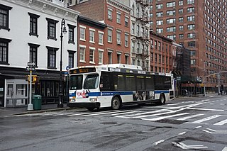
The M5 and M55 bus routes constitute a public transit corridor in Manhattan, New York City, running along the Fifth / Sixth Avenues / Riverside Drive Line as well as the southern portion of the Broadway Line after the discontinuation of the M6. The routes primarily run along Broadway, Fifth and Sixth Avenues, and Riverside Drive from South Ferry, Lower Manhattan to Washington Heights. The M5 covers the northern portion of the route north of 31st Street, while the M55 operates along the southern portion of the route south of 44th Street. The two routes overlap in Midtown Manhattan. The portion along Broadway south of East 8th Street was originally a streetcar line.

The Columbus Avenue Line is a public transit line in Manhattan, New York City, running mostly along Columbus Avenue, 116th Street, and Lenox Avenue from Lower Manhattan to Harlem. Originally a streetcar line, it is now the M7 bus route, operated by the New York City Transit Authority, a division of the Metropolitan Transportation Authority.
The Bleecker Street Line was a public transit line in Manhattan, New York City, United States, running mostly along Bleecker Street, Crosby Street, and Lafayette Street from the West 14th Street Ferry in Chelsea to the Fulton Ferry in the Financial District. It was the last horse car line in New York City, and was not replaced with a trolley line or bus route when it was abandoned in 1917.

The Broadway Line is a surface transit line in Manhattan, New York City, running mainly along 42nd Street and Broadway from Murray Hill to Harlem. Formerly a streetcar line operated by the Third Avenue Railway, it is now the M104 bus route operated by the New York City Transit Authority, a subsidiary of the Metropolitan Transportation Authority. This bus route no longer runs along the entire route of the former streetcar.
The Lenox Avenue Line is a surface transit line on Lenox Avenue in Harlem, Manhattan, New York City, United States. The line was once operated separately, but later became the northern end of the Broadway and Columbus Avenue Line and Broadway and Lexington Avenue Line, now the M7 and M102 bus routes.

West Broadway is a north-south street in the New York City borough of Manhattan, separated into two parts by Tribeca Park. The northern part begins at Tribeca Park, near the intersection of Avenue of the Americas, Walker Street and Beach Street in Tribeca. It runs northbound as a one-way street past Canal Street and becomes two-way at the intersection with Grand Street one block farther north. West Broadway then operates as a main north-south thoroughfare through SoHo until its northern end at Houston Street, on the border between SoHo and Greenwich Village. North of Houston Street, it is designated as LaGuardia Place, which continues until Washington Square South.

The Fulton Street station is a major New York City Subway station complex in Lower Manhattan. It consists of four linked stations on the IND Eighth Avenue Line, the IRT Lexington Avenue Line, the BMT Nassau Street Line and the IRT Broadway–Seventh Avenue Line. The complex is served by the 2, 4, A, and J trains at all times. The 3, 5, and C trains stop here at all times except late nights, and the Z stops during rush hours in the peak direction.

The Broadway–Lafayette Street/Bleecker Street station is a New York City Subway station complex in the NoHo neighborhood of Manhattan on the IRT Lexington Avenue Line and the IND Sixth Avenue Line. It is served by the 6, D, and F trains at all times; the B and M trains on weekdays; the <6> and <F> trains during rush hours in the peak direction; and the 4 train during late nights.
References
- ↑ Chapter 513, An Act to authorize the construction of a railroad in Seventh avenue, and in certain other streets and avenues of the city of New York, passed April 17, 1860, reproduced in A Compilation of the Ferry Leases and Railroad Grants Made by the Corporation of the City of New York, 1860, pages 354 to 359
- 1 2 Harry James Carman, The Street Surface Railway Franchises of New York City, pages 119 to 121
- ↑ New York Times, Our City Railroads, December 26, 1865, page 8
- ↑ Chapter 500, An Act to change the route of the Broadway and Seventh Avenue Railroad Company in the city of New York, reproduced in A Compilation of the Existing Ferry Leases and Railroad Grants Made by the Corporation of the City of New York, 1866, pages 412 to 413
| Current routes |  | |
|---|---|---|
| Former local routes | ||
| Former express routes | ||