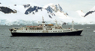
Booth Island is a Y-shaped island, 5 nautical miles long and rising to 980 metres (3,220 ft) in the northeast part of the Wilhelm Archipelago, Antarctica.
The Neptune Range is a mountain range, 70 nautical miles long, lying west-southwest of Forrestal Range in the central part of the Pensacola Mountains, Antarctica. The range comprises Washington Escarpment with its associated ridges, valleys and peaks, the Iroquois Plateau, the Schmidt and the Williams Hills.
The Keltie Glacier is a large Antarctic glacier, 30 nautical miles (56 km) long, draining from Pain Névé southwest around the southern extremity of the Commonwealth Range, and then northwest to enter Beardmore Glacier at Ranfurly Point. It was discovered by the British Antarctic Expedition, 1907–09, under Ernest Shackleton, who named it for Sir John Scott Keltie, Secretary of the Royal Geographical Society, 1892–1915.
The Anare Mountains are a large group of mainly snow-covered peaks and ridges along the northern coast of Victoria Land, Antarctica. The group is bounded on the north and east by the Pacific Ocean, on the west by Lillie Glacier, and on the south by Ebbe Glacier and Dennistoun Glacier. They are north of the Concord Mountains and east of the Bowers Mountains.

The Prince Charles Mountains are a major group of mountains in Mac. Robertson Land in Antarctica, including the Athos Range, the Porthos Range, and the Aramis Range. The highest peak is Mount Menzies, with a height of 3,228 m (10,591 ft). Other prominent peaks are Mount Izabelle and Mount Stinear. These mountains, together with other scattered peaks, form an arc about 420 km (260 mi) long, extending from the vicinity of Mount Starlight in the north to Goodspeed Nunataks in the south.
Wilson Hills is a group of scattered hills, nunataks and ridges that extend northwest–southeast about 70 nautical miles between Matusevich Glacier and Pryor Glacier in Antarctica.
The Rockefeller Mountains are a group of low-lying, scattered granite peaks and ridges, almost entirely snow-covered, standing 30 nautical miles south-southwest of the Alexandra Mountains on the Edward VII Peninsula of Antarctica.

Liv Glacier is a steep valley glacier, 40 nautical miles long, emerging from the Antarctic Plateau just southeast of Barnum Peak and draining north through the Queen Maud Mountains to enter Ross Ice Shelf between Mayer Crags and Duncan Mountains. It was discovered in 1911 by Roald Amundsen, who named it for the daughter of Fridtjof Nansen.
The Mariner Glacier is a major glacier over 60 nautical miles long, descending southeast from the plateau of Victoria Land, Antarctica, between Mountaineer Range and Malta Plateau, and terminating at Lady Newnes Bay, Ross Sea, where it forms the floating Mariner Glacier Tongue.
Aitkenhead Glacier is a 10 nautical miles long glacier flowing east-southeast from the Detroit Plateau, Graham Land, into Prince Gustav Channel.

Sigmen Glacier is a 2.2 km long and 2 km wide glacier draining the northwest slopes of Brugmann Mountains on Liège Island in the Palmer Archipelago, Antarctica. It is situated northeast of Zbelsurd Glacier and southwest of Shterna Glacier, draining the west-southwest slopes of Vazharov Peak and the northwest slopes of Mount Kozyak, and flows northwestwards to enter Palakariya Cove.
Campbell Glacier is a glacier, about 60 nautical miles long, originating near the south end of Mesa Range and draining southeast between the Deep Freeze Range and Mount Melbourne to discharge into north Terra Nova Bay in Victoria Land, Antarctica.
The Carey Range is a mountain range, about 35 nautical miles long and 5 nautical miles wide with peaks rising to 1,700 metres (5,600 ft), between Mosby Glacier and Fenton Glacier in southeast Palmer Land, Antarctica.

Cooper Snowfield is a snowfield with an area of about 25 square miles (65 km2) in the Churchill Mountains of Antarctica.
Kvinge Peninsula is a snow-covered peninsula at the north side of Palmer Inlet terminating in Cape Bryant, on the east coast of Palmer Land, Antarctica.
The Playfair Mountains are a group of mountains between Swann Glacier and Squires Glacier in southeast Palmer Land, Antarctica.

Paradise Harbour is a wide embayment behind Lemaire Island and Bryde Island, indenting the west coast of Graham Land, Antarctica, between Duthiers Point and Leniz Point. The name was first applied by whalers operating in the vicinity and was in use by 1920.
The Edgeworth Glacier is a glacier 12 nautical miles long, flowing south-southwestwards from the edge of Detroit Plateau below Wolseley Buttress to the ice shelf west of Sobral Peninsula, Graham Land, Antarctica.
Salamander Range is a distinctive linear range between Canham Glacier and Black Glacier, in the Freyberg Mountains, Antarctica. The range was named by the Northern Party of New Zealand Geological Survey Antarctic Expedition (NZGSAE), 1963–64, from the nickname given to Lord Freyberg by Sir Winston Churchill, for the lizard that is untouched by fire.
The Lillie Range in Antarctica extends northward from the Prince Olav Mountains to the Ross Ice Shelf. Mounts Hall, Daniel, Krebs and Mason are in the range.


