
The Bavarian Forest is a wooded, low-mountain region in Bavaria, Germany that is about 100 kilometres long. It runs along the Czech border and is continued on the Czech side by the Bohemian Forest. Most of the Bavarian Forest lies within the province of Lower Bavaria, but the northern part lies within Upper Palatinate. In the south it reaches the border with Upper Austria.

The Karawanks or Karavankas or Karavanks are a mountain range of the Southern Limestone Alps on the border between Slovenia to the south and Austria to the north. With a total length of 120 kilometres (75 mi) in an east–west direction, the Karawanks chain is one of the longest ranges in Europe. It is traversed by important trade routes and has a great tourist significance. Geographically and geologically, it is divided into the higher Western Karawanks and the lower-lying Eastern Karawanks. It is traversed by the Periadriatic Seam, separating the Apulian tectonic plate from the Eurasian Plate.

Wildspitze is the highest mountain in the Ötztal Alps and in North Tyrol, as well as the second highest mountain in Austria after the Großglockner and in terms of prominence is the fourth summit of the Alps and the fifteenth of Europe.

The Grossglockner, or just Glockner, is, at 3,798 metres above the Adriatic (12,461 ft), the highest mountain in Austria and the highest mountain in the Alps east of the Brenner Pass. It is part of the larger Glockner Group of the Hohe Tauern range, situated along the main ridge of the Central Eastern Alps and the Alpine divide. The Pasterze, Austria's most extended glacier, lies on the Grossglockner's eastern slope.
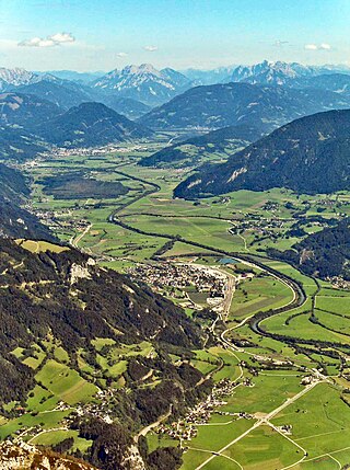
The Enns is a southern tributary of the river Danube in Austria, joining northward at the city of Enns. It forms much of the border between the states of Lower Austria and Upper Austria. The Enns spans 253 kilometres (157 mi), in a flat-J-shape. It flows from its source near the village Flachau, generally eastward through Radstadt, Schladming, and Liezen, then turns north near Hieflau, to flow past Weyer and Ternberg through Steyr, and further north to the Danube at Enns.
The Austrian Alpine Club has about 700,000 members in 194 sections and is the largest mountaineering organisation in Austria. It is responsible for the upkeep of over 234 alpine huts in Austria and neighbouring countries. It also maintains over 26,000 kilometres of footpaths, and produces detailed maps of key mountain areas within Austria. Much of this work is done by the association's 22,000 volunteers. The association has a museum in Innsbruck dedicated to the history of alpinism. It also has sections in Belgium and the United Kingdom, and a group in Poland.

Ortler is, at 3,905 m (12,812 ft) above sea level, the highest mountain in the Eastern Alps outside the Bernina Range. It is the main peak of the Ortler Range. It is the highest point of the Southern Limestone Alps, of South Tyrol in Italy, of Tyrol overall, and, until 1919, of the Austrian-Hungarian empire. In German the mountain is commonly referred to as "König Ortler", like in the unofficial hymn of South Tyrol, the Bozner Bergsteigerlied.

The Großer Priel is, at 2,515 metres above the Adriatic (8,251 ft), the highest mountain of the Totes Gebirge range, located in the Traunviertel region of Upper Austria. It ranks among the ultra prominent peaks of the Alps. Part of the Northern Limestone Alps, its steep Dachstein cliffs form the northeastern rim of a large karst plateau and are visible from afar across the Alpine Foreland.

Patscherkofel is a mountain and ski area in the Alps, in Tyrol in western Austria, 7 km (4 mi.) south of Innsbruck. The peak rises to a summit elevation of 2,246 m (7,369 ft) above sea level. The town of Igls at its northwest base is at 870 m (2,854 ft), a vertical drop of 1,376 m (4,514 ft).

The Battles of Monte Grappa were a series of three battles which were fought during World War I between the armies of the Austro-Hungarian Empire and the Kingdom of Italy for control of the Monte Grappa massif, as it covered the left flank of the Italian Piave front.

The German Alpine Club is the world's largest climbing association and the eighth-largest sporting association in Germany. It is a member of the German Olympic Sports Confederation and the competent body for sport and competition climbing, hiking, mountaineering, hill walking, ice climbing, mountain expeditions, as well as ski mountaineering. It is an association made up of local branches known as 'sections'.

Alpine Club maps are especially detailed maps for summer and winter mountain climbers, hikers, and ski tourers. They are predominantly published at a scale of 1:25.000, although some sheets have scales of 1:50.000 and 1:100.000.
