Related Research Articles

The Chenango River is a 90-mile-long (140 km) tributary of the Susquehanna River in central New York in the United States. It drains a dissected plateau area in upstate New York at the northern end of the Susquehanna watershed.

The West Branch Delaware River is one of two branches that form the Delaware River. It is approximately 90 mi (144 km) long, and flows through the U.S. states of New York and Pennsylvania. It winds through a mountainous area of New York in the western Catskill Mountains for most of its course, before joining the East Branch along the northeast border of Pennsylvania with New York. Midway or so it is empounded by the Cannonsville Dam to form the Cannonsville Reservoir, both part of the New York City water supply system for delivering drinking water to the City.

The Sacandaga River is a 64-mile-long (103 km) river in the northern part of New York in the United States. Its name comes from the Native American Sa-chen-da'-ga, meaning "overflowed lands".
Ohio Brush Creek is a 59.9-mile-long (96.4 km) tributary of the Ohio River in southern Ohio in the United States. Via the Ohio River, it is part of the watershed of the Mississippi River, draining an area of 435 square miles (1,130 km2). According to the Geographic Names Information System, it has also been known historically as "Brush Creek," "Elk Creek," and "Little Scioto River".

Stony Clove Creek is a 10.3-mile-long (16.6 km) creek in the Catskill Mountains in New York. It is a tributary of Esopus Creek, which in turn is a tributary of the Hudson River. It joins the Esopus in the village of Phoenicia, and has two smaller tributaries up north of Phoenicia.
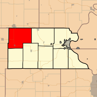
Grasshopper Township is a township in Atchison County, Kansas, United States. As of the 2010 census, its population was 567.

Spring Valley Township is a township in Cherokee County, Kansas, USA. As of the 2000 census, its population was 1,007.

Crag Mountain, 1,503 feet (458 m), of the Bald Hills region of east Franklin County, Massachusetts is the southern and most apparent summit of Brush Mountain, 1,507 feet (459 m). Narrow and precipitous, the mountain offers expansive views from its open, knife-edge summit. Crag Mountain is composed of quartzite, a weather-resistant metamorphic rock. The 114 mile (183 km) Metacomet-Monadnock Trail traverses its summit ridge. Crag Mountain is located within the town of Northfield, Massachusetts.

Millbrook Township is a township in Graham County, Kansas, USA. As of the 2000 census, its population was 150.

The Titicus River is an 8.5-mile-long (13.7 km) river in southwestern Connecticut and southeastern New York that drains into the Titicus Reservoir, part of New York City's water supply system. Part of both the Croton River watershed and the system's Croton Watershed, has a 23.8 square miles (62 km2) drainage area. It is one of the few rivers with headwaters in Connecticut that is part of the system. The source of the river is in Ridgefield, Connecticut. About one mile down stream, the stream marks the southern boundary of the Kiahs Brook Reserve. Another 0.5 miles downriver, it joins with Kiahs Brook, and then runs fairly close to Route 116. Once past the New York border, the Titicus River still runs close to New York 116 until emptying into the Titicus Reservoir. After the Titicus Reservoir, it runs another 0.5 miles, under I-684, and drains into the Muscoot Reservoir.
Pilgrim's Rest is an unincorporated community in Brush Creek Township, Washington County, Arkansas, United States.
Spring Valley is an unincorporated community in Brush Creek Township, Washington County, Arkansas, United States.
Brush Glacier is a broad glacier in the northwest part of the Bear Peninsula, flowing west into Dotson Ice Shelf to the north of Jeffrey Head, in Marie Byrd Land. The head of the glacier is marked by rocky, wedge-shaped Rogers Spur. Webster Pass divides Brush Glacier from Holt Glacier.
Fish Creek is a moderately sized river emptying into the eastern end of Oneida Lake in Oneida County, New York. Formed by the confluence of its east and west forks near the hamlet of Blossvale, the creek flows southwest for 11 miles (18 km), through the towns of Annsville and Vienna. The last mile of the creek is channelized to form part of the Erie Canal, which joins the lake at Sylvan Beach. The creek drains approximately 528.9 square miles (1,370 km2) of the Tug Hill plateau country in Central New York.
Trout Brook, also called Ball Brook, is a cold water tributary of the Quinapoxet River located in Holden, Massachusetts. Trout Brook is stocked with trout each spring by the Massachusetts Fisheries and Wildlife Division. As the Quinapoxet River is part of the water supply for Worcester, Massachusetts, both the Quinapoxet and all of its major tributaries including Trout Brook are monitored by the USGS for water quality.
Charlotte Creek is a river located in Delaware County, New York. Charlotte Creek borders the southern border of Otsego County, New York for a few miles near the mouth. The creek converges with the Susquehanna River by Emmons, New York.

Bowmans Creek is a river in Montgomery County, New York. It begins west of the hamlet of Hessville and just south of the hamlet of Ripple Corners. It then flows in a mostly southeast direction for a few miles passing through the hamlet of Sprout Brook before flowing into the Canajoharie Creek just east of the hamlet of Sprout Brook.
References
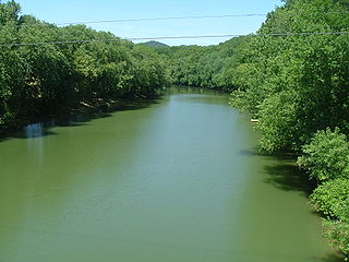
- ↑ "Brush Brook". usgs.gov. usgs. 1998. Retrieved 17 May 2017.
data