Bovina, New York | |
---|---|
Coordinates: 42°15′39″N74°46′56″W / 42.26083°N 74.78222°W | |
Country | United States |
State | New York |
County | Delaware |
Government | |
• Type | Town Council |
• Town Supervisor | Tina B. Mole (R) |
• Town Council | Members' List |
Area | |
• Total | 44.49 sq mi (115.24 km2) |
• Land | 44.26 sq mi (114.64 km2) |
• Water | 0.23 sq mi (0.60 km2) |
Elevation | 1,729 ft (527 m) |
Population (2010) | |
• Total | 633 |
• Estimate (2016) [2] | 595 |
• Density | 13.44/sq mi (5.19/km2) |
Time zone | UTC-5 (Eastern (EST)) |
• Summer (DST) | UTC-4 (EDT) |
FIPS code | 36-025-07597 |
GNIS feature ID | 0978745 |
Website | bovinany |
Bovina is a town in Delaware County, New York, United States. The population was 633 at the 2010 census. [3] The name "Bovina" was suggested by General Erastus Root, who noted the area's fitness for grazing. [4] Bovina is an interior town in the eastern part of the county.
The town formed in 1820 from parts of the towns of Delhi, Stamford, and Middletown. The town's population was around 1,200 at its creation, but after reaching a peak in the 1840s, it steadily declined. The town became noted for the quality of its dairy products, especially butter, in the late 19th century.
The Burns Family Farm was listed on the National Register of Historic Places in 2007. [5]
The town has some of the highest uplands in the county. The elevation of the highest point exceeds 3,340 feet (1,020 m) above sea level, on an unnamed summit at the eastern corner of the town overlooking the Plattekill Mountain ski area in neighboring Roxbury.
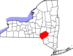
According to the United States Census Bureau, the town of Bovina has a total area of 44.5 square miles (115.2 km2), of which 44.2 square miles (114.6 km2) is land and 0.2 square miles (0.6 km2), or 0.52%, is water. [3]
Census | Pop. | Note | %± |
---|---|---|---|
1820 | 1,207 | — | |
1830 | 1,346 | 11.5% | |
1840 | 1,403 | 4.2% | |
1850 | 1,316 | −6.2% | |
1860 | 1,242 | −5.6% | |
1870 | 1,022 | −17.7% | |
1880 | 1,022 | 0.0% | |
1890 | 1,007 | −1.5% | |
1900 | 932 | −7.4% | |
1910 | 912 | −2.1% | |
1920 | 858 | −5.9% | |
1930 | 771 | −10.1% | |
1940 | 806 | 4.5% | |
1950 | 711 | −11.8% | |
1960 | 594 | −16.5% | |
1970 | 506 | −14.8% | |
1980 | 562 | 11.1% | |
1990 | 550 | −2.1% | |
2000 | 664 | 20.7% | |
2010 | 633 | −4.7% | |
2016 (est.) | 595 | [2] | −6.0% |
U.S. Decennial Census [6] |
As of the census [7] of 2000, there were 664 people, 277 households, and 193 families residing in the town. The population density was 15.0 people per square mile (5.8/km2). There were 521 housing units at an average density of 11.7 per square mile (4.5/km2). The racial makeup of the town was 98.34% White, 0.15% African American, 0.45% Native American, 0.30% Asian, 0.15% from other races, and 0.60% from two or more races. Hispanic or Latino of any race were 2.71% of the population.
There were 277 households, out of which 24.5% had children under the age of 18 living with them, 60.3% were married couples living together, 5.8% had a female householder with no husband present, and 30.3% were non-families. 22.7% of all households were made up of individuals, and 11.2% had someone living alone who was 65 years of age or older. The average household size was 2.40 and the average family size was 2.78.
In the town, the population was spread out, with 19.9% under the age of 18, 5.6% from 18 to 24, 22.6% from 25 to 44, 30.1% from 45 to 64, and 21.8% who were 65 years of age or older. The median age was 46 years. For every 100 females, there were 101.2 males. For every 100 females age 18 and over, there were 105.4 males.
The median income for a household in the town was $43,359, and the median income for a family was $46,094. Males had a median income of $30,875 versus $21,442 for females. The per capita income for the town was $19,653. About 3.4% of families and 5.7% of the population were below the poverty line, including 4.7% of those under age 18 and 2.6% of those age 65 or over.
Knox is a town in Albany County, New York, United States. The population was 2,692 at the 2010 census.
Meredith is a town in Delaware County, New York, United States. The population was 1,529 at the 2010 census. It is an interior town in the northern part of the county.
Lincoln is a town in Madison County, New York, United States. The population was 2,012 at the 2010 census.
Hagaman, formerly Hagamans Mills, is a village in Montgomery County, New York, United States. The population was 1,292 at the 2010 census. It is named after Joseph Hagaman, the founding father.
Rockland is a town in the northern part of Sullivan County, New York, United States. At the 2020 census, the population was 3,290.
Thompson is a town in the southern part of Sullivan County, New York, United States. The population was 16,550 at the 2020 census. The town is named after William Thompson, an early settler.
Sodus Point is a village in Wayne County, New York, United States. The population was 900 at the 2010 census. However, the last official US Census in 2020 recorded the population at 822. The name is derived from a nearby body of water, Sodus Bay. It is considered to be within the larger Rochester metropolitan area.
Breckinridge is a town in Garfield County, Oklahoma, United States. The population was 245 at the 2010 census.
Juniata Township is a township in Perry County, Pennsylvania, United States. As of the 2020 census, the township population was 1,531.
Hopewell Township is a township in Washington County, Pennsylvania, United States. The population was 853 at the 2020 census.
Morris Township is a township in Washington County, Pennsylvania, United States. The population was 906 at the 2020 census.
Fairfield Township is a township in Westmoreland County, Pennsylvania, United States. The population was 2,051 at the 2020 census.
Noxen Township is a township that is located in Wyoming County, Pennsylvania, United States. The population was 919 at the time of the 2020 census.
Gretna is a town in Pittsylvania County, Virginia, United States. The population was 1,267 at the 2010 census. It is part of the Danville Metropolitan Statistical Area.
Mount Crawford is a town in Rockingham County, Virginia, United States. It is included in the Harrisonburg Metropolitan Statistical Area, and the town's population was 433 at the 2010 census.
Newsoms is a town in Southampton County, Virginia, United States. The population was 282 at the 2000 census.
Albright is a town in central Preston County, West Virginia, United States, along the Cheat River. The population was 260 at the 2020 census. A former coal town, it is part of the Morgantown metropolitan area.
Tunnelton is a town in southwestern Preston County, West Virginia, United States. The population was 307 at the 2020 census. It is part of the Morgantown metropolitan area.
Harman is a town in Randolph County, West Virginia, United States. The population was 96 at the 2020 census.
Liberty is a village in Sullivan County, New York, United States. The population was 4,700 at the 2020 census.