Rock Rift, New York | |
---|---|
Coordinates: 42°05′32″N75°11′31″W / 42.0923080°N 75.1918367°W [1] | |
Country | United States |
State | New York |
County | Delaware |
Town | Tompkins |
Elevation | 1,289 ft (393 m) |
Time zone | UTC-5 (Eastern (EST)) |
• Summer (DST) | UTC-4 (EDT) |
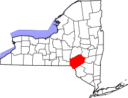
Rock Rift was a hamlet in Delaware County, New York, United States. It was located southwest of Walton on the bank of the West Branch Delaware River.
Rock Rift was a hamlet taken by eminent domain by New York City to build the Cannonsville Reservoir. There is a hiking trail that passes through the former settlement, constructed and maintained by the Finger Lakes Trail Conference (FLTC). Crumbling pavement from portions of old NYS Route 10 descend into the waters of the reservoir. Some bluestone front steps to homes and businesses remain, as the heart of the village was mostly located above the current waterline of Cannonsville Reservoir. The reservoir dams a portion of the West Branch of the Delaware River and provides potable water for New York City. [2]
The Delaware River is a major river in the Mid-Atlantic region of the United States and is the longest free-flowing (undammed) river in the Eastern United States. From the meeting of its branches in Hancock, New York, the river flows for 282 miles (454 km) along the borders of New York, Pennsylvania, New Jersey, and Delaware, before emptying into Delaware Bay.
Tompkins is a town in Delaware County, New York, United States. The population was 1,247 at the 2010 census. The town is named after Daniel D. Tompkins, the fourth governor of New York and sixth vice president of the United States.
Hancock is a town in Delaware County, New York, United States. The town contains a village, also named Hancock. The town is in the southwest part of the county. The population was 3,224 at the 2010 census. The town is the largest by area in Delaware County. The town borders two other counties, Sullivan County, NY, to the south and Wayne County, PA, to the west. The town is located partially in the Catskill Park.
The Beaver Kill, sometimes written as the Beaverkill or Beaverkill River, is a tributary of the East Branch Delaware River, a main tributary of the Delaware River, approximately 44 miles (71 km) long, in the U.S. state of New York. The kill drains a 300-square-mile (780 km2) area of the Catskill Mountains and has long been celebrated as one of the most famous trout streams in the United States. Its preservation helped establish many of the basic conservation principles of rivers in the United States.
The East Branch Delaware River is one of two branches that form the Delaware River. It is approximately 75 mi (121 km) long, and flows through the U.S. state of New York. It winds through a mountainous area on the southwestern edge of Catskill Park in the Catskill Mountains for most of its course, before joining the West Branch along the northeast border of Pennsylvania with New York. Much of it is paralleled by State Route 30.
The West Branch Delaware River is one of two branches that form the Delaware River. It is approximately 90 mi (144 km) long, and flows through the U.S. states of New York and Pennsylvania. It winds through a mountainous area of New York in the western Catskill Mountains for most of its course, before joining the East Branch along the northeast border of Pennsylvania with New York. Midway or so it is empounded by the Cannonsville Dam to form the Cannonsville Reservoir, both part of the New York City water supply system for delivering drinking water to the City.
Deposit is a town in Delaware County, New York, United States. As of the 2010 census, the town's population was 1,712.
Neversink Reservoir is a reservoir in the New York City water supply system. It is located in the Catskill Mountain town of Neversink in Sullivan County, New York, 75 miles (121 km) northwest of the City.
The Pepacton Reservoir, also known as the Downsville Reservoir, is a reservoir in Delaware County, New York on the East Branch of the Delaware River in the Catskill Mountains of New York. Part of the New York City water supply system, it was formed by the construction of Downsville Dam, and impounds over one-quarter of the East Branch's flow.
The Cannonsville Reservoir is a reservoir in the New York City water supply system in Delaware County, New York. It was formed by construction of the Cannonsville Dam on its west end, which impounded over half of the West Branch of the Delaware River. Lying on the western part of the Delaware Watershed, it is the westernmost of New York City's reservoirs. It was placed in service in 1964, and is the most recently constructed New York City-owned reservoir.
New York State Route 268 (NY 268) is a state highway located in southwestern Delaware County, New York, in the United States. It runs from NY 97 in Hancock north over 10 miles (16 km) to a bridge over Cannonsville Reservoir near the former site of the hamlet of Rock Rift in Tompkins. There, it ends at a junction with NY 10. NY 268 meets the Quickway (NY 17) east of the Hancock village limits.
Downsville is a hamlet, census-designated place (CDP), and former village in the town of Colchester, Delaware County, New York, United States. The population was 617 at the 2010 census.
Roods Creek is a river in Delaware County, New York. It begins just south of Cannonsville Reservoir and flows south into Crystal Lake. After exiting Crystal Lake it continues flowing south and then flows into Silver Lake. After exiting Silver Lake it continues southward before converging with the West Branch Delaware River east of the hamlet of Hale Eddy.
Chamberlain Brook is a river in Delaware County, New York. It flows into Cannonsville Reservoir west-northwest of Rock Rift.
Dryden Brook is a river in Delaware County, New York. It flows into Cannonsville Reservoir west-northwest of Rock Rift.
Maxwell Brook is a river in Delaware County, New York. It flows into Cannonsville Reservoir west-northwest of Rock Rift.
Fish Brook is a river in Delaware County, New York. It flows into Cannonsville Reservoir west-southwest of Rock Rift.
Rock Rift Fire Observation Tower, also known as the Rock Rift Fire Tower, is a historic fire observation station located in the Town of Tompkins, Delaware County, New York. The tower stands at the summit of Tower Mountain at an elevation of 2,376 ft (724 m) and rises above the Cannonsville Reservoir, part of New York City’s extensive water supply system. It was built in 1934 and listed on the National Register of Historic Places # 100003231 in 2018. The Rock Rift Fire Tower is also listed on the National Historic Lookout Register of the Forest Fire Lookout Association. Its listing numbers are US 1183, NY 41. The tower was transferred to the Town of Tompkins from New York State Department of Environmental Conservation in 2017. The land that the tower rests on is owned by New York City as part of their West of Hudson Watershed. The tower was decommissioned from active use in 1989.
Tower Mountain is a mountain located in the Catskill Mountains of New York state, east-northeast of Deposit in Delaware County. Speedwell Mountain is located west-southwest of Tower Mountain, Walton Mountain is located north-northeast of it, and Crane Hill is located northeast of Tower Mountain. In 1934, the Civilian Conservation Corps built what was known as the Rock Rift Fire Observation Tower on the mountain. The tower ceased fire lookout operations at the end of the 1988 season and was officially closed in early 1989. At the present time the tower is not safe to climb. The first set of steps has been removed to prevent injury. Restoration of the tower is planned by the Town of Tompkins.