Ojców is a village in Gmina Skała, in Kraków County, Lesser Poland Voivodeship, in southern Poland. It is one of the sights of the Eagle Nests Trail, as there are the ruins of a gothic castle near the village. The village is where the authorities of the Ojców National Park have their headquarters. It lies approximately 4 kilometres (2 mi) south-west of Skała and 18 km (11 mi) north-west of the regional capital Kraków.

Wojciechów is a village in the administrative district of Gmina Siedliszcze, within Chełm County, Lublin Voivodeship, in eastern Poland. It lies approximately 8 kilometres (5 mi) west of Siedliszcze, 30 km (19 mi) west of Chełm, and 35 km (22 mi) east of the regional capital Lublin.
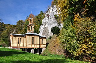
Czerna is a village in the administrative district of Gmina Krzeszowice, within Kraków County, Lesser Poland Voivodeship, in southern Poland. It lies approximately 5 kilometres (3 mi) north of Krzeszowice and 26 km (16 mi) north-west of the regional capital Kraków. The village is located in the historical region Galicia.
Żary is a village in the administrative district of Gmina Krzeszowice, within Kraków County, Lesser Poland Voivodeship, in southern Poland. It lies approximately 7 kilometres (4 mi) north-east of Krzeszowice and 22 km (14 mi) north-west of the regional capital Kraków. The village is located in the historical region Galicia.

Balice is a village in the administrative district of Gmina Zabierzów, within Kraków County, Lesser Poland Voivodeship, in southern Poland. It lies approximately 4 kilometres (2 mi) south of Zabierzów and 11 km (7 mi) west of the city centre of Kraków.
Karniowice is a village in the administrative district of Gmina Zabierzów, within Kraków County, Lesser Poland Voivodeship, in southern Poland. The village is located in the historical region Galicia.
Rząska is a village in the administrative district of Gmina Zabierzów, within Kraków County, Lesser Poland Voivodeship, in southern Poland. It lies approximately 5 kilometres (3 mi) south-east of Zabierzów and 9 km (6 mi) north-west of the regional capital Kraków.
Ujazd is a village in the administrative district of Gmina Zabierzów, within Kraków County, Lesser Poland Voivodeship, in southern Poland. It lies approximately 4 kilometres (2 mi) north-east of Zabierzów and 12 km (7 mi) north-west of the regional capital Kraków. The village is located in the historical region Galicia.
Boleń is a village in the administrative district of Gmina Zielonki, within Kraków County, Lesser Poland Voivodeship, in southern Poland. It lies approximately 9 km (6 mi) north of the regional capital Kraków. The village is located in the historical region Galicia.

Bosutów is a village in the administrative district of Gmina Zielonki, within Kraków County, Lesser Poland Voivodeship, in southern Poland. It lies approximately 9 km (6 mi) north-east of the regional capital Kraków. The village is located in the historical region Galicia.
Owczary is a village in the administrative district of Gmina Zielonki, within Kraków County, Lesser Poland Voivodeship, in southern Poland. It lies approximately 13 km (8 mi) north of the regional capital Kraków.
Pękowice is a village in the administrative district of Gmina Zielonki, within Kraków County, Lesser Poland Voivodeship, in southern Poland. It lies approximately 8 km (5 mi) north of the regional capital Kraków. The village is located in the historical region Galicia.
Przybysławice is a village in the administrative district of Gmina Zielonki, within Kraków County, Lesser Poland Voivodeship, in southern Poland. It lies approximately 12 km (7 mi) north of the regional capital Kraków.
Maków is a village in the administrative district of Gmina Gołcza, within Miechów County, Lesser Poland Voivodeship, in southern Poland. It lies approximately 4 kilometres (2 mi) north-west of Gołcza, 10 km (6 mi) west of Miechów, and 34 km (21 mi) north of the regional capital Kraków.
Lasochów is a village in the administrative district of Gmina Małogoszcz, within Jędrzejów County, Świętokrzyskie Voivodeship, in south-central Poland. It lies approximately 8 kilometres (5 mi) west of Małogoszcz, 20 km (12 mi) north-west of Jędrzejów, and 33 km (21 mi) west of the regional capital Kielce.
Ameliówka is a village in the administrative district of Gmina Masłów, within Kielce County, Świętokrzyskie Voivodeship, in south-central Poland.
Wojciechów is a village in the administrative district of Gmina Krasocin, within Włoszczowa County, Świętokrzyskie Voivodeship, in south-central Poland. It lies approximately 6 kilometres (4 mi) north-east of Krasocin, 17 km (11 mi) north-east of Włoszczowa, and 32 km (20 mi) west of the regional capital Kielce.
Nowe Iganie is a village in the administrative district of Gmina Siedlce, within Siedlce County, Masovian Voivodeship, in east-central Poland.
Klecie is a village in the administrative district of Gmina Stare Pole, within Malbork County, Pomeranian Voivodeship, in northern Poland. It lies approximately 4 kilometres (2 mi) south-west of Stare Pole, 10 km (6 mi) east of Malbork, and 52 km (32 mi) south-east of the regional capital Gdańsk.
Olszynka is a village in the administrative district of Gmina Korsze, within Kętrzyn County, Warmian-Masurian Voivodeship, in northern Poland.


