Topola is a village in the administrative district of Gmina Kamieniec Ząbkowicki, within Ząbkowice Śląskie County, Lower Silesian Voivodeship, in south-western Poland. Prior to 1945 it was in Germany. It lies approximately 5 kilometres (3 mi) south-east of Kamieniec Ząbkowicki, 12 km (7 mi) south-east of Ząbkowice Śląskie, and 70 km (43 mi) south of the regional capital Wrocław.
Wołkuny is a village in the administrative district of Gmina Poświętne, within Białystok County, Podlaskie Voivodeship, in north-eastern Poland.

Chodaki is a village in the administrative district of Gmina Zadzim, within Poddębice County, Łódź Voivodeship, in central Poland. It lies approximately 6 kilometres (4 mi) east of Zadzim, 13 km (8 mi) south of Poddębice, and 38 km (24 mi) west of the regional capital Łódź.

Kalinowa is a village in the administrative district of Gmina Zapolice, within Zduńska Wola County, Łódź Voivodeship, in central Poland. It lies approximately 7 kilometres (4 mi) south-east of Zapolice, 13 km (8 mi) south of Zduńska Wola, and 50 km (31 mi) south-west of the regional capital Łódź.

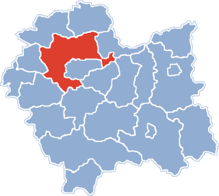
Balice is a village in the administrative district of Gmina Zabierzów, within Kraków County, Lesser Poland Voivodeship, in southern Poland. It lies approximately 4 kilometres (2 mi) south of Zabierzów and 11 km (7 mi) west of the city centre of Kraków.

Boleń is a village in the administrative district of Gmina Zielonki, within Kraków County, Lesser Poland Voivodeship, in southern Poland. It lies approximately 9 km (6 mi) north of the regional capital Kraków. The village is located in the historical region Galicia.

Januszowice is a village in the administrative district of Gmina Zielonki, within Kraków County, Lesser Poland Voivodeship, in southern Poland. It lies approximately 10 km (6 mi) north of the regional capital Kraków.
Jaksice is a village in the administrative district of Gmina Koszyce, within Proszowice County, Lesser Poland Voivodeship, in southern Poland.

Włochy is a village in the administrative district of Gmina Nowa Słupia, within Kielce County, Świętokrzyskie Voivodeship, in south-central Poland. It lies approximately 7 kilometres (4 mi) north-east of Nowa Słupia and 38 km (24 mi) east of the regional capital Kielce.

Cierpisz is a village in the administrative district of Gmina Sędziszów Małopolski, within Ropczyce-Sędziszów County, Subcarpathian Voivodeship, in south-eastern Poland. It lies approximately 9 kilometres (6 mi) north of Sędziszów Małopolski, 9 km (6 mi) north-east of Ropczyce, and 24 km (15 mi) north-west of the regional capital Rzeszów.

Święcica is a village in the administrative district of Gmina Rytwiany, within Staszów County, Świętokrzyskie Voivodeship, in south-central Poland. It lies approximately 6 kilometres (4 mi) south-west of Rytwiany, 7 km (4 mi) south of Staszów, and 57 km (35 mi) south-east of the regional capital Kielce.

Adamów is a village in the administrative district of Gmina Grodzisk Mazowiecki, within Grodzisk Mazowiecki County, Masovian Voivodeship, in east-central Poland.

Niesiobędy is a village in the administrative district of Gmina Krasne, within Przasnysz County, Masovian Voivodeship, in east-central Poland. It lies approximately 11 kilometres (7 mi) south of Przasnysz and 80 km (50 mi) north of Warsaw.

Modła Księża is a village in the administrative district of Gmina Stare Miasto, within Konin County, Greater Poland Voivodeship, in west-central Poland. It lies approximately 5 kilometres (3 mi) south of Stare Miasto, 9 km (6 mi) south-west of Konin, and 93 km (58 mi) east of the regional capital Poznań.

Lizaki is a village in the administrative district of Gmina Kościerzyna, within Kościerzyna County, Pomeranian Voivodeship, in northern Poland. It lies approximately 6 kilometres (4 mi) south-west of Kościerzyna and 57 km (35 mi) south-west of the regional capital Gdańsk.

Kołtyniany is a village in the administrative district of Gmina Stary Dzierzgoń, within Sztum County, Pomeranian Voivodeship, in northern Poland. It lies approximately 10 kilometres (6 mi) north of Stary Dzierzgoń, 28 km (17 mi) east of Sztum, and 73 km (45 mi) south-east of the regional capital Gdańsk.

Kaszuny is a village in the administrative district of Gmina Lidzbark Warmiński, within Lidzbark County, Warmian-Masurian Voivodeship, in northern Poland. It lies approximately 17 kilometres (11 mi) west of Lidzbark Warmiński and 42 km (26 mi) north of the regional capital Olsztyn.

Raj is a village in the administrative district of Gmina Morąg, within Ostróda County, Warmian-Masurian Voivodeship, in northern Poland. It lies approximately 5 kilometres (3 mi) south of Morąg, 21 km (13 mi) north of Ostróda, and 40 km (25 mi) west of the regional capital Olsztyn.

Brzeziny is a village in the administrative district of Gmina Drawno, within Choszczno County, West Pomeranian Voivodeship, in north-western Poland. It lies approximately 10 kilometres (6 mi) south-west of Drawno, 20 km (12 mi) east of Choszczno, and 80 km (50 mi) east of the regional capital Szczecin.

Lestkowo is a village in the administrative district of Gmina Nowogard, within Goleniów County, West Pomeranian Voivodeship, in north-western Poland. It lies approximately 7 kilometres (4 mi) north of Nowogard, 29 km (18 mi) north-east of Goleniów, and 50 km (31 mi) north-east of the regional capital Szczecin.


