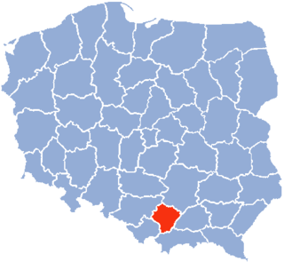
Kraków Voivodeship, refers to several historical Voivodeships of Poland in the surrounding regions, with the city of Kraków as its capital.

New Silesia was a small province of the Kingdom of Prussia from 1795 to 1807, created after the Third Partition of Poland. It was located northwest of Kraków and southeast of Częstochowa, in the lands that had been part of the Duchy of Siewierz and the adjacent Polish historical province of Lesser Poland, including the towns of Żarki, Pilica, Będzin, and Sławków.

The Archdiocese of Kraków is an archdiocese located in the city of Kraków in Poland. As of 2013 weekly mass attendance was 51.3% of the population.
Kraków Governorate was an administrative unit of the Congress Poland.
Kożanówka is a village in the administrative district of Gmina Rossosz, within Biała Podlaska County, Lublin Voivodeship, in eastern Poland.
Olchowiec is a village in the administrative district of Gmina Żółkiewka, within Krasnystaw County, Lublin Voivodeship, in eastern Poland.

Karkoszki is a village in the administrative district of Gmina Gomunice, within Radomsko County, Łódź Voivodeship, in central Poland. It lies approximately 3 kilometres (2 mi) south of Gomunice, 9 km (6 mi) north of Radomsko, and 72 km (45 mi) south of the regional capital Łódź.
Radzibórz is a village in the administrative district of Gmina Parzęczew, within Zgierz County, Łódź Voivodeship, in central Poland. It lies approximately 5 kilometres (3 mi) south-east of Parzęczew, 14 km (9 mi) north-west of Zgierz, and 21 km (13 mi) north-west of the regional capital Łódź.
Borki is a village in the administrative district of Gmina Szczucin, within Dąbrowa County, Lesser Poland Voivodeship, in southern Poland. It lies approximately 6 kilometres (4 mi) east of Szczucin, 21 km (13 mi) north-east of Dąbrowa Tarnowska, 36 km (22 mi) north-east of Tarnów and 91 km (57 mi) east of the regional capital Kraków.
Padoły is a settlement in the administrative district of Gmina Biecz, within Gorlice County, Lesser Poland Voivodeship, in southern Poland. It lies approximately 10 kilometres (6 mi) west of Biecz, 12 km (7 mi) north of Gorlice, and 93 km (58 mi) east of the regional capital Kraków.
Brzana Górna is a village in the administrative district of Gmina Bobowa, within Gorlice County, Lesser Poland Voivodeship, in southern Poland. It lies approximately 4 kilometres (2 mi) north-west of Bobowa, 21 km (13 mi) north-west of Gorlice, and 79 km (49 mi) south-east of the regional capital Kraków. The village has a population of 600.

Bieliny is a village in Kielce County, Świętokrzyskie Voivodeship, in south-central Poland. It is the seat of the gmina called Gmina Bieliny. It lies approximately 21 km (13 mi) east of the regional capital Kielce.
Stary Sokołów is a village in the administrative district of Gmina Końskie, within Końskie County, Świętokrzyskie Voivodeship, in south-central Poland. It lies approximately 11 kilometres (7 mi) south-west of Końskie and 36 km (22 mi) north-west of the regional capital Kielce.
Czachów is a village in the administrative district of Gmina Ożarów, within Opatów County, Świętokrzyskie Voivodeship, in south-central Poland. It lies approximately 4 kilometres (2 mi) north-east of Ożarów, 23 km (14 mi) north-east of Opatów, and 77 km (48 mi) east of the regional capital Kielce.
Grzegorzowice is a village in the administrative district of Gmina Waśniów, within Ostrowiec County, Świętokrzyskie Voivodeship, in south-central Poland. It lies approximately 7 kilometres (4 mi) south-west of Waśniów, 20 km (12 mi) west of Ostrowiec Świętokrzyski, and 37 km (23 mi) east of the regional capital Kielce.
Nowe Sady is a village located in Poland, in the Opole Voivodeship, Głubczyce County and Gmina Głubczyce.
Michałów is a village in the administrative district of Gmina Kłomnice, within Częstochowa County, Silesian Voivodeship, in southern Poland. It lies approximately 2 kilometres (1 mi) south of Kłomnice, 22 km (14 mi) north-east of Częstochowa, and 78 km (48 mi) north of the regional capital Katowice.
Kołacin is a settlement in Gmina Miastko, Bytów County, Pomeranian Voivodeship, in northern Poland. It lies approximately 30 kilometres (19 mi) south-west of Bytów and 109 km (68 mi) south-west of Gdańsk.
Zwierzyniec Trzeci is a village in the administrative district of Gmina Panki, within Kłobuck County, Silesian Voivodeship, in southern Poland. It lies approximately 4 kilometres (2 mi) north of Panki, 12 km (7 mi) west of Kłobuck, and 76 km (47 mi) north of the regional capital Katowice.
Nidowo is a village in the administrative district of Gmina Nowy Staw, within Malbork County, Pomeranian Voivodeship, in northern Poland. It lies approximately 8 kilometres (5 mi) east of Nowy Staw, 14 km (9 mi) north-east of Malbork, and 41 km (25 mi) south-east of the regional capital Gdańsk.


