
Choszczówka Dębska is a village in the administrative district of Gmina Dębe Wielkie, within Mińsk County, Masovian Voivodeship, in east-central Poland. It lies approximately 4 kilometres (2 mi) north-east of Dębe Wielkie, 6 km (4 mi) north-west of Mińsk Mazowiecki, and 35 km (22 mi) east of Warsaw.
Choszczówka Rudzka is a village in the administrative district of Gmina Dębe Wielkie, within Mińsk County, Masovian Voivodeship, in east-central Poland. It lies approximately 3 kilometres (2 mi) north-east of Dębe Wielkie, 7 km (4 mi) north-west of Mińsk Mazowiecki, and 33 km (21 mi) east of Warsaw.
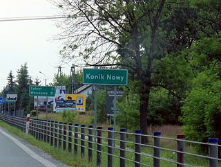
Nowy Konik is a village in the administrative district of Gmina Halinów, within Mińsk County, Masovian Voivodeship, in east-central Poland. It lies approximately 4 kilometres (2 mi) south-west of Halinów, 19 km (12 mi) west of Mińsk Mazowiecki, and 21 km (13 mi) east of Warsaw.
Anielinek is a village in the administrative district of Gmina Jakubów, within Mińsk County, Masovian Voivodeship, in east-central Poland. It lies approximately 6 kilometres (4 mi) north-east of Mińsk Mazowiecki and 44 km (27 mi) east of Warsaw.
Mistów is a village in the administrative district of Gmina Jakubów, within Mińsk County, Masovian Voivodeship, in east-central Poland. It lies approximately 5 kilometres (3 mi) north-east of Mińsk Mazowiecki and 41 km (25 mi) east of Warsaw.

Arynów is a village in the administrative district of Gmina Mińsk Mazowiecki, within Mińsk County, Masovian Voivodeship, in east-central Poland. It lies approximately 3 kilometres (2 mi) north-west of Mińsk Mazowiecki and 37 km (23 mi) east of Warsaw.
Barcząca is a village in the administrative district of Gmina Mińsk Mazowiecki, within Mińsk County, Masovian Voivodeship, in east-central Poland. It lies approximately 5 kilometres (3 mi) east of Mińsk Mazowiecki and 44 km (27 mi) east of Warsaw.
Budy Janowskie is a village in the administrative district of Gmina Mińsk Mazowiecki, within Mińsk County, Masovian Voivodeship, in east-central Poland. It lies approximately 6 kilometres (4 mi) east of Mińsk Mazowiecki and 45 km (28 mi) east of Warsaw.
Chmielew is a village in the administrative district of Gmina Mińsk Mazowiecki, within Mińsk County, Masovian Voivodeship, in east-central Poland. It lies approximately 7 kilometres (4 mi) south-east of Mińsk Mazowiecki and 43 km (27 mi) east of Warsaw.
Dłużka is a village in the administrative district of Gmina Mińsk Mazowiecki, within Mińsk County, Masovian Voivodeship, in east-central Poland. It lies approximately 4 kilometres (2 mi) north of Mińsk Mazowiecki and 40 km (25 mi) east of Warsaw.
Dziękowizna is a village in the administrative district of Gmina Mińsk Mazowiecki, within Mińsk County, Masovian Voivodeship, in east-central Poland. It lies approximately 6 kilometres (4 mi) east of Mińsk Mazowiecki and 45 km (28 mi) east of Warsaw.
Janów is a village in the administrative district of Gmina Mińsk Mazowiecki, within Mińsk County, Masovian Voivodeship, in east-central Poland. It lies approximately 7 kilometres (4 mi) east of Mińsk Mazowiecki and 46 km (29 mi) east of Warsaw.

Józefów is a village in the administrative district of Gmina Mińsk Mazowiecki, within Mińsk County, Masovian Voivodeship, in east-central Poland. It lies approximately 10 kilometres (6 mi) south-west of Mińsk Mazowiecki and 35 km (22 mi) east of Warsaw.
Karolina is a village in the administrative district of Gmina Mińsk Mazowiecki, within Mińsk County, Masovian Voivodeship, in east-central Poland. It lies approximately 3 kilometres (2 mi) north-east of Mińsk Mazowiecki and 40 km (25 mi) east of Warsaw.
Kolonia Janów is a village in the administrative district of Gmina Mińsk Mazowiecki, within Mińsk County, Masovian Voivodeship, in east-central Poland. It lies approximately 4 kilometres (2 mi) south-east of Mińsk Mazowiecki and 43 km (27 mi) east of Warsaw.
Osiny is a village in the administrative district of Gmina Mińsk Mazowiecki, within Mińsk County, Masovian Voivodeship, in east-central Poland. It lies approximately 4 kilometres (2 mi) east of Mińsk Mazowiecki and 43 km (27 mi) east of Warsaw.
Stojadła is a village in the administrative district of Gmina Mińsk Mazowiecki, within Mińsk County, Masovian Voivodeship, in east-central Poland. It lies approximately 3 kilometres (2 mi) west of Mińsk Mazowiecki and 37 km (23 mi) east of Warsaw.
Targówka is a village in the administrative district of Gmina Mińsk Mazowiecki, within Mińsk County, Masovian Voivodeship, in east-central Poland. It lies approximately 3 kilometres (2 mi) south-east of Mińsk Mazowiecki and 42 km (26 mi) east of Warsaw.
Zamienie is a village in the administrative district of Gmina Mińsk Mazowiecki, within Mińsk County, Masovian Voivodeship, in east-central Poland. It lies approximately 6 kilometres (4 mi) south-west of Mińsk Mazowiecki and 35 km (22 mi) east of Warsaw.
Suchowizna is a village in the administrative district of Gmina Stanisławów, within Mińsk County, Masovian Voivodeship, in east-central Poland. It lies approximately 3 kilometres (2 mi) south-west of Stanisławów, 10 km (6 mi) north of Mińsk Mazowiecki, and 37 km (23 mi) east of Warsaw.


