
Brecon, archaically known as Brecknock, is a market town and community in Powys, Wales, with a population in 2001 of 7,901, increasing to 8,250 at the 2011 census. Historically it was the county town of Brecknockshire (Breconshire); although its role as such was eclipsed with the formation of the County of Powys, it remains an important local centre. Brecon is the third-largest town in Powys, after Newtown and Ystradgynlais. It lies north of the Brecon Beacons mountain range, but is just within the Brecon Beacons National Park.
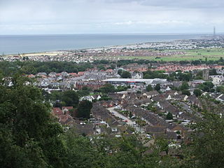
Abergele is a small market town and community, situated on the north coast of Wales between the holiday resorts of Colwyn Bay and Rhyl, in Conwy County Borough. Its northern suburb of Pensarn lies on the Irish Sea coast and is known for its beach, where it is claimed by some that a ghost ship has been sighted. Abergele and Pensarn railway station serves both resorts. Abergele is often overlooked due to the popularity of towns in nearby Rhyl, Prestatyn, Colwyn Bay, Llandudno and Conwy.
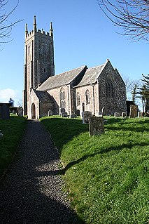
Bondleigh is a village and civil parish in the West Devon district of Devon, England, on the River Taw, north of North Tawton. According to the 2001 census it had a population of 123.

Dalmeny is a village and parish in Scotland. It is located on the south side of the Firth of Forth, 1 mile (1.6 km) southeast of South Queensferry and 8 miles (13 km) west of Edinburgh city centre. It lies within the traditional boundaries of West Lothian, and falls under the local governance of the City of Edinburgh Council.

Helmsley Castle is a medieval castle situated in the market town of Helmsley, within the North York Moors National Park, North Yorkshire, England.

Hertford Castle was a Norman castle situated by the River Lea in Hertford, the county town of Hertfordshire, England. Only the gatehouse survives, and is a Grade I listed building.
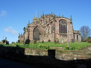
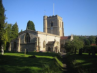
St Oswald's Church stands on the highest point in the market town of Malpas, Cheshire, England, on or near the site of a Norman motte and bailey castle. The church is recorded in the National Heritage List for England as a designated Grade I listed building and is recognised as being one of the best examples in Cheshire of a late 15th to early 16th-century church. It is an active Anglican parish church in the diocese of Chester, the archdeaconry of Chester and the deanery of Malpas. Its benefice is combined with those of St John, Threapwood, and Holy Trinity, Bickerton. Alec Clifton-Taylor includes it in his list of 'best' English parish churches.

The Church of the Holy Rude is the medieval parish church of Stirling, Scotland. The church was founded in 1129 during the reign of David I, but earliest part of the present church dates from the 15th century. As such it is the second oldest building in Stirling after Stirling Castle, parts of which date from the later 14th century. The chancel and tower were added in the 16th century.

Meigle is a village in Strathmore, Scotland. It lies in the council area of Perth and Kinross in the Coupar Angus and Meigle ward. The nearest town is Forfar in neighbouring Angus. Other smaller settlements nearby are Balkeerie, Kirkinch and Kinloch. Meigle is accessed from the north and south via the B954 road. Meigle was included in the locality of Alyth for the 2001 Census when the population for the division was 167871.

David Rhind FRSE was a prominent Scottish architect, mainly remembered for his public buildings, banks, churches and schools, most of which are now listed buildings.

Clavering Castle remains are situated in the small parish village of Clavering in the County of Essex, 50m north of the church of St Mary and St Clement on the southern bank of the River Stort, some 10 kilometres (6.2 mi) south-west of Bishop's Stortford.
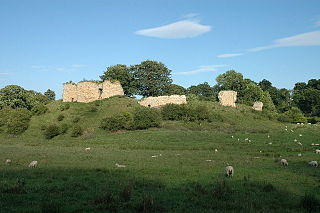
Mitford Castle is an English castle dating from the end of the 11th century and located at Mitford, Northumberland. It is a Scheduled Ancient Monument and a Grade I listed building, enlisted on 20 October 1969. The castle is also officially on the Buildings at Risk Register. The Norman motte and bailey castle stands on a small prominence, a somewhat elliptical mound, above the River Wansbeck. The selected building site allowed for it be to natural hill scarped and ditched, producing the motte.

Seix is a commune in the Ariège department in southwestern France.

While there are many castles in South Yorkshire, the majority are manor houses and motte-and-bailey which were commonly found in England after the Norman Conquest.
Northchurch is a village and civil parish in the Bulbourne valley in the county of Hertfordshire in the United Kingdom. It lies between the towns of Berkhamsted and Tring.

The Canongate Kirkyard stands around Canongate Kirk on the Royal Mile in Edinburgh, Scotland. The churchyard was used for burials from the late 1680s until the mid-20th century.
The Vale of Glamorgan has 740 listed buildings of which 4% are Grade I listed, 10% Grade II* listed and remainder Grade II listed.

Snead is a small village in Powys, Wales.

Brecon Castle is a castle in the town of Brecon, Wales. It was built by the Norman Lord Bernard de Neufmarché in 1093, and was frequently assaulted by the Welsh in 13th and 15th centuries. The castle's ownership changed numerous times. It began falling into ruin when Henry VIII executed the last dukes of Buckingham, who at the time controlled the castle. It was renovated and made a hotel in the early 19th century.


