Budaka town

Last updated
Budaka
Uganda location map.svg
Red pog.svg
Budaka
Location in Uganda
Coordinates: 01°01′00″N33°56′42″E / 1.01667°N 33.94500°E / 1.01667; 33.94500
Country Flag of Uganda.svg Uganda
Region Eastern Region of Uganda
District Budaka District
Elevation
3,810 ft (1,160 m)
Population
 (2014 Census)
  Total23,834 [1]

Budaka is a town in the Eastern Region of Uganda. It is the chief town of Budaka District, and the district headquarters are located there.

Contents

Location

Budaka is approximately 36 kilometres (22 mi), by road, west of Mbale, the largest city in the sub-region. [2] This is approximately 212 kilometres (132 mi), by road, north-east of Kampala, the capital and largest city of Uganda. [3] The coordinates of the town are:01 01 00N, 33 56 42E (Latitude:1.0150; Longitude:33.9450). [4]

Population

The 2002 national population census estimated the town's population at 17,000. The Uganda Bureau of Statistics (UBOS) estimated the 2010 population at 21,100. In 2011, UBOS estimated the population at 21,700. [1] [5]

Points of interest

The following points of interest are located within the town of Budaka or close to the edges of town:

Naboa Sub-County was given that name by British Colonial masters because the area was full of Grammodes geometrica moths (Nziira) of the family Erebidae.[ citation needed ]

The Basimba people of the Leopard Clan with the names Katunku, Ngulya, Kaabya, Mwati, Kabolesa, Namuyonjo, Ntembe of Lupada, Naboa Sub-County, Budaka County, Budaka District live among the Bagwere but trace their origin from Tanzania and Zambia. [6]

See also

Related Research Articles

Mbale Place in Eastern Uganda, Uganda

Mbale is a city in the Eastern Region of Uganda. It is the main municipal, administrative, and commercial center of Mbale District and the surrounding sub-region.

Moroto Town Place in Northern Region, Uganda

Moroto is a town in Moroto District in the Northern Region of Uganda. It is the location of the district headquarters.

Pallisa Place in Eastern Region of Uganda, Uganda

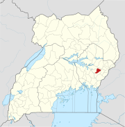
Pallisa is a town in Pallisa District of the Eastern Region of Uganda.

Bugiri Place in Eastern Uganda, Uganda

Bugiri is a town in the Eastern Region of Uganda. It is the chief town of Bugiri District, and the district headquarters are located there.

Iganga Place in Eastern Region of Uganda, Uganda

Iganga is a town in the Eastern Region of Uganda. It is the main municipal, administrative, and commercial center of Iganga District.

Kamuli Place in Eastern Uganda, Uganda

Kamuli is a town in the Eastern Region of Uganda. It is the main municipal, administrative, and commercial centre of Kamuli District, and the district headquarters are located there. The district is named after the town.

Katakwi Place in Eastern Region of Uganda

Katakwi is a town in the Eastern Region of Uganda. It is the main municipal, administrative, and commercial center of Katakwi District and the site of the district headquarters. It borders Moroto District.

Kamwenge Place in Western Uganda, Uganda

Kamwenge is a town in the Western Region of Uganda. It is the site of the Kamwenge District headquarters.

Kapchorwa Town in Eastern Uganda, Uganda

Kapchorwa is a town in the Eastern Region of Uganda. It is the main municipal, commercial, and administrative center of Kapchorwa District.Initially the present day kapchorwa was known as sebei region.

Kaberamaido Place in Eastern Uganda, Uganda

Kaberamaido is a town in Eastern Uganda. It is the main municipal, administrative and commercial center of Kaberamaido District and is the location of the headquarters for the district.

Nakapiripirit Place in Uganda

Nakapiripirit is a town in the Nakapiripirit District of the Northern Region of Uganda. It is the seat of the district headquarters. The town is an administrative unit of the district, at the level of a sub-county; one of the eight sub-counties in the district.

Butaleja Place in Eastern Uganda, Uganda

Butaleja is a town in Eastern Uganda. It is the main municipal, administrative and commercial center of Butaleja District and the district headquarters are located there. The district is named after the town.

Kaliro Place in Eastern Uganda, Uganda

Kaliro is a town in the Eastern Region of Uganda. It is the main municipal, administrative, and commercial center of Kaliro District and the site of the district headquarters.

Kumi Town Place in Eastern Region of Uganda, Uganda

Kumi Town, commonly called Kumi, is a town in the Eastern Region of Uganda. It is the main municipal, administrative, and commercial center in Kumi District and is the site of the district headquarters.

Busolwe Place in Eastern Uganda, Uganda

Busolwe is a town in the Eastern Region of Uganda. It is one of the two municipalities in Butaleja District, the other being Butaleja.

Bukedea Place in Uganda

Bukedea is a town in the Eastern Region of Uganda. It is the chief municipal, administrative, and commercial center of Bukedea District, and the district headquarters are located there.

Namutumba, Uganda Place in Eastern Region of Uganda, Uganda

Namutumba is a town in the Namutumba District of the Eastern Region of Uganda. It is the main municipal, administrative, and commercial centre of the district.

Abim, Uganda Place in Northern Uganda, Uganda

Abim is a town in the Northern Region of Uganda. It is the chief municipal, administrative, and commercial center of Abim District.

Nagongera Place in Uganda

Nagongera is a town in Tororo District, in the Eastern Region of Uganda.

Bududa Place in Uganda

Bududa is a town in the Eastern Region of Uganda. It is the main municipal, administrative, and commercial center of Bududa District.

References

  1. 1 2 UBOS, . (27 August 2014). "The Population of The Regions of the Republic of Uganda And All Cities And Towns of More Than 15,000 Inhabitants". Citypopulation.de Quoting Uganda Bureau of Statistics (UBOS). Retrieved 21 February 2015.CS1 maint: numeric names: authors list (link)
  2. "Road Distance Between Mbale And Budaka with Map". Globefeed.com. Retrieved 29 May 2014.
  3. "Map Showing Kampala And Budaka With Distance Marker". Globefeed.com. Retrieved 29 May 2014.
  4. Google (3 July 2015). "Location of Budaka Town At Google Maps" (Map). Google Maps . Google. Retrieved 3 July 2015.
  5. UBOS, . "Estimated Population of Budaka In 2002, 2010 & 2011" (PDF). Uganda Bureau of Statistics (UBOS). Archived from the original (PDF) on 7 July 2014. Retrieved 17 April 2014.CS1 maint: numeric names: authors list (link)
  6. Ethnographic Survey of Africa: East Central Africa, Parts 1-4, International African Institute, 1950, p. 80

Coordinates: 01°01′00″N33°56′42″E / 1.01667°N 33.94500°E / 1.01667; 33.94500