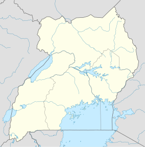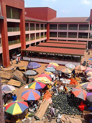
Hoima is the second capital of Uganda. It is the main municipal, administrative, and commercial center of Hoima District. It is also the location of the palace of the Omukama of Bunyoro.
Kabalega Hydroelectric Power Station, also known as Kabalega Power Station is a 9 MW (12,000 hp) mini hydroelectric power project located across River Wambabya, in Buseruka Sub County, Hoima District, in Western Uganda. At the beginning of planning and during construction, the power station was referred to as Buseruka Power Station, but was renamed after completion.
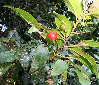
Celtis mildbraedii is a species of forest tree in the family Cannabaceae. It was previously assigned to the family Ulmaceae. These trees grow in limited areas of South Africa, Mozambique and Zimbabwe. They are also found in forested areas from West Africa to Sudan, DRC, Angola and Tanzania. Common names include natal white stinkwood, red-fruited white-stinkwood and natal elm. This species is more common in Tropical Africa than in Southern Africa.

The Budongo Forest in Uganda is northwest of the capital city Kampala on the way to Murchison Falls National Park and is located on the escarpment northeast of Lake Albert. It covers parts of Hoima and Kikuube. It is known for its former abundance of East African mahogany trees as well as being home to a population of chimpanzees. An exceptionally large mahogany tree is still found here and is more than 80 meters tall and some 20 meters in circumference. The forest covers 82,530 hectares and is a catchment for Lake Albert. It is managed by National Forestry Authority (NFA).
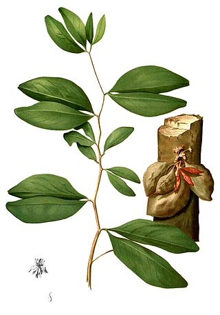
Cynometra alexandri, the Uganda ironwood or muhimbi, is a species of legume that occurs in tropical lowland forests of central and east Africa. They grow gregariously in drier forest types and as a constituent of swamp forests. They reach some 120 feet (37 m) to 150 feet (46 m) in height, and larger trees often develop hollow boles and buttress roots.
Hoima–Butiaba–Wanseko Road is a road in the Western Region of Uganda, connecting the city of Hoima and the towns of Butiaba, Buliisa, and Wanseko on the shores of Lake Albert. This is one of Uganda's critical oil roads because it facilitates oil exploration in the Albertine Graben, as well as tourism, due to its proximity to Kabalega National Park.
Nyabiku Central Forest Reserve is a gazetted forest reserve in Kibaale District, Uganda. It is located in the sub-counties of Mugarama and Nyamarunda, approximately 10 kilometers (6.2 mi) from Kibaale Town. The reserve covers an area of 3,400 hectares.
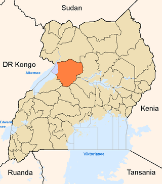
Hoima Sugar Limited (HSL), also Hoima Sugar is a sugar manufacturer in Uganda, the third-largest economy in the East African Community and responsible for massive deforestation.

Kikuube District is a district in the Western Region of Uganda. It is named after its main municipal centre, Kikuube.

The Victoria Basin forest–grassland mosaic is an ecoregion that lies mostly in Uganda and extends into neighboring countries. The ecoregion is centered north and west of Lake Victoria, with an outlier on the border of Ethiopia and South Sudan.
Guramwa Central Forest Reserve is a protected area located in Western Uganda's Kibaale district. It is managed by the National Forestry Authority and was first gazetted in 1932 under the National Forestry and Tree Planting Act, 2003 with an area of 230 ha (0.9 sq mi), and was later re-gazetted in 1968 with an area of 1,550 ha.
Wambabya Central Forest Reserve is located in both Hoima District and Kikuube district in Western Uganda near the north-eastern border of Bugoma Central Forest Reserve. It was demarcated in 1932. It is operated by the National Forest Authority (NFA). It covers an area of 3,429 ha (13.24 sq mi).
Rwensama Central Forest Reserve is a tropical high forest found in Masindi District in Uganda. It covers 127 hectares and it is meant for ecological and environmental purposes.
Bujawe Central Forest Reserve is a protected tropical forest that is located in Hoima district of western Uganda. The forest covers an area of 50 km2. Bujawe has one named mountain called Buhirigi which has the highest peak and is the most prominent mountain in Uganda with 1130m/3707 ft a.s.l. and the prominence is 60m/197 ft. The size of the forest is 31km2. The estimated terrain elevation is 1079 metres above sea level. The Latitude is 1°31'54.26 while Longitude is 31°11'50.21.
Matiri Central Forest Reserve is a protected tropical forest reserve that is located in Kyenjojo district of western Uganda. The central forest covers an area of 64 square kilometres (25 sq mi) and is among the few surviving natural forest reserves in the Tooro region.
Kagombe Central Forest Reserve is a 301-square-kilometre (74,000-acre) forest reserve located in Western Uganda's district of Kagadi and Nyamarundu sub county. It is also located in Uganda's Albertine Rift ecoregion area renowned for its rich biodiversity.
Musoma Central Forest is located in Masindi, Uganda. The Forest Reserve showcases Uganda's landscape, wildlife, and culture.
Kasato Central Forest Reserve is a protected tropical forest that is located in Kiryanga subcounty in Kagadi District in Western Uganda. It covers an area of 26.82 km2(2691 hectares). It managed by the National Forestry Authority. It was designated a reserve in 1965. Its WPDA ID is 39988.
Ibamba Central Forest Reserve is a protected forest reserve under the mandate of National Forestry Authority and is located in Hoima District, western Uganda. The Forest Reserve is situated nearby to the villages Kihuule and Kicwamba. Hoima is a city found in the Western part of Uganda and is the main municipal, administrative, and commercial center for Hoima District, also known as the Oil City.

Mparo Royal Tombs also Mparo tombs is a historical royal burial site for Omukama Kabalega II and kings and royals of Bunyoro-Kitara kingdom. The tombs cover six acres of land.