Related Research Articles
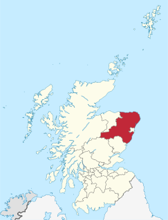
Aberdeenshire is one of the 32 council areas of Scotland.

Banffshire ; Scots: Coontie o Banffshire; Scottish Gaelic: Siorrachd Bhanbh) is a historic county, registration county and lieutenancy area of Scotland. The county town is Banff, although the largest settlement is Buckie to the west. It borders the Moray Firth to the north, Morayshire and Inverness-shire to the west, and Aberdeenshire to the east and south.
Banff and Buchan is a committee area of the Aberdeenshire Council, Scotland. It has a population of 35,742. Fishing and agriculture are important industries, together with associated processing and service activity.

Gardenstown is a small coastal village, 8.7 miles (14.0 km) by road east of Banff in Aberdeenshire, northeastern Scotland.

Pennan is a small village in Aberdeenshire, Scotland, consisting of a small harbour and a single row of homes, including a hotel. It is on the north-facing coast and is about one hour's drive from Aberdeen. It was formerly known as St Magnus Haven or Auchmedden.
Finzean is a rural community, electoral polling district, community council area and former ecclesiastical parish, which forms the southern part of the Parish of Birse, Aberdeenshire, Scotland. Finzean was the subject of many well-known landscape paintings by the artist Joseph Farquharson, whose family have owned Finzean Estate since the 17th century. Finzean extends to approximately 8000 hectares in area and had a population of approximately 270 in 2002.

The A98 road is a major coastal road of northeast Scotland passing through Moray and Aberdeenshire. The A98 is no longer a primary route, with this status being removed shortly after the A92 was renumbered A90.

Macduff is a town in the Banff and Buchan area of Aberdeenshire, Scotland. It is situated on Banff Bay and faces the town of Banff across the estuary of the River Deveron. Macduff is a former burgh and was the last place in the United Kingdom where deep-water wooden fishing boats were built.
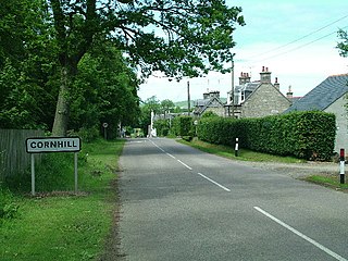
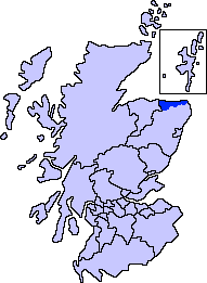
Cornhill is a small village close to Banff, Aberdeenshire, Scotland. It lies 5 miles (8.0 km) to the south of Portsoy. The village was originally a burgh of a feudal barony and is now a farming community.

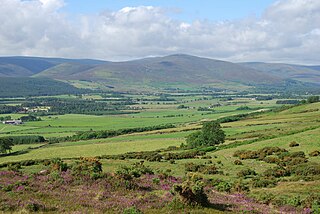
Dinnet is a village in the Marr area of Aberdeenshire, Scotland. Approximately equidistant from Deeside towns Aboyne and Ballater and situated on the main A93 road in the valley of the River Dee, it is said to be the gateway to both the Highlands and the Cairngorms National Park. It is the first village along the Dee to be located inside the park.
Netherley, Scotland is a village in Aberdeenshire, situated approximately five miles northwest of Stonehaven. Netherley is located in the Mounth area of the Grampian Highlands. At the eastern edge of Netherley is a significant wetland bog known as Red Moss. To the southwest of Netherley lie Meikle Carewe Hill and Curlethney Hill. At the south edge of Netherley is the peak of Craggie Cat.

Meikle Carewe Hill is a landform in Aberdeenshire, Scotland within the Mounth Range of the Grampian Mountains. The peak elevation of this mountain is 266 metres above mean sea level. Meikle Carewe is a prominent landform visible from a number of coastal hills such as Kempstone Hill and Megray Hill; it also forms a major backdrop to the community of Netherley.

Banff Bay is a coastal embayment in Scotland situated between the towns of Banff, Aberdeenshire and Macduff, Aberdeenshire. The Burn of Myrehouse is one of the streams draining to Banff Bay. Banff Bay is a prominent geographical feature along the northern coast of Aberdeenshire, and it is visible from a number of locations along the coastal plain such as Longman Hill situated somewhat distant to the east.
The Foudland Hills is a mountainous landform in the northeast of Aberdeenshire, Scotland and northwest of Morayshire. The Foudland Hills are a prominent feature along the northern coastal region of Aberdeenshire, and are visible from somewhat distant points such as Longman Hill to the east.
Cairn Lee is a prehistoric monument in Aberdeenshire, Scotland. Cairn Lee and proximate Longman Hill are the oldest prehistoric features in the local area.

Dubford is a small village in northern coastal Aberdeenshire, Scotland. Dubford is situated along the B9031 road approximately 6 kilometres (3.7 mi) east of Macduff, south of Gardenstown. There is evidence of prehistoric man in the vicinity of Dubford, notably from the nearby Longman Hill and Cairn Lee ancient monuments.

Cairn Catto is a Neolithic long cairn near Longside, Aberdeenshire, Scotland.
The South Ugie Water is a tributary of the Ugie Water in northeastern Aberdeenshire, Scotland. To the south of the Ugie Water are a number of prehistoric monuments, evidencing the habitation of early man in the northeast of Scotland; for example, the Catto Long Barrow and a number of tumuli are situated in this locale.

Longmanhill is a settlement in the Aberdeenshire parish of Gamrie; it is located along the A98 road connecting Fraserburgh to Macduff. This hamlet was founded in the year 1822 by the Earl of Fife. Nearby is a prehistoric cairn, the eponymous Longman Hill.
The B9031 Road is a paved public highway in northern Aberdeenshire, Scotland. The roadway is notable for its proximity and access to a number of scenic, historic and prehistoric sites. for example the road provides access to the historic St. Drostan's Kirk. The road also provides proximity access to the prehistoric sites of Cairn Lee and Longman Hill.
References
- ↑ United Kingdom Ordnance Survey Map 1:50,000 (2004)
- ↑ C. Michael Hogan (2009) Longman Hill, The Modern Antiquarian http://www.themodernantiquarian.com/site/11228/longman_hill.html#fieldnotes
| | This Aberdeenshire location article is a stub. You can help Wikipedia by expanding it. |