Burncourt

Last updated
Burncourt
An Chúirt Dóite
Village
Castles of Munster, Burncourt, Tipperary (2) - geograph.org.uk - 1393348.jpg
Ireland adm location map.svg
Red pog.svg
Burncourt
Location in Ireland
Coordinates: 52°19′N8°04′W / 52.31°N 8.07°W / 52.31; -8.07 Coordinates: 52°19′N8°04′W / 52.31°N 8.07°W / 52.31; -8.07
Country Ireland
Province Munster
County County Tipperary
Time zone UTC+0 (WET)
  Summer (DST) UTC-1 (IST (WEST))

Burncourt (Irish: An Chúirt Dóite) is a village in County Tipperary, Ireland with an approximate population of 138 people. [1]

Irish language Goidelic (Gaelic) language spoken in Ireland and by Irish people

Irish is a Goidelic (Gaelic) language originating in Ireland and historically spoken by the Irish people. Irish is spoken as a first language in substantial areas of counties Galway, Kerry, Cork and Donegal, smaller areas of Waterford, Mayo and Meath, and a few other locations, and as a second language by a larger group of non-habitual speakers across the country.

County Tipperary County in the Republic of Ireland

County Tipperary is a county in Ireland. It is located in the province of Munster. The county is named after the town of Tipperary, and was established in the early thirteenth century, shortly after the Norman invasion of Ireland. The population of the county was 159,553 at the 2016 census. The largest towns are Clonmel, Nenagh and Thurles.

Republic of Ireland Ireland, a country in north-western Europe, occupying 5/6 of the island of Ireland; succeeded the Irish Free State (1937)

Ireland, also known as the Republic of Ireland, is a country in north-western Europe occupying 26 of 32 counties of the island of Ireland. The capital and largest city is Dublin, which is located on the eastern part of the island, and whose metropolitan area is home to around a third of the country's over 4.8 million inhabitants. The sovereign state shares its only land border with Northern Ireland, a part of the United Kingdom. It is otherwise surrounded by the Atlantic Ocean, with the Celtic Sea to the south, Saint George's Channel to the south-east, and the Irish Sea to the east. It is a unitary, parliamentary republic. The legislature, the Oireachtas, consists of a lower house, Dáil Éireann, an upper house, Seanad Éireann, and an elected President who serves as the largely ceremonial head of state, but with some important powers and duties. The head of government is the Taoiseach, who is elected by the Dáil and appointed by the President; the Taoiseach in turn appoints other government ministers.

Contents

Location

It lies in the Galtee-Vee Valley with the Galtee Mountains to the north and the Knockmealdowns to the south. It is located 1.7 kilometres from the former main Dublin to Cork road now designated as the R639 regional road. The nearest large towns are Cahir and Mitchelstown, which are 16 kilometres and 15 kilometres respectively.

Knockmealdown Mountains mountain range in Ireland

The Knockmealdown Mountains is a mountain range located on the border of counties Tipperary and Waterford in Ireland, running east and west between the two counties. The highest peak of the range is Knockmealdown, in County Waterford. On the western side of the summit, the range is crossed by a high pass through which runs the old mail coach road from Lismore to Clogheen.

Dublin capital and largest city in Ireland

Dublin is the capital and largest city of Ireland. It is on the east coast of Ireland, in the province of Leinster, at the mouth of the River Liffey, and is bordered on the south by the Wicklow mountains. It has an urban area population of 1,173,179, while the population of the Dublin Region, as of 2016, was 1,347,359, and the population of the Greater Dublin area was 1,904,806.

Cork (city) City in Munster, Ireland

Cork is a city in south-west Ireland, in the province of Munster, which had a population of 125,657 in 2016.

History

The settlement gets its name from the castle situated 650 metres east of the village centre, it was burned to its shell during the Cromwellian conquest of Ireland in 1650, later becoming known as "Burnt Court". [2]

Cromwellian conquest of Ireland

The Cromwellian conquest of Ireland or Cromwellian war in Ireland (1649–53) refers to the conquest of Ireland by the forces of the English Parliament, led by Oliver Cromwell, during the Wars of the Three Kingdoms. Cromwell invaded Ireland with his New Model Army on behalf of England's Rump Parliament in August 1649.

The Mitchelstown Caves are situated approximately 2.5 kilometres from Burncourt and were discovered in 1833 by a labourer quarrying on a small farm. [3] Today the caves are a popular tourist attraction.

The stately Shanbally Castle was situated 4 kilometres outside the village. Built c.1820 for the 1st Viscount Lismore and designed by the architect John Nash. It was completely demolished in 1960. [4]

Shanbally Castle

Shanbally Castle was located near Clogheen, County Tipperary and built for Cornelius O'Callaghan, the first Viscount Lismore, in around 1810. It was the largest house built in Ireland by the noted English architect John Nash. The castle was acquired by the Irish Land Commission in 1954. On 21 March 1960 the castle, after much controversy, was demolished.

John Nash (architect) British architect

John Nash was one of the foremost British architects of the Regency and Georgian eras, during which he was responsible for the design, in the neoclassical and picturesque styles, of many important areas of London. His designs were financed by the Prince Regent, and by the era's most successful property developer, James Burton, with whose son Decimus Burton he collaborated extensively. Nash's best-known solo designs are the Royal Pavilion, Brighton, Marble Arch, and Buckingham Palace; his best known collaboration with James Burton is Regent Street; and his best-known collaborations with Decimus Burton are Regent's Park and its terraces and Carlton House Terrace. The majority of his buildings, including those to the design of which the Burtons did not contribute, were built by the company of James Burton.

Related Research Articles

Mitchelstown Town in Munster, Ireland

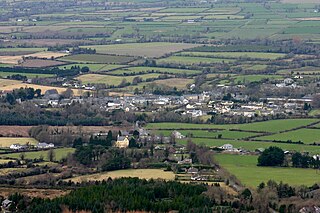
Mitchelstown is a town in County Cork, Ireland with a population of approximately 3740. Mitchelstown is situated in the valley to the south of the Galtee Mountains, 12 km south-west of the Mitchelstown Caves, 28 km from Cahir, 50 km from Cork, 59 km from Limerick and 10 km from Fermoy. The River Gradoge runs by the town into the River Funshion, which in turn is a tributary of the River Blackwater. The town is best known as a centre for cheese production.

Cahir Town in Munster, Ireland

Cahir is a town in County Tipperary in Ireland. It is also a civil parish in the barony of Iffa and Offa West.

Ballyporeen Village in Munster, Ireland

Ballyporeen is a village in County Tipperary, Ireland. The national census of 2016 recorded the population of Ballyporeen at 318 with an additional 603 in its rural hinterland.

Ardfinnan Village in Munster, Ireland

Ardfinnan is a small village in County Tipperary in Ireland. It is situated on the River Suir and R665 regional road. The Catholic parish of Ardfinnan is made up of three areas: Ardfinnan, Ballybacon, and Grange. Ardfinnan is also a civil parish in the ancient barony of Iffa and Offa West. The village is located 14 kilometers from the town of Clonmel and six miles from Cahir via the R670 road. The population of the village is approximately 1000 people.

Galtymore Mountain in Tipperary/Limerick, Ireland

Galtymore or Galteemore at 918 metres (3,012 ft), is the 12th–highest peak in Ireland on the Arderin scale, and the 14th–highest peak in Ireland according to the Vandeleur-Lynam scale. Galtymore has the 4th highest topographic prominence in Ireland which classifies Galtymore as a P600, or "major mountain". Galtymore is also one of the 13 recognised Scottish Furths, or Irish Munros, in Ireland. Galtymore is the County Top for both Limerick and Tipperary, and it is the highest mountain of the Galty Mountains, or Galtee Mountains, a 30–kilometre range that runs east–west, split between Limerick and Tipperary in Munster, Ireland.

Golden Vale

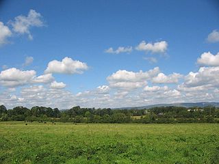
The Golden Vale is an area of rolling pastureland in the civil province of Munster, southwestern Ireland. Covering parts of three counties, Limerick, Tipperary and Cork, it is the best land in Ireland for dairy farming. Historically it has been called the Golden Vein. An early instance is an 1837 book by Jonathan Binns, a British government official, where he refers to the area as '"the golden vale" ' and states "The land is of excellent quality, being part of the golden vein of Ireland—a district reaching from Tipperary towards Limerick. The extent of the golden vein is about fourteen miles long, by six or seven wide." Some subsequent writers similarly prefer "vein".

Clogheen, County Tipperary Village in Munster, Ireland

Clogheen is a village in County Tipperary, Ireland. The census of 2006 recorded the population at 509 people.

Anglesboro Village in Munster, Ireland

Anglesboro or Anglesborough is a small village at the foot of the Galtee Mountains, in southeastern County Limerick, Ireland. The nearest town is Mitchelstown in County Cork approximately 12 kilometres away.

R639 road (Ireland)

The R639 road is one of Ireland's regional roads. Once designated the N8 national primary road, it was reclassified in stages as the R639 following the progressive opening of sections of the M8 motorway, which rendered the single carriageway N8 redundant as a national primary road. By-passed sections of the old N8 were generally reclassified as R639 as soon a new section of M8 opened, thereby increasing the length of the R639. With the completion of the M8 on 28 May 2010, the R639 now stretches from Durrow, County Laois to Cork, running through counties Laois, Kilkenny, Tipperary, Limerick and Cork.

The Glen of Aherlow is a valley located between Slievenamuck and the Galtee Mountains in the western part of County Tipperary in Ireland. The principal village is Lisvarrinane. There is also a hamlet at Rossadrehid, where Aherlow creamery was located before its closure in the late 20th century. Other adjacent centres of population are the villages of Galbally, Kilross and Bansha. Across the northern flank of Slievenamuck lies Tipperary Town.

Tubrid Town in Munster, Ireland

Tubrid or Tubbrid was formerly a civil and ecclesiastical parish situated between the towns of Cahir and Clogheen in County Tipperary, Ireland. A cluster of architectural remains at the old settlement still known as Tubrid includes an ancient cemetery and two ruined churches of regional historical significance.

Kilbehenny Village in County Limerick, Ireland

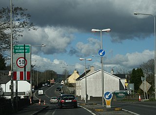
Kilbehenny is a village in County Limerick, Ireland, on the R639 regional road. It is situated on the County Cork border and is within two kilometers of the County Tipperary border. The village is 5 km (3.1 mi) east of Mitchelstown, the nearest town, and 1 km from Junction 12 of the M8 Dublin to Cork motorway.

M8 motorway (Ireland) motorway in Ireland

The M8 motorway is an inter-urban motorway in Ireland, which forms part of the motorway from the capital Dublin to Cork city. The 149 km motorway commences in the townland of Aghaboe, County Laois and runs through the counties of Kilkenny, Tipperary and Limerick, terminating at the Dunkettle interchange in County Cork. First called for in the Road Needs Study (1998), it was later incorporated into the National Development Plan (2000–2006) and later still formed part of the Irish Government's Transport 21 plan for infrastructural development. The majority of the M8 (115 km) was built between 2006 and 2010. On 28 May 2010, the motorway was completed and had replaced almost all of the single-carriageway N8 except for a short section of urban road in Cork City.

Glengarra Wood

Glengarra Wood is a mixed woodland in Ireland located 15 kilometres (9.3 mi) southwest of Cahir, Co. Tipperary off the M8 motorway and R639 road. Approximately 570 hectares in extent, it is situated on Old Red Sandstone on the southern slopes of the Galtee Mountains. It is mainly a coniferous forest with Sitka Spruce being the main species. Other conifer species present include Scots Pine, Japanese Larch, Douglas Fir, Norway Spruce, Western Hemlock and Western Red Cedar. The area also contains approximately 50 hectares of native Oak, Birch and Alder. Animals present include fallow deer, foxes, badgers, hares and red squirrels. Birds include pheasants, hawks, kestrels, ravens, herons and many song birds.

Skeheenarinky Townland in Munster, Ireland

Skeheenarinky is a townland in south-west County Tipperary, Ireland. It is a dispersed settlement with a focal point at Skeheenarinky Cross where a school is located.

Mitchelstown Cave is a limestone cave near Burncourt, County Tipperary, Ireland. Situated 12 kilometres (7.5 mi) from Mitchelstown, County Cork, it became the first cave in Ireland to be developed for the public in 1972.

Galtee Castle 18th–19th century mansion in County Tipperary, Ireland (now demolished)

Galtee Castle was a mansion that was situated on the foothills of the Galtee Mountains at Skeheenarinky in County Tipperary, Ireland approximately 10 km. from Mitchelstown.

River Funshion

The River Funshion is a river in Munster, Ireland, a tributary of the Munster Blackwater.

Burncourt Castle

Burncourt Castle is a fortified house and a National Monument in County Tipperary, Ireland.

References

  1. Tipperary County Council figure (page 13)
  2. Power,Rev.P. Canon; 'Place Names of the Decies' Volume II, Cork University Press Oxford: B. H. Blackwell. Ltd. (1952)
  3. Baker,Ernest A.; A Visit to Mitchelstown Cave, The Irish Naturalist, Vol. 15, No. 2 (Feb., 1906)
  4. McDonnell, Randal; The Lost Houses of Ireland, A chronicle of great houses and the families who lived there, Weidenfeld & Nicolson(2002)