Related Research Articles
The Goreng Goreng, also known Kooreng Gooreng, are an inland Freshwater Australian Aboriginal people of Queensland, and also a language group. The Goreng Goreng area is between Central West Queensland in the north around Boyne Valley, extending westerly as far as the Great Dividing Range along the Dawes, Auburn, Nogo and Callide Ranges to meet the Wulli Wulli and Ghunghulu to their immediate west over the Great Dividing Range.

Arrernte or Aranda or sometimes referred to as Upper Arrernte, is a dialect cluster in the Arandic language group spoken in parts of the Northern Territory, Australia, by the Arrernte people. Other spelling variations are Arunta or Arrarnta, and all of the dialects have multiple other names.
Gavan Breen, OAM, also known as J.G. Breen, is an Australian linguist, specialising in the description of Australian Aboriginal languages. He has studied and recorded 49 such languages.
The Yurlayurlanya formerly spelt Ulaolinya were an Indigenous Australian tribe living in the Glenormiston region of South West Queensland.

The Gabulbarra people, also rendered Gabalbura, Gabalbara and Kabalbara, is an Aboriginal Australian people of an area in eastern Central Queensland, but there is little recorded information about them.
The Tulua people were an Aboriginal Australian people of Queensland, in the southern to central region from the coast to the ranges. The Dappil and Tulua people possibly spoke the same language.
The Goeng or Gureng were an Aboriginal Australian people of the state of Queensland. They lived in the area of the area of present-day Gladstone.
The Wadjabangai, otherwise known as Wadjabangayi, were an indigenous Australian people of Queensland.
The Wadjalang, also known as the Dharawala, were an indigenous Australian people of Queensland.
The Koa (Guwa) are Australian Aboriginal people and Native Title Holders of land in the Upper Diamantina River catchment area in the state of Queensland that includes the towns of Winton, Kynuna, Corfield and Middleton.
The Kulumali were an indigenous Australian people of the state of Queensland.
The Marulta were an indigenous Australian people of the state of Queensland, Australia.
The Yalarnnga, also known as the Jalanga, are an indigenous Australian people of the state of Queensland.
Kyabra County, Queensland is a cadastral division of Queensland and a County of the South Gregory District of south western Queensland.
Palmer County is a cadastral division of Queensland and a County of the Warrego Land District of southwestern Queensland.

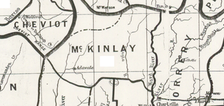
McKinlay County, Queensland is a cadastral division of Queensland and a County of the Warrego Land District of south western Queensland.
Ross County, Queensland is a cadastral division of Queensland and a County of remote western Queensland.

County of Kungie is one of the 318 counties of Queensland, Australia. The county is divided into civil parishes. It is within the Darling Downs region west Brisbane.

Rodney County is one of the 318 counties of Queensland, Australia. The county is divided into civil parishes.

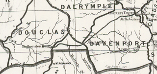
Douglas County, Queensland is one of the 318 counties of Queensland, Australia. It is within the The county came into existence in the 19th century, and on 8 March 1901, the Governor of Queensland issued a proclamation legally dividing Queensland into counties under the Land Act 1897. Like all counties in Queensland, it is a non-functional administrative unit, that is used mainly for the purpose of registering land titles. From 30 November 2015, the government no longer referenced counties and parishes in land information systems however the Museum of Lands, Mapping and Surveying retains a record for historical purposes.
References
- ↑ "Recent Acquisitions at the British Museum (Natural History)". Nature. 135 (3422): 920–921. 1935-06-01. Bibcode:1935Natur.135S.920.. doi: 10.1038/135920c0 . ISSN 1476-4687. S2CID 4090738.
- ↑ Queensland showing counties / compiled and published at the Survey Department, Brisbane, Brisbane : Survey Dept., 1900.
- ↑ Breen, Gavan (1990). Salvage Studies of Western Queensland Aboriginal Languages. Research School of Pacific Studies, ANU. ISBN 978-0-858-83401-9. Dalhunty, L. F.; Crombie, James (1887). "Barcoo, Tambo, Mount Enniskillen, and Ravensbourne Creek" (PDF). In Curr, Edward Micklethwaite (ed.). The Australian race: its origin, languages, customs, place of landing in Australia and the routes by which it spread itself over the continent. Volume 3. Melbourne: J. Ferres. pp. 86–89. Tindale, Norman Barnett (1974). "Wadjalang (QLD)". Aboriginal Tribes of Australia: Their Terrain, Environmental Controls, Distribution, Limits, and Proper Names. Australian National University. ISBN 978-0-708-10741-6. page 186.
- ↑ Breen, Gavan (1990). Salvage Studies of Western Queensland Aboriginal Languages. Research School of Pacific Studies, ANU. ISBN 978-0-858-83401-9.
- ↑ A Proclamation". Queensland Government Gazette. 75. 8 March 1901. pp. 967-980.
- ↑ "Locality boundaries - Queensland". Department of Natural Resources, Mines and Energy. 27 August 2017. Archived from the original on 31 March 2018. Retrieved 2 October 2018.