
The Macquarie River or Wambuul is part of the Macquarie–Barwon catchment within the Murray–Darling basin, is one of the main inland rivers in New South Wales, Australia.

Wellington is a town in the Central Western Slopes region of New South Wales, Australia, located at the junction of the Wambuul Macquarie and Bell Rivers. It is within the local government area of Dubbo Regional Council. The town is 362 kilometres (225 mi) northwest of Sydney on the Mitchell Highway and Main Western Railway, and 50 km southeast of Dubbo, the main centre of the Central Western Slopes region.

Lake Burrendong is a man-made reservoir created by Burrendong Dam. It impounds waters on the Macquarie and Cudgegong rivers, near Wellington, in the central west region of New South Wales, Australia.
Cudgegong River, a perennial stream that is part of the Macquarie catchment within the Murray–Darling basin, is located in the central western and Orana districts of New South Wales, Australia.
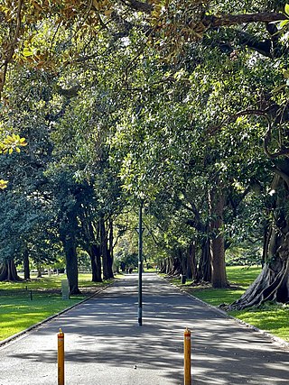
The Domain is a heritage-listed 34-hectare (84-acre) area of open space on the eastern fringe of the Sydney central business district, in the City of Sydney local government area of New South Wales, Australia. Separating the central business district from Woolloomooloo, The Domain adjoins the Royal Botanic Garden and is managed by The Royal Botanic Gardens and Domain Trust, a division of the NSW Office of Environment and Heritage, an agency of the Government of New South Wales. The Domain is used as a venue for outdoor concerts, open-air events, large political gatherings and rallies, as well as being used daily by the people of Sydney for exercise and relaxation. Along with the Royal Botanic Garden, The Domain was added to the New South Wales State Heritage Register on 2 April 1999.

The Royal Botanic Garden, Sydney is a heritage-listed major 30-hectare (74-acre) botanical garden, event venue and public recreation area located at Farm Cove on the eastern fringe of the Sydney central business district, in the City of Sydney local government area of New South Wales, Australia.
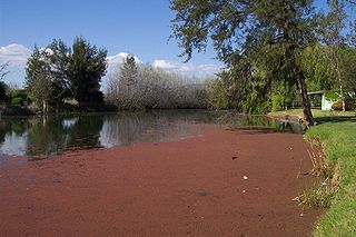
Burrendong Dam is a rock-fill embankment major gated dam with a clay core across the Macquarie River upstream of Wellington in the central west region of New South Wales, Australia. The dam's purpose includes flood mitigation, irrigation, water supply and hydro-electric power generation. The dam impounds Lake Burrendong and is filled by the waters from the Macquarie, and Cudgegong rivers as well as Meroo Creek.

The Australian Botanic Garden Mount Annan is a 416-hectare (1,030-acre) botanical garden located in a hilly area of the southwestern Sydney suburb of Mount Annan, between Campbelltown and Camden, New South Wales. It is the largest botanical garden in Australia, specializing in native plants, with a collection of over 4000 species. Officially opened in 1988, it was known as Mount Annan Botanic Garden, until 2011.

Ulmus × hollandica 'Major' is a distinctive cultivar that in England came to be known specifically as theDutch Elm, although all naturally occurring Field Elm Ulmus minor × Wych Elm U. glabra hybrids are loosely termed 'Dutch elm'. It is also known by the cultivar name 'Hollandica'. Nellie Bancroft considered 'Major' either an F2 hybrid or a backcrossing with one of its parents.

Stuart Town, formerly known as Ironbark, is a small town on the Central Western Slopes of New South Wales, Australia within Dubbo Regional Council. It is located 317 kilometres (197 mi) north-west of the state capital, Sydney. At the 2011 census, Stuart Town had a population of 487. The area around the town is rich in cattle farming and orchards, so the town serves as a service centre to that area.
Burrendong was an electoral district of Legislative Assembly of the Australian state of New South Wales, created in 1968, partly replacing Mudgee and named after the Burrendong Dam. It was abolished in 1981.

Mount Tomah is a locality and a mountain that is located in the Blue Mountains region of the state of New South Wales, Australia. The locality is known for the Blue Mountains Botanic Garden on the Bells Line of Road.

William Brian Keith Holmes is an Australian palaeobotanist, best known for his work "Fructifications of Glossopteris" (1974), published in the Proceedings of the Linnean Society of New South Wales. Despite having received no formal training in palaeontology, he has become an important contributor in the field and has described some 80 new species, mostly from 2 quarries at Nymboida in northern New South Wales, and situated on the Triassic.
East Bowral is a gazetted locality and state suburb approximately 2 kilometres (1.2 mi) east of the town of Bowral of the Southern Highlands, New South Wales, Australia.
Meroo River, also called Meroo Creek, a watercourse that is part of the Macquarie catchment within the Murray–Darling basin, is located in the central western district of New South Wales, Australia.
George William Francis Althofer (1903–1993) was an Australian botanist, nurseryman, author and poet, with a special interest in the mint-bush genus Prostanthera as well as other Australian native plants, who founded the Burrendong Botanic Garden and Arboretum.

The National Herbarium of New South Wales was established in 1853. The Herbarium has a collection of more than 1.4 million plant specimens, making it the second largest collection of pressed, dried plant specimens in Australia, including scientific and historically significant collections and samples of Australian flora gathered by Joseph Banks and Daniel Solander during the voyage of HMS Endeavour in 1770.
Driel is a rural locality of Warren Shire 31°39′54″S 147°56′04″E a few miles north of Warren, New South Wales Driel is also a civil Parish]] of Ewenmar County, a cadastral division of New South Wales.

Mayfield Garden is a cool climate garden situated in Oberon in the Central Tablelands region of New South Wales, Australia. Located approximately 200 kilometres (120 mi) west of Sydney, the garden is one of the world's largest privately owned cool climate gardens, lying within a 2,000-hectare (5,000-acre) working farm. The garden is known as one of Australia's most significant horticultural destinations and has become a key element of the tourism industry in the Central West area of the state. Mayfield Garden is open daily with an entry fee, whilst the full private estate is also opened to the public for a short period during each season.

