Related Research Articles
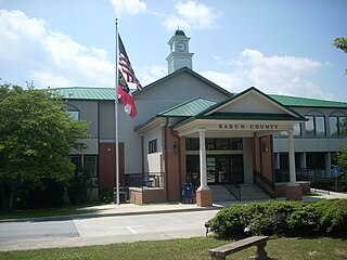
Rabun County is the north-easternmost county in the U.S. state of Georgia. As of the 2020 census, the population was 16,883, up from 16,276 in 2010. The county seat is Clayton. With an average annual rainfall of over 70 inches (1,800 mm), Rabun County has the title of the rainiest county in Georgia and is one of the rainiest counties east of the Cascades. The year 2018 was the wettest on record in the county's history. The National Weather Service cooperative observation station in northwest Rabun's Germany Valley measured 116.48 inches of rain during the year. During 2020, the Germany Valley NWS station reported a yearly precipitation total of 100.19 inches.

The Tallulah River is a 47.7-mile-long (76.8 km) river in Georgia and North Carolina. It begins in Clay County, North Carolina, near Standing Indian Mountain in the Southern Nantahala Wilderness and flows south into Georgia, crossing the state line into Towns County. The river travels through Rabun County and ends in Habersham County. It cuts through the Tallulah Dome rock formation to form the Tallulah Gorge and its several waterfalls. The Tallulah River intersects with the Chattooga River to form the Tugaloo River at Lake Tugalo in Habersham County. It joins South Carolina's Seneca River at Lake Hartwell to form the Savannah River, which flows southeastward into the Atlantic Ocean.

The Tallulah Gorge is a gorge formed by the Tallulah River cutting through the Tallulah Dome rock formation. The gorge is approximately 2 miles (3 km) long and almost 1,000 feet (300 m) deep. The Tallulah Gorge is located next to the town of Tallulah Falls, Georgia. Tallulah Gorge State Park protects much of the gorge and its waterfalls. The gorge is one of the Seven Natural Wonders of Georgia.

The Chattooga River is the main tributary of the Tugaloo River.
The Tugaloo River is a 45.9-mile-long (73.9 km) river that forms part of the border between the U.S. states of Georgia and South Carolina. It was named for the historic Cherokee town of Tugaloo at the mouth of Toccoa Creek, south of present-day Toccoa, Georgia and Travelers Rest State Historic Site in Stephens County, Georgia.
The Chestatee River is a 32.76-mile-long (52.72 km) river in the Appalachian Mountains of northern Georgia, USA.

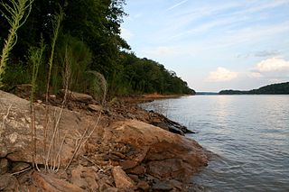
Lake Rabun is a twisty 835-acre (3.4 km2) reservoir with 25 miles (40 km) of shoreline located in the Northeastern corner of the U.S. state of Georgia in Rabun County. It is the third lake in a six-lake series that follows the original course of the Tallulah River. The series begins with Lake Burton as the northernmost lake, followed by Lake Seed, Lake Rabun, Lake Tallulah Falls, Lake Tugalo, and Lake Yonah. Lake Rabun was built in a deep valley located along a 10-mile (16 km) section of the Tallulah River.

Lake Burton is a 2,775 acres (11.23 km2) reservoir with 62 miles (100 km) of shoreline located in the northeastern corner of Georgia in Rabun County. The lake is owned and administered by the Georgia Power/Southern Company, but it is a public lake. Noted for the remarkable clarity of its water and surrounded by the biodiverse ecosystem of the Blue Ridge Mountains, the lake celebrated its centennial in 2020.

Moccasin Creek State Park is a 32-acre (13 ha) state park located on the western shore of Lake Burton in Rabun County in the northeast corner of Georgia. The park features campgrounds; a fishing pier for the physically disabled, the elderly, and children; and walking trails. Even though the surrounding area is mountainous, the camping area is relatively flat.
The Coleman River Scenic Area is located in Rabun County, Georgia in the Chattooga River District of the Chattahoochee National Forest. It is located at the point of confluence of Coleman River with the Tallulah River. The scenic area consists of 330 acres (1.3 km2) encompassing lower Coleman River and was dedicated in 1960 to "Ranger Nick" Nicholson following his 40 years of public service. At the point of confluence of the two rivers, the elevation is approximately 2,200 feet (670 m).

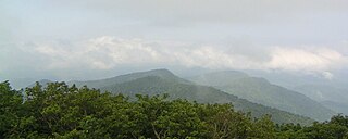
The Southern Nantahala Wilderness was designated in 1984 and currently consists of 23,473 acres (94.99 km2). Approximately 11,770 acres (47.6 km2) are located in Georgia in the Chattahoochee National Forest and approximately 11,703 acres (47.36 km2) are located in North Carolina in the Nantahala National Forest. The Wilderness is managed by the United States Forest Service and is part of the National Wilderness Preservation System. The highest elevation in the Southern Nantahala Wilderness is the 5,499-foot (1,676 m) peak of Standing Indian Mountain in North Carolina and the lowest elevation is approximately 2,400 feet (730 m). The Appalachian Trail passes through the Wilderness in both states.

Rich Knob, elevation 4,152 feet, is located in Towns County, Georgia. It is part of the Georgia portion of the Southern Nantahala Wilderness and is within the boundaries of the Tallulah Ranger District of the Chattahoochee National Forest. The mountain lies along the Appalachian Trail, which crosses over its eastern flank in Rabun County as it enters North Carolina. Rich Knob also is along the route of The Mountains-To-Sea Trail, East of Rattlesnake Lodge.

The Soque River and its watershed are located entirely within the county boundaries of Habersham County in northeast Georgia. The Soque is a tributary of the Chattahoochee River. Portions of the river run along State Route 197.
Lake Burton Fish Hatchery is a fish hatchery operated by the Wildlife Resources Division of the Georgia Department of Natural Resources for the purpose of raising rainbow trout and brown trout being raised for stocking into mountain trout streams in North Georgia, United States. The hatchery located on the shores of Lake Burton in Rabun County, Georgia next to Moccasin Creek and adjacent to Moccasin Creek State Park. It is on Georgia State Route 197 approximately 20 miles north of Clarkesville, Georgia.

Dukes Creek is the creek in White County, Georgia, on which gold was found in 1828. The discovery of gold in White County and neighboring Lumpkin County led to the Georgia Gold Rush. The creek is approximately 8.76 miles (14.10 km) long.
Lake Tugalo is a 597-acre (2.42 km2) reservoir with 18 miles (29 km) of shoreline located in the northeastern Georgia in Habersham and Rabun counties, but also lies partially in Oconee County, South Carolina. It is the fifth lake in a six-lake series created by hydroelectric dams operated by Georgia Power that follows the original course of the Tallulah River. The series starts upstream on the Tallulah River with Lake Burton followed by Lake Seed, Lake Rabun, Lake Tallulah Falls and Lake Tugalo, ending with Lake Yonah. The western arm of Lake Tugalo is filled by the Tallulah River and the eastern arm is filled by the Chattooga River. Georgia Power considers the lake full at a surface elevation of 891.5 feet (271.7 m).
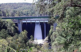
Tallulah Falls Lake is a 63-acre (250,000 m2) reservoir with 3.6 miles (5.8 km) of shoreline located in the Northeastern corner of Georgia in Rabun County. It is the fourth and smallest lake in a six-lake series created by hydroelectric dams operated by Georgia Power that follows the original course of the Tallulah River. The series starts upstream on the Tallulah River with Lake Burton followed by Lake Seed, Lake Rabun, Tallulah Falls Lake, Lake Tugalo and Lake Yonah. Georgia Power considers the lake full at a surface elevation of 1,500 feet (460 m).
Germany Valley, located in Rabun County in the U.S. state of Georgia, four miles northwest of Clayton, is a gently sloping valley surrounded by Blue Ridge Mountain peaks. The Germany community is often referred to by local residents as "Germany Mountain," although there is actually no named peak in the area by that name.
References
- ↑ U.S. Geological Survey Geographic Names Information System: Burton (historical)
- ↑ Helbock, Richard W. (2007) United States Post Offices, Volume VIII - The Southeast, p. 48 Scappoose, Oregon: La Posta Publications
