Helen, Georgia | |
---|---|
Nickname: "Star of the North" | |
Motto: "Georgia‘s Alpine village" | |
Coordinates: 34°42′9″N83°43′39″W / 34.70250°N 83.72750°W | |
Country | United States |
State | Georgia |
County | White |
Incorporated | August 18, 1913 |
Founded by | John E. Mitchell |
Area | |
• Total | 2.09 sq mi (5.43 km2) |
• Land | 2.09 sq mi (5.41 km2) |
• Water | 0.01 sq mi (0.02 km2) |
Elevation | 1,444 ft (440 m) |
Population (2020) | |
• Total | 531 |
• Density | 254.19/sq mi (98.14/km2) |
Time zone | UTC−05:00 (Eastern (EST)) |
• Summer (DST) | UTC−04:00 (EDT) |
ZIP Code | 30545 |
Area code | 706 |
FIPS code | 13-37788 [3] |
GNIS feature ID | 0331948 [2] |
Website | cityofhelen.org |
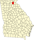
Helen is a city in White County, Georgia, United States, located along the Chattahoochee River. The population was 531 at the 2020 census. The city has now been made over, as a tourist attraction, to look like an old-world Bavarian village. This idea was suggested by John Kollock, an Atlanta artist.
Helen was laid out by John E. Mitchell of St. Louis during the years 1912 and 1913. When a name for the small settlement was being sought, a lumber official suggested the name of his daughter and there was little opposition. [4] Called the "Star of the North," Helen was incorporated on August 18, 1913. [5] Helen was built along the former route of the Unicoi Turnpike, a 1,000-year-old Native American trail connecting Tennessee, North Carolina, and Georgia. [6]
Formerly a logging town in decline, Helen resurrected itself by becoming a replica of a Bavarian alpine town, in the Appalachians instead of the Alps. This design is mandated through zoning first adopted in 1969, so that the classic southern German style is present on every building, even on the small number of national franchisees present. In 1975, Documerica photographer Al Stephenson documented the life, recreation, and economy of the Helen area before and during the reconstruction of the settlement.
This section needs additional citations for verification .(May 2019) |
Tourism is a key economic activity in Helen, catering mostly to weekend visitors from the Atlanta area and also motorcyclists who enjoy riding the roads in Helen and its surrounding areas. Helen can be crowded in late October, when autumn leaves typically peak. It also hosts its own Oktoberfest during September, October and November. Events and festivals are held throughout the year, including the "Southern Worthersee", which is a stateside Volkswagen and Audi event that pays tribute to the Worthersee Tour in Austria. An annual hot-air balloon race is also held here on the first weekend in June.
The main road through town is north–south Georgia 75. The Helen stream gauge (HDCG1) is located on its bridge over the Chattahoochee in the middle of downtown. A parallel route to the west is labeled Georgia 75 Alt to identify it as a bypass route around the town and its traffic jams in the autumn and on some weekends.
Unicoi State Park and Lodge, spanning 1,050 acres (420 ha), is located immediately northeast of Helen on Georgia 356. The park encompasses Unicoi Lake, a 53-acre (21 ha) freshwater lake, offering outdoor activities for all seasons. Among these are a swimming beach, trout streams, wheelchair-accessible fishing docks, seasonal canoe, kayak and paddle boat rentals, seven picnic shelters with charcoal grills, three playgrounds for children, spots for birding, 7.5 miles (12.1 km) of hiking within the park (with adjacent trails in the Chattahoochee National Forest), 8 miles (13 km) of mountain biking trails within the park, and a number of places to enjoy the natural environment of the lake and park.[ citation needed ] Unicoi State Park also offers lodging in several forms. Access to Anna Ruby Falls, part of the Chattahoochee National Forest, is through the park. [7]
Hardman Farm State Historic Site is located near Helen.
Helen is located at 34°42′9″N83°43′39″W / 34.70250°N 83.72750°W (34.702396, -83.727508). [8]
Georgia State Routes 17 and 75 are the main routes through the city, and run through the downtown area together as North Main Street. GA-17/75 lead north together 21 miles (34 km) to Hiawassee. The two highways split south of the city, with GA-17 leading southeast 15 miles (24 km) to Clarkesville and GA-75 leading south 9 miles (14 km) to Cleveland, the White County seat.
According to the United States Census Bureau, the city has a total area of 2.1 square miles (5.4 km2), all land.
Climate data for Helen, GA (1991–2020, extremes 1956–present) | |||||||||||||
---|---|---|---|---|---|---|---|---|---|---|---|---|---|
Month | Jan | Feb | Mar | Apr | May | Jun | Jul | Aug | Sep | Oct | Nov | Dec | Year |
Record high °F (°C) | 84 (29) | 80 (27) | 85 (29) | 92 (33) | 96 (36) | 102 (39) | 102 (39) | 99 (37) | 97 (36) | 91 (33) | 84 (29) | 76 (24) | 102 (39) |
Mean daily maximum °F (°C) | 49.0 (9.4) | 53.3 (11.8) | 61.0 (16.1) | 70.4 (21.3) | 76.9 (24.9) | 82.9 (28.3) | 86.2 (30.1) | 85.1 (29.5) | 79.6 (26.4) | 70.0 (21.1) | 59.7 (15.4) | 51.4 (10.8) | 68.8 (20.4) |
Daily mean °F (°C) | 39.0 (3.9) | 42.0 (5.6) | 48.6 (9.2) | 56.9 (13.8) | 64.6 (18.1) | 71.9 (22.2) | 75.4 (24.1) | 74.5 (23.6) | 68.6 (20.3) | 58.1 (14.5) | 47.8 (8.8) | 41.5 (5.3) | 57.4 (14.1) |
Mean daily minimum °F (°C) | 28.9 (−1.7) | 30.6 (−0.8) | 36.2 (2.3) | 43.4 (6.3) | 52.3 (11.3) | 60.8 (16.0) | 64.5 (18.1) | 63.9 (17.7) | 57.6 (14.2) | 46.2 (7.9) | 35.9 (2.2) | 31.6 (−0.2) | 46.0 (7.8) |
Record low °F (°C) | −12 (−24) | −1 (−18) | 6 (−14) | 21 (−6) | 22 (−6) | 36 (2) | 44 (7) | 44 (7) | 29 (−2) | 19 (−7) | 10 (−12) | −6 (−21) | −12 (−24) |
Average precipitation inches (mm) | 6.78 (172) | 6.03 (153) | 6.75 (171) | 5.82 (148) | 5.56 (141) | 6.29 (160) | 5.63 (143) | 6.63 (168) | 5.33 (135) | 4.94 (125) | 5.98 (152) | 6.97 (177) | 72.71 (1,847) |
Average snowfall inches (cm) | 0.5 (1.3) | 0.7 (1.8) | 0.0 (0.0) | 0.0 (0.0) | 0.0 (0.0) | 0.0 (0.0) | 0.0 (0.0) | 0.0 (0.0) | 0.0 (0.0) | 0.0 (0.0) | 0.0 (0.0) | 0.3 (0.76) | 1.5 (3.8) |
Average precipitation days (≥ 0.01 in) | 10.4 | 10.6 | 10.3 | 9.0 | 10.3 | 11.9 | 11.4 | 11.8 | 8.4 | 7.2 | 8.1 | 10.7 | 120.1 |
Average snowy days (≥ 0.1 in) | 0.2 | 0.2 | 0.0 | 0.0 | 0.0 | 0.0 | 0.0 | 0.0 | 0.0 | 0.0 | 0.0 | 0.2 | 0.6 |
Source: NOAA [9] [10] |
Census | Pop. | Note | %± |
---|---|---|---|
1920 | 176 | — | |
1930 | 252 | 43.2% | |
1940 | 198 | −21.4% | |
1950 | 191 | −3.5% | |
1960 | 227 | 18.8% | |
1970 | 252 | 11.0% | |
1980 | 265 | 5.2% | |
1990 | 300 | 13.2% | |
2000 | 430 | 43.3% | |
2010 | 510 | 18.6% | |
2020 | 531 | 4.1% | |
2023 (est.) | 600 | [11] | 13.0% |
U.S. Decennial Census [12] |
Race | Num. | Perc. |
---|---|---|
White (non-Hispanic) | 469 | 88.32% |
Black or African American (non-Hispanic) | 4 | 0.75% |
Asian | 17 | 3.2% |
Other/Mixed | 30 | 5.65% |
Hispanic or Latino | 11 | 2.07% |
As of the 2020 United States census, there were 531 people, 271 households, and 161 families residing in the city.
As of the census [3] of 2000, there were 430 people, 208 households, and 112 families residing in the city. The population density was 203.8 inhabitants per square mile (78.7/km2). There were 319 housing units at an average density of 151.2 per square mile (58.4/km2). The racial makeup of the city was 82.56% White, 5.12% African American, 0.23% Native American, 10.93% Asian, 0.23% Pacific Islander, 0.47% from other races, and 0.47% from two or more races. Hispanic or Latino of any race were 3.02% of the population.
There were 208 households, out of which 25.0% had children under the age of 18 living with them, 38.0% were married couples living together, 11.5% had a female householder with no husband present, and 45.7% were non-families. 42.8% of all households were made up of individuals, and 14.4% had someone living alone who was 65 years of age or older. The average household size was 2.07 and the average family size was 2.83.
In the city the population was spread out, with 20.5% under the age of 18, 6.7% from 18 to 24, 27.9% from 25 to 44, 28.8% from 45 to 64, and 16.0% who were 65 years of age or older. The median age was 42 years. For every 100 females, there were 91.1 males. For every 100 females age 18 and over, there were 87.9 males.
The median income for a household in the city was $32,917, and the median income for a family was $40,781. Males had a median income of $39,107 versus $23,750 for females. The per capita income for the city was $22,281. About 6.7% of families and 8.2% of the population were below the poverty line, including 8.1% of those under age 18 and 8.8% of those age 65 or over.
Smokey and the Bandit (1977) includes a scene filmed on Chimney Mountain Rd. just outside of Helen.
In the episode "Helen" from Season 2: Robbin' Season of the television series Atlanta , main characters Vanessa and Earn visit Helen for a Fastnacht celebration. [17] The character Vanessa, played by Zazie Beetz, is fluent in German. The episode aired on March 22, 2018.
The Lifetime TV movie Christmas Love Letter was filmed in Helen and aired on December 21, 2019. [18]
Whitfield County is a county in the Northwest region of the U.S. state of Georgia. As of the 2020 census shows a population of 102,864. The county seat is Dalton. The county was created on December 30, 1851, and named after George Whitefield, Methodist evangelist. The "e" was omitted to reflect the pronunciation of his name.
White County is a county in the Northeast region of the U.S. state of Georgia. As of the 2020 census, the population was 28,003. The county seat is Cleveland. The county was created on December 22, 1857, formerly a part of Habersham County and most likely was named for Newton County Representative David T. White, who helped a Habersham representative successfully attain passage of an act creating the new county.
Union County is a county in the Northeast region of the U.S. state of Georgia. As of the 2020 census, the population was 24,632. The county seat is Blairsville.
Towns County is a county in the Northeast region of the U.S. state of Georgia. As of the 2020 census, the population was 12,493. Its county seat is Hiawassee. The county was created on March 6, 1856, and named for lawyer, legislator, and politician George W. Towns.
Paulding County is a county in the Northwest region of the U.S. state of Georgia. Part of Metro Atlanta, it had an estimated population of 168,661 in 2020. The county seat is Dallas.
Hall County is a county in the Northeast region of the U.S. state of Georgia. As of the 2020 census, the population was 203,136, up from 179,684 at the 2010 census. The county seat is Gainesville. The entirety of Hall County comprises the Gainesville, Georgia, Metropolitan Statistical Area, which is also part of the Atlanta-Athens-Clarke County-Sandy Springs, Combined Statistical Area.
Habersham County is a county in the Northeast region of the U.S. state of Georgia. As of the 2020 census, the population was 46,031. The county seat is Clarkesville. The county was created on December 15, 1818, and named for Colonel Joseph Habersham of the Continental Army in the Revolutionary War.
Fulton County is a county in the north-central portion of the U.S. state of Georgia. As of the 2020 United States census, the population was 1,066,710, making it the state's most populous county. Its county seat and most populous city is Atlanta, the state capital. About 90% of the city of Atlanta is within Fulton County; the remaining portion is in DeKalb County. Fulton County is the principal county of the Atlanta–Sandy Springs–Roswell metropolitan statistical area.
DeKalb County is located in the north central portion of the U.S. state of Georgia. As of the 2020 census, the population was 764,382, making it Georgia's fourth-most populous county. Its county seat is Decatur.
Cobb County is a county in the U.S. state of Georgia, and is a core county of the Atlanta metropolitan area in the north-central portion of the state. As of the 2020 Census, the population was 766,149. It is the state's third most populous county, after Fulton and Gwinnett counties. Its county seat is Marietta; its largest city is Mableton.
Clayton County is located in the north central portion of the U.S. state of Georgia. As of the 2020 census, the population was 297,595 by the U.S. Census Bureau. The county seat is Jonesboro.
Chattooga County is a county in the Northwest region of the U.S. state of Georgia. As of the 2020 census, the population was 24,965. The county seat is Summerville. The county was created on December 28, 1838. Chattooga County comprises the Summerville, GA Micropolitan Statistical Area, which is included in the Rome-Summerville Combined Statistical Area. Summerville is the site of the Chattooga County Courthouse. The county is home to several properties listed on the National Register of Historic Places.
Roswell is a city in northern Fulton County, Georgia, United States. At the official 2020 census, the city had a population of 92,883, making Roswell the state's ninth largest city. A suburb of Atlanta, Roswell has an affluent historic district.
Clarkesville is a city that is the county seat of Habersham County, Georgia, United States. As of the 2020 census, it had a population of 1,911, up from the 2010 census population of 1,733, up from 1,248 at the 2000 census.
Dallas is a city in, and the county seat of, Paulding County, Georgia, United States. The estimated population, as of 2020, was 14,042. Dallas is a northwestern exurb of Atlanta, located approximately 38 miles (61 km) from the downtown area. It was named for George M. Dallas, Vice President of the United States, under James K. Polk.
Hiram is a city in Paulding County, Georgia, United States. As of the 2020 census, the population is 4,929.
Hiawassee is the county seat of Towns County, Georgia, United States. The population was 981 at the 2020 census. Its name is derived from the Cherokee—or perhaps Creek—word Ayuhwasi, which means meadow, Hiawassee is also known in the novel "Restart" by Gordon Korman.
Blairsville is a city and the county seat of Union County, on the northern border of Georgia, United States. It was founded near the Nottely River, which was dammed in 1942 as part of the Tennessee Valley Authority project, forming Lake Nottely. As of the 2020 census, the city had a population of 616.
Cleveland is a city in White County, Georgia, located 90 miles (140 km) northeast of Atlanta and 128 miles (206 km) southeast of Chattanooga, Tennessee. Its population was 3,514 at the 2020 census. It is the county seat of White County.
Johns Creek is a city in Fulton County, Georgia, United States. According to the 2020 census, the population was 82,453. The city is a northeastern suburb of Atlanta.