Yonah, Georgia | |
---|---|
Coordinates: 34°38′28″N83°45′13″W / 34.64111°N 83.75361°W | |
Country | United States |
State | Georgia |
County | White |
Area | |
• Total | 3.15 sq mi (8.17 km2) |
• Land | 3.13 sq mi (8.10 km2) |
• Water | 0.03 sq mi (0.07 km2) |
Elevation | 1,595 ft (486 m) |
Population (2020) | |
• Total | 657 |
• Density | 210.11/sq mi (81.13/km2) |
Time zone | UTC-5 (Eastern (EST)) |
• Summer (DST) | UTC-4 (EDT) |
Area code(s) | 706 & 762 |
GNIS feature ID | 2587050 [2] |
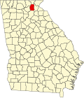
Yonah is an unincorporated community and census-designated place (CDP) in White County, Georgia, United States. It first appeared as a CDP in the 2010 census. Its population was 657 as of the 2020 census. Georgia State Route 75 passes through the community.
Yonah is a name derived from the Cherokee language meaning "bear". [3] Among the locals, Yonah is said to be pronounced as a southern way of saying "You’re on a", so Yonah Mountain sounds like "You’re on a mountain".
Yonah first appeared as a census designated place in the 2010 United States Census.
Census | Pop. | Note | %± |
---|---|---|---|
2010 | 507 | — | |
2020 | 657 | 29.6% | |
U.S. Decennial Census [4] 2010 [5] 2020 [6] |
Race / Ethnicity | Pop 2010 [5] | Pop 2020 [6] | % 2010 | % 2020 |
---|---|---|---|---|
White alone (NH) | 485 | 590 | 95.66% | 89.80% |
Black or African American alone (NH) | 3 | 9 | 0.59% | 1.37% |
Native American or Alaska Native alone (NH) | 6 | 4 | 1.18% | 0.61% |
Asian alone (NH) | 0 | 0 | 0.00% | 0.00% |
Pacific Islander alone (NH) | 0 | 0 | 0.00% | 0.00% |
Some Other Race alone (NH) | 0 | 2 | 0.00% | 0.30% |
Mixed Race/Multi-Racial (NH) | 8 | 33 | 1.58% | 5.02% |
Hispanic or Latino (any race) | 5 | 19 | 0.99% | 2.89% |
Total | 507 | 657 | 100.00% | 100.00% |
Perkins is a census-designated place and unincorporated community in Jenkins County, Georgia, United States. As of the 2010 census it had a population of 91.
Deep Creek is a census-designated place (CDP) in Accomack County, Virginia, United States. Per the 2020 census, the population was 94.
Greenbush is a census-designated place (CDP) in Accomack County, Virginia, United States. Per the 2020 census, the population was 224.
Harborton is a census-designated place (CDP) in Accomack County, Virginia, United States. Per the 2020 census, the population was 130.
Lee Mont is a census-designated place (CDP) in Accomack County, Virginia, United States. Per the 2020 census, the population was 102.
Quinby is a census-designated place (CDP) in Accomack County, Virginia, United States. It was first listed as a CDP in 2010. Per the 2020 census, the population was 285.
Savageville is a census-designated place (CDP) in Accomack County, Virginia, United States. It was first listed as a CDP in 2010. Per the 2020 census, the population was 175.
Wattsville is a census-designated place (CDP) in Accomack County, Virginia, United States. It was first listed as a CDP in 2010. As of the 2020 census, it had a population of 1,341.
Bayside is a census-designated place (CDP) in Accomack County, Virginia, United States. Per the 2020 census, the population was 107.
Bobtown is a census-designated place (CDP) in Accomack County, Virginia, United States. Per the 2020 census, the population was 267.
Boston is a census-designated place (CDP) in Accomack County, Virginia, United States. Per the 2020 census, the population was 454.
Cats Bridge is a census-designated place (CDP) in Accomack County, Virginia, United States. Per the 2020 census, the population was 184.
Chase Crossing is a census-designated place (CDP) in Accomack County, Virginia, United States. Per the 2020 census, the population was 335.
Metompkin is a census-designated place (CDP) in Accomack County, Virginia, United States. Per the 2020 census, the population was 490.
Pastoria is a census-designated place (CDP) in Accomack County, Virginia, United States. It was first listed as a CDP in 2010. Per the 2020 census, the population was 627.
Savage Town is a census-designated place (CDP) in Accomack County, Virginia, United States. It was first listed as a CDP in 2010. Per the 2020 census, the population was 72.
South Chesconessex is an unincorporated community and census-designated place (CDP) in Accomack County, Virginia, United States. The census uses the name Southside Chesconessex. It was first listed as a CDP in 2010. As of the 2020 census, it had a population of 115.
Whitesville is a census-designated place (CDP) in Accomack County, Virginia, United States. It was first listed as a CDP in 2010. As of the 2020 census, it had a population of 241.
Tate City is an unincorporated community and census-designated place in Towns County, Georgia, United States. It was founded as a mining and logging community. The community was named after one Mr. Tate, a businessperson in the local lumber industry.
Mendes is a census-designated place and unincorporated community in Tattnall County, Georgia, United States. Its population was 124 as of the 2020 census. Georgia State Route 169 passes through the community.
Media related to Yonah, Georgia at Wikimedia Commons