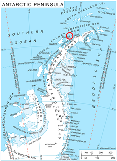
Eliseyna Cove is a 3 km wide cove indenting for 1.4 km in the northwest coast of Varna Peninsula between Slab Point to the north and Kotis Point to the south. The cove is named after the Iskar Gorge settlement of Eliseyna in western Bulgaria.

Pomorie Point is a point on the coast of McFarlane Strait forming the north side of the entrance to Lister Cove, Varna Peninsula, Livingston Island in the South Shetland Islands, Antarctica.

Avitohol Point is a point on the north coast of Livingston Island, Antarctica projecting 1.15 km into Hero Bay to form the west side of the entrance to Skravena Cove and the southeast side of the entrance to Prisoe Cove. The point is named after the legendary Khan Avitohol listed in the 8th Century ‘Nominalia of the Bulgarian Khans’, who laid the foundations of the Bulgarian statehood in Europe in 165 AD.

Ballester Point is a point forming the south side of the entrance to Johnsons Dock and the northeast side of the entrance to Española Cove in Hurd Peninsula, Livingston Island in the South Shetland Islands, Antarctica. The area was visited by early 19th century sealers operating from Johnsons Dock.

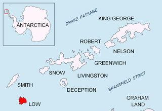
Solnik Point is a rocky point projecting 550 m from the northwest coast of Low Island in the South Shetland Islands, Antarctica. Forming the south side of the entrance to Kazichene Cove. Situated 4.1 km southwest of Cape Wallace and 11.15 km north of Cape Garry.

Bebresh Point is a point projecting 1.3 km from the northwest coast of Liège Island in the Palmer Archipelago, Antarctica forming the north side of the entrance to Palakariya Cove and the west side of the entrance to Boisguehenneuc Bay. Situated 7.7 km southwest of Moureaux Point and 11.3 km north-northeast of Chauveau Point.

Herring Point is a point on the north coast of Rugged Island off the west coast of Byers Peninsula of Livingston Island in the South Shetland Islands, Antarctica forming the east side of the entrance to Hersilia Cove.

Yana Point is the point forming the west side of the entrance to Bruix Cove in eastern Livingston Island in the South Shetland Islands, Antarctica. The point separates the glacier termini of Huron Glacier to the northwest and Iskar Glacier to the southeast. The feature is named after the settlement of Yana in western Bulgaria.

Kiten Point is the point forming the south side of the entrance to Chudomir Cove on the Trinity Peninsula coast of Prince Gustav Channel, Weddell Sea in Antarctica.

Yasen Point is the sharp, rocky point on the south coast of Livingston Island in the South Shetland Islands, Antarctica, forming the west side of the entrance to Mateev Cove. Situated on the east side of the small ice-free promontory ending in Hannah Point to the west.

Ugorelets Point is the rocky point on the south side of the entrance to Malina Cove on the west coast of Low Island in the South Shetland Islands, Antarctica.

Binkos Point is the point on the northeast side of the entrance to Latinka Cove on the northwest coast of Pefaur (Ventimiglia) Peninsula, Danco Coast on the Antarctic Peninsula.

Leshko Point is the point on the north side of the entrance to Beripara Cove on the southeast coast of Liège Island in the Palmer Archipelago, Antarctica.

Deliradev Point is the point forming the south side of the entrance to Galata Cove and the north side of the entrance to Lapeyrère Bay on the northeast coast of Anvers Island in the Palmer Archipelago, Antarctica.

Skalina Point is the ice-covered point on the southwest side of the entrance to Yarebitsa Cove on the southeast coast of Smith Island in the South Shetland Islands, Antarctica. It is named after the settlement of Skalina in Southern Bulgaria.

Kamenar Point is the narrow rocky point on Davis Coast in Graham Land, Antarctica projecting 650 m northwards into Jordanoff Bay and forming the east side of the entrance to Hvoyna Cove. The point is named after the two settlements of Kamenar in northeastern and southeastern Bulgaria.

Albatros Point is the mostly ice-covered rocky east entrance point of Lorna Cove on the north coast of Trinity Island in the Palmer Archipelago, Antarctica projecting 600 m north-northeastwards. It is “named after the ocean fishing trawler Albatros of the Bulgarian company Ocean Fisheries – Burgas whose ships operated in the waters of South Georgia, Kerguelen, the South Orkney Islands, South Shetland Islands and Antarctic Peninsula from 1970 to the early 1990s. The Bulgarian fishermen, along with those of the Soviet Union, Poland and East Germany are the pioneers of modern Antarctic fishing industry.”


