
Iratais Point is a point forming both the south extremity and the vertex of the V-shaped Desolation Island situated in the entrance to Hero Bay, Livingston Island, Antarctica. Separated from Miladinovi Islets to the south by Neck or Nothing Passage.

Elemag Point is a point on the coast of Moon Bay in Livingston Island, Antarctica situated 6.75 km south-southwest of Edinburgh Hill, 1.76 km southeast of Sindel Point, 3.05 km east of Sliven Peak, 2.05 km northeast of Zlatograd Rock, and 5,57 km northwest of Rila Point. Separates the glacier termini of Struma Glacier to the north and Huron Glacier to the south. Bulgarian topographic survey Tangra 2004/05.

Ballester Point is a point forming the south side of the entrance to Johnsons Dock and the northeast side of the entrance to Española Cove in Hurd Peninsula, Livingston Island in the South Shetland Islands, Antarctica. The area was visited by early 19th century sealers operating from Johnsons Dock.

Elin Pelin Point is a point on the northwest coast of Smith Island, South Shetland Islands situated 4.6 km north-northeast of Cape James and 4.8 km south-southwest of Lista Point. Bulgarian early mapping in 2009. Named after the Bulgarian writer Elin Pelin.
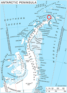
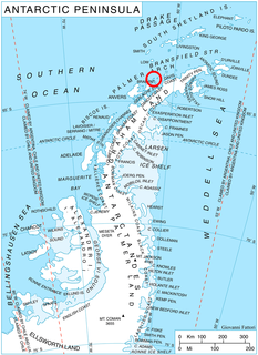
Raduil Point is a point forming the northwest extremity of Astrolabe Island in Bransfield Strait off Trinity Peninsula, Antarctica.
Bebresh Point is a point projecting 1.3 km from the northwest coast of Liège Island in the Palmer Archipelago, Antarctica forming the north side of the entrance to Palakariya Cove and the west side of the entrance to Boisguehenneuc Bay. Situated 7.7 km southwest of Moureaux Point and 11.3 km north-northeast of Chauveau Point.

Studena Point is a rocky point forming the west side of the entrance to Dalchev Cove on the north coast of Parker Peninsula in the northeast part of Anvers Island, the Palmer Archipelago in Antarctica. It projects 1.4 km northwards into Fournier Bay and separates the termini of Kleptuza Glacier to the west and Altimir Glacier to the east.

Nedelya Point is a sharp ice-free point at the southwest extremity of Ivanov Beach on the north coast of Livingston Island in the South Shetland Islands, Antarctica projecting 300 m into Barclay Bay. It is linked by a chain of rocks to Cutler Stack located 310 m to the north-northwest. The feature is part of the Antarctic Specially Protected Area ASPA 126 Byers Peninsula, situated in one of its two restricted zones.

Dink Island is the central in the group of three rocky islands in Krivina Bay on the west coast of Trinity Island in the Palmer Archipelago, Antarctica. The feature is 610 m long in northeast-southwest direction and 320 m wide.
Rogulyat Island is the southernmost in the group of three rocky islands in Krivina Bay on the west coast of Trinity Island in the Palmer Archipelago, Antarctica. The island is 350 m long in east-west direction and 160 m wide.

Butrointsi Point is the ice-free tipped point on the southeast side of the entrance to Kotev Cove on the northeast coast of Two Hummock Island in the Palmer Archipelago, Antarctica.

Sursuvul Point is the rocky point on Davis Coast in Graham Land, Antarctica projecting 300 m northwards into Orléans Strait. The point is named after Georgi Sursuvul, first minister and regent of Bulgaria during the reigns of Czar Simeon the Great and Czar Peter I.
Alka Island is the 250 m long in west–east direction and 110 m wide rocky island lying in Belimel Bay on the southwest coast of Trinity Island in the Palmer Archipelago, Antarctica. It is “named after the ocean fishing trawler Alka of the Bulgarian company Ocean Fisheries – Burgas whose ships operated in the waters of South Georgia, Kerguelen, the South Orkney Islands, South Shetland Islands and Antarctic Peninsula from 1970 to the early 1990s. The Bulgarian fishermen, along with those of the Soviet Union, Poland and East Germany are the pioneers of modern Antarctic fishing industry.”

Tizoin Point is the rocky point on the southwest coast of Trinity Island in the Palmer Archipelago, Antarctica projecting 1 km southwestwards into Belimel Bay. It is “named after Tizoin Cave in Western Bulgaria.”
Chayka Passage is the 1 km long in south-north direction and 110 m wide passage between Spert Island and the southwest coast of Trinity Island in the Palmer Archipelago, Antarctica. Its south entrance is situated just west of Bulnes Point. The vertical cliffs of Symplegades rise either side of the feature.
Albatros Point is the mostly ice-covered rocky east entrance point of Lorna Cove on the north coast of Trinity Island in the Palmer Archipelago, Antarctica projecting 600 m north-northeastwards. It is “named after the ocean fishing trawler Albatros of the Bulgarian company Ocean Fisheries – Burgas whose ships operated in the waters of South Georgia, Kerguelen, the South Orkney Islands, South Shetland Islands and Antarctic Peninsula from 1970 to the early 1990s. The Bulgarian fishermen, along with those of the Soviet Union, Poland and East Germany are the pioneers of modern Antarctic fishing industry.”
Fizalia Island is the mostly ice-covered rocky island 330 m long in southeast-northwest direction and 180 m wide, lying off the northeast coast of Trinity Island in the Palmer Archipelago, Antarctica. It is “named after the ocean fishing trawler Fizalia of the Bulgarian company Ocean Fisheries – Burgas whose ships operated in the waters of South Georgia, Kerguelen, the South Orkney Islands, South Shetland Islands and Antarctic Peninsula from 1970 to the early 1990s. The Bulgarian fishermen, along with those of the Soviet Union, Poland and East Germany are the pioneers of modern Antarctic fishing industry.”
Kanarata Point is the rocky point in northeastern Astrolabe Island in Bransfield Strait, Antarctica forming the north extremity of the island surmounted by Dragons Teeth. It is “named after Kanarata Peak in Rila Mountain, Bulgaria.”


