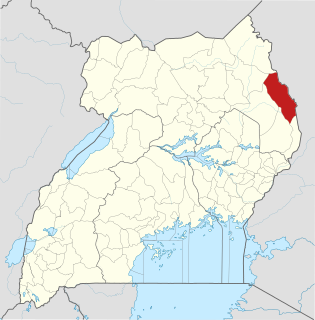
Moroto District is a district in the Northern Region of Uganda. The town of Moroto is the site of the district headquarters.

Pallisa District is a district in Eastern Uganda. Like most other Ugandan districts, it is named after its chief town, Pallisa, where the district headquarters are located.
Pallisa is a town in Pallisa District of the Eastern Region of Uganda.
Katakwi is a town in the Eastern Region of Uganda. It is the main municipal, administrative, and commercial center of Katakwi District and the site of the district headquarters. It borders Moroto District.
Kumi Town, commonly called Kumi, is a town in the Eastern Region of Uganda. It is the main municipal, administrative, and commercial center in Kumi District and is the site of the district headquarters.
Musita is a town in Mayuge District, in the Eastern Region of Uganda.
Lumino is a settlement in the Eastern Region of Uganda.
Suam, Uganda is a border crossing between Uganda and Kenya. The settlement sits directly across the Suam River from Suam, Kenya.
Muyembe is a town in the Eastern Region of Uganda.
The Tirinyi–Pallisa–Kamonkoli–Kumi Road is a road in the Eastern Region of Uganda, connecting the towns of Tirinyi in Kibuku District, Pallisa in Pallisa District, Kamonkoli in Budaka District, and Kumi in Kumi District.
Tirinyi is a town in the Kibuku District in the Eastern Region of Uganda.
Kamonkoli is a town in Budaka District, in the Eastern Region of Uganda.
Atutur is a town in the Eastern Region of Uganda.
The Jinja–Iganga–Bugiri–Tororo Road is a road in the Eastern Region of Uganda, connecting the towns of Jinja and Tororo. Sometimes referred to as Tororo–Jinja Road, it is a busy transport corridor, connecting traffic from neighboring Kenya, and northeastern Uganda to Jinja, a major commercial and industrial center, and ultimately to Kampala, the country's capital and points beyond.
Rubanda District is a district in the Western Region of Uganda. The largest town in the district, Rubanda, serves as the main administrative and commercial center in the district.
Rubanda is a town in the extreme southwest of the Western Region of Uganda. It serves as the commercial, political and administrative center of Rubanda District.
Rukiga District is a district in Western Uganda. Its capital is Mparo. However, the largest urban center in the district is Muhanga.

Butebo District is a district in the Eastern Region of Uganda. Like most other Ugandan districts, it is named after its chief town, Butebo, where the district headquarters are located.
Namisindwa District is a district in the Eastern Region of Uganda. The town of Bupoto is the district headquarters.
Kadama is a town in Kibuku District, in the Eastern Region of Uganda.
