Butler County is a county in the Commonwealth of Pennsylvania. As of the 2020 census, the population was 193,763. Its county seat is Butler. Butler County was created on March 12, 1800, from part of Allegheny County and named in honor of General Richard Butler, a hero of the American Revolution. The county is part of the Greater Pittsburgh region of the state.

Butler is a town in Wayne County, New York, United States. The population was 2,064 at the 2010 census. It is also the town with the fewest Registered Voters in Wayne County with approximately 140 active voters.

Butler Township is a township in Butler County, Pennsylvania, United States. The population was 17,230 at the 2020 census. The township was first settled by Europeans in 1795. It was established as a township in 1804 and as a first class township in 1922.

The 1779 Sullivan Expedition was a United States military campaign during the American Revolutionary War, lasting from June to October 1779, against the four British-allied nations of the Iroquois. The campaign was ordered by George Washington in response to Iroquois and Loyalist attacks on the Wyoming Valley, German Flatts, and Cherry Valley. The campaign had the aim of "the total destruction and devastation of their settlements." The Continental Army carried out a scorched-earth campaign in the territory of the Iroquois Confederacy in what is now central New York.

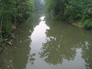
Connoquenessing Creek is a tributary of the Beaver River, approximately 50 mi (80 km) long, in Western Pennsylvania in the United States.

Canadarago Lake is a 1,917-acre (7.76 km2) lake located in Otsego County, New York and is the source of Oaks Creek. The Village of Richfield Springs is located at the lake's northern end. It is the second largest lake in Otsego County, lying to the west of and parallel to the larger Otsego Lake. The lake's name is also spelled "Candajarago Lake" or "Caniadaraga Lake".

The Sacandaga River is a 64-mile-long (103 km) river in the northern part of New York in the United States. Its name comes from the Native American Sa-chen-da'-ga, meaning "overflowed lands".

The West Canada Creek is a 76-mile-long (122 km) river in upstate New York, United States. West Canada Creek is an important water way in Hamilton, Oneida, and Herkimer counties, draining the south part of the Adirondack Mountains before emptying into the Mohawk River near the Village of Herkimer. The name "Canada" is derived from an Iroquoian word for "village" (Kanata).

Wappinger Creek is a 41.7-mile-long (67.1 km) creek which runs from Thompson Pond to the Hudson River at New Hamburg in Dutchess County, New York, United States. It is the longest creek in Dutchess County, with the largest watershed in the county.

Otego Creek is a 32.7-mile-long (52.6 km) tributary of the Susquehanna River in Otsego County, New York. Otego Creek rises in the Town of Otsego and flows south through the Towns of Hartwick and Laurens, before joining the Susquehanna River southwest of the City of Oneonta.

Butler is an unincorporated community in Johnson County in the northeastern corner of the U.S. state of Tennessee. It is located along the northern shore of Watauga Lake. Butler is served by a post office, assigned ZIP Code 37640.
The 17th Pennsylvania House of Representatives District is located in western Pennsylvania and has been represented by Republican Timothy R. Bonner since 2023.

Mount Pleasant Township is one of twenty-four townships in Bates County, Missouri, and is part of the Kansas City metropolitan area within the USA. As of the 2000 census, its population was 5,060.
Nine Partners Creek is a tributary of Tunkhannock Creek in Susquehanna County, Pennsylvania, in the United States. It is approximately 10 miles (16 km) long and flows through New Milford Township, Harford Township, and Lenox Township. The watershed of the creek has an area of 38.6 square miles (100 km2). The creek has two named tributaries: Butler Creek and Leslie Creek. The surficial geology in the vicinity of Nine Partners Creek includes Wisconsinan Till, alluvium, bedrock, alluvial fan, and wetlands. The creek's drainage basin is designated as a Coldwater Fishery and a Migratory Fishery.

The Canajoharie Creek is a river that flows into the Mohawk River in the Village of Canajoharie in the U.S. State of New York. The name "Canajoharie" is a Mohawk language term meaning "the pot that washes itself", referring to the "Canajoharie Boiling Pot", a 20-foot (6.1 m) wide and 10-foot (3.0 m) deep pothole in the Canajoharie Creek, just south of the village of Canajoharie. Bowmans Creek is one main tributary that enters the creek east of the Hamlet of Sprout Brook. The other main tributary is Brimstone Creek which enters the creek north-northwest of the Village of Ames.
Caroga Creek is a river in Fulton and Montgomery counties in the U.S. State of New York. It begins at East Caroga Lake and flows south passing through Rockwood Lake before converging with the Mohawk River in the Hamlet of Palatine Church.

West Branch Sacandaga River is a river in Hamilton County in the state of New York. It begins northwest of Benson and flows west then northward then eastward before converging with the Sacandaga River south of Wells.
Panther Mountain is a mountain located in Central New York of New York near Fly Creek, New York and Schuyler Lake, New York. The east side of Panther Mountain drains into Fly Creek and the west side drains into Oaks Creek and Canadarago Lake.
Spectacle Lake is a small lake southeast of Wilmurt in Herkimer County, New York. It drains northwest via an unnamed creek that flows into West Canada Creek. Butler Lake is located west of Spectacle Lake.


