Bátaapáti | |
|---|---|
Village | |
 Bátaapáti Location in Hungary | |
| Coordinates: 46°13′20″N18°36′01″E / 46.222272°N 18.600239°E | |
| Country | |
| Region | Southern Transdanubia |
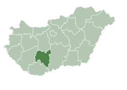
| County | Tolna |
| District | Bonyhád |
| Area | |
• Total | 20.44 km2 (7.89 sq mi) |
| Population (2022) [1] | |
• Total | 362 |
| • Density | 18/km2 (46/sq mi) |
| Time zone | UTC+1 (CET) |
| • Summer (DST) | UTC+2 (CEST) |
| KSH code | 28909 [1] |
Bátaapáti is a village in Tolna County, Hungary.