Kakasd Kockrsch | |
|---|---|
Village | |
 Kakasd Location of Kakasd in Hungary | |
| Coordinates: 46°20′55″N18°35′28″E / 46.34856°N 18.59105°E | |
| Country | |
| Region | Southern Transdanubia |
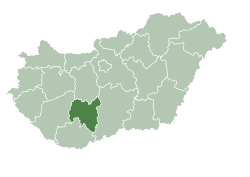
| County | Tolna |
| District | Bonyhád |
| Area | |
• Total | 20.78 km2 (8.02 sq mi) |
| Population (2022) [1] | |
• Total | 1,538 |
| • Density | 74/km2 (190/sq mi) |
| Time zone | UTC+1 (CET) |
| • Summer (DST) | UTC+2 (CEST) |
| Postal code | 7122 |
| Area code | +36 74 |
| KSH code | 02033 [1] |
Kakasd (German : Kockrsch) is a village in Tolna County, Hungary.