
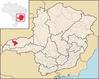
Cachoeira Dourada is a municipality in the west of the Brazilian state of Minas Gerais. As of 2020 [update] the population was 2,706 in a total area of 202 km2. [1] It became a municipality in 1963, separating from Capinópolis.
Cachoeira Dourada is a municipality in the west of the Brazilian state of Minas Gerais. As of 2020 [update] the population was 2,706 in a total area of 202 km2. [1] It became a municipality in 1963, separating from Capinópolis.
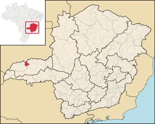
Cachoeira Dourada is located at an elevation of 460 meters on the south bank of the Paranaíba River, just south of the Cachoeira Dourada Hydroelectric Station. Cachoeira Dourada, Goiás, lies a few kilometers to the north on the other side of the dam. It belongs to the statistical microregion of Ituiutaba. Neighboring municipalities are Itumbiara, Capinópolis, and Centralina.
Distances
The most important economic activities are cattle raising, commerce, agriculture and royalties from the hydroelectric station. The GDP in 2005 was R$104,818,000. Cachoeira Dourada is in the top tier of municipalities in the state with regard to economic and social development. It is in a region of good soils, adequate rainfall, and abundance of surface water. As of 2007 [update] there were no banking agencies in the town. There was a small retail commerce serving the surrounding area of cattle and agricultural lands. In the rural area there were 84 establishments employing about 300 workers. Only 30 of the farms had tractors. There were 213 automobiles in all of the municipality. There were 7,000 head of cattle in 2006. The crops with a planted area of more than 100 hectares were sugarcane, soybeans, and corn. [2]
In the health sector there were 02 clinics and no hospitals. In the educational sector there was 01 primary school. [2]
The highest ranking municipality in Minas Gerais in 2000 was Poços de Caldas with 0.841, while the lowest was Setubinha with 0.568. Nationally the highest was São Caetano do Sul in São Paulo with 0.919, while the lowest was Setubinha. In more recent statistics (considering 5,507 municipalities) Manari in the state of Pernambuco has the lowest rating in the country—0,467—putting it in last place. [3]

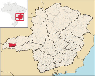
Ubaí is a municipality in the north of the Brazilian state of Minas Gerais. As of 2020 the population was 12,599 in a total area of 821 km2. It became a municipality in 1962.
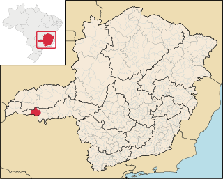
Ituiutaba is a municipality in the western part of the state of Minas Gerais, Brazil. Elevated to city status in 1901, its population in 2020 was 105,255 and a total area in the municipality of 2,694 km2. The elevation of the seat of the municipality is 544 m.

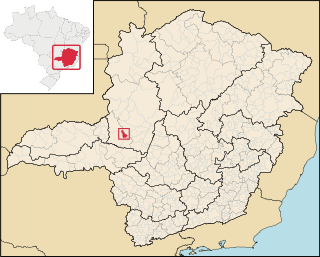
Araporã is a Brazilian municipality located in the west of the state of Minas Gerais. Its population as of 2020 was 6,931 people living in a total area of 298 square kilometres (115 sq mi). The city belongs to the statistical mesoregion of Triângulo Mineiro and Alto Paranaíba and to the microregion of Uberlândia. It became a municipality in 1992.

Glacilândia is a Brazilian municipality located in the north of the state of Minas Gerais. In 2020 the population was 3,164 in a total area of 145 km2. It became a municipality in 1996.

Ibiracatu is a Brazilian municipality located in the north of the state of Minas Gerais. In 2020 the population was 5,369 in a total area of 359 km2. It became a municipality in 1995.

Ponto Chique is a municipality in the north of the Brazilian state of Minas Gerais. As of 2020, the population was 4,283 in a total area of 602 km2. It became a municipality in 1997.

São João da Lagoa is a municipality in the north of the Brazilian state of Minas Gerais. As of 2020 the population was 4,932 in a total area of 990 km2. It became a municipality in 1995.

Capinópolis is a municipality in the west of the Brazilian state of Minas Gerais. As of 2020 the population was 16,234 in a total area of 621 km². It became a municipality in 1953. The name means "city of grass".

Gurinhatã is a municipality in the west of the Brazilian state of Minas Gerais. As of 2020 the population was 5,577 in a total area of 1,844 km2. It became a municipality in 1962.

Ipiaçu is a municipality in the west of the Brazilian state of Minas Gerais. As of 2020 the population was 4,225 in a total area of 470 km². It became a municipality in 1962.
Campina Verde is a municipality in the north of the Brazilian state of Minas Gerais. As of 2020 the population was 19,752 in a total area of 3,663 km². It became a municipality in 1938.
Itapagipe is a municipality in the west of the Brazilian state of Minas Gerais. As of 2020 the population was 15,379 in a total area of 1,795 km². It became a municipality in 1885.

Planura is a municipality in the west of the Brazilian state of Minas Gerais. As of 2020 the population was 12,292 in a total area of 318 km2. It became a municipality in 1962.

São Francisco de Sales is a municipality in the west of the Brazilian state of Minas Gerais. As of 2020 the population was 6,274 in a total area of 1,129 km2. It became a municipality in 1962.
Guimarânia is a Brazilian municipality located in the northwest of the state of Minas Gerais. Its population as of 2020 was 8,105 people living in a total area of 371 km². The city belongs to the mesoregion of Triângulo Mineiro e Alto Paranaiba and to the microregion of Patos de Minas. It became a municipality in 1963.

Centralina is a Brazilian municipality located in the west of the state of Minas Gerais. Its population as of 2020 was 10,346 living in a total area of 322 km². The city belongs to the statistical mesoregion of Triângulo Mineiro and Alto Paranaíba and to the statistical microregion of Uberlândia. It became a municipality in 1954.
Canápolis is a Brazilian municipality located in the west of the state of Minas Gerais. Its population as of 2020 was 12,201 living in a total area of 845 km². The city belongs to the statistical mesoregion of Triângulo Mineiro and Alto Paranaíba and to the statistical microregion of Uberlândia. It became a municipality in 1948.

Monte Alegre de Minas is a Brazilian municipality located in the west of the state of Minas Gerais. Its population as of 2020 was 15,790 living in a total area of 2,593 km2 (1,001 sq mi). The city belongs to the statistical mesoregion of Triângulo Mineiro and Alto Paranaíba and to the statistical microregion of Uberlândia. It became a municipality in 1870.

Iguatama is a Brazilian municipality located in the west of the state of Minas Gerais. Its population as of 2020 was 7,923 people living in a total area of 627 km². The city belongs to the meso-region of Oeste de Minas and to the micro-region of Piumhi. It became a municipality in 1944.

Fortaleza de Minas is a Brazilian municipality located in the southwest of the state of Minas Gerais. Its population as of 2020 was 4,437 people living in a total area of 218 km2 (84 sq mi). The city belongs to the meso-region of Sul e Sudoeste de Minas and to the micro-region of Passos. It became a municipality in 1963.
18°31′S49°30′W / 18.517°S 49.500°W
| | This geographical article relating to Minas Gerais is a stub. You can help Wikipedia by expanding it. |